برچسب: Walking

  • Hiking in Andros Greece – the Andros Routes walking trails

    Hiking in Andros Greece – the Andros Routes walking trails


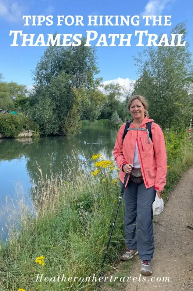
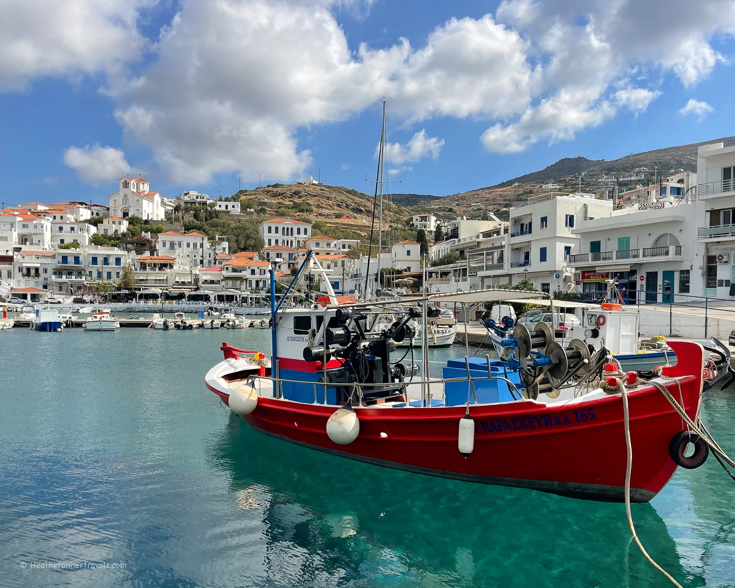
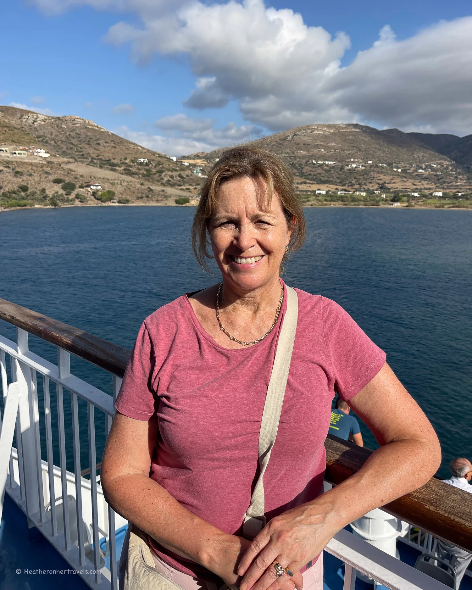
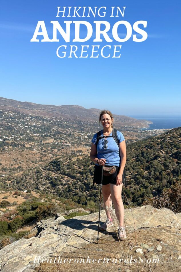
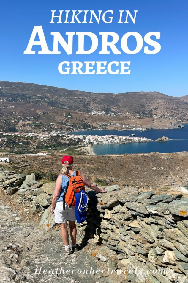
    The Greek island of Andros in the Cyclades, offers a network of well marked hiking trails, often with a beach to swim at the end. Now that’s my idea of a perfect activity holiday! I spent a week hiking in Andros on the Andros Routes, that offer scenic day hikes, easy circular routes and a 100km long distance trail.

    Follow our 7 day itinerary for a hiking holiday in Andros with the best coastal views, charming mountain villages and swimming in river pools.

    Hiking in Andros Greece Photo Heatheronhertravels.com
    Hiking in Andros Greece

    This article may contain affiliate links that provide commission on purchases you make at no extra cost to you. As an Amazon Associate I earn from qualifying purchases.

    Why go hiking in Andros?

    Andros is unusual in the Greek islands for offering a well developed network of hiking trails, with something for every ability. Here’s why you should consider Andros for a hiking holiday:

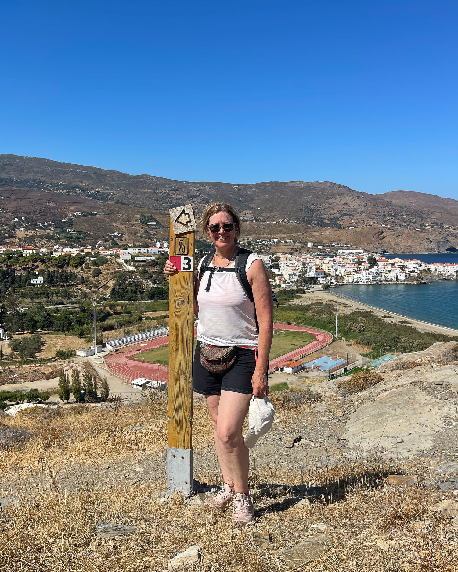
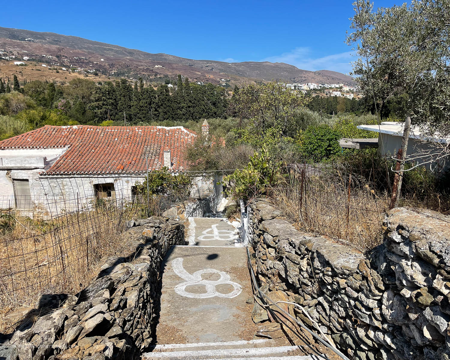
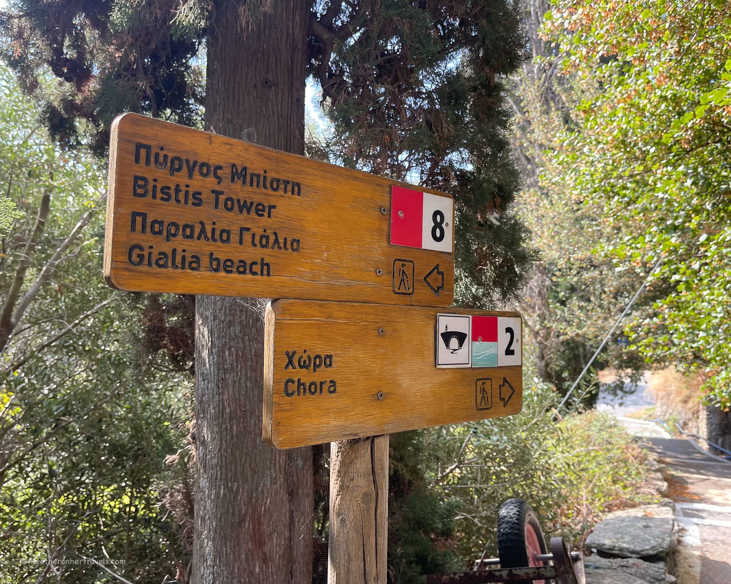
    • Andros offers 240km of marked hiking trails that are easy to follow, with maps available to plan your hiking routes. The traditional kalderimia or mule paths between villages, have been restored and signposted by a group of volunteers through the Andros Routes organisation.
    Hiking in Andros Greece Photo Heatheronhertravels.com
    Hiking in Andros Greece
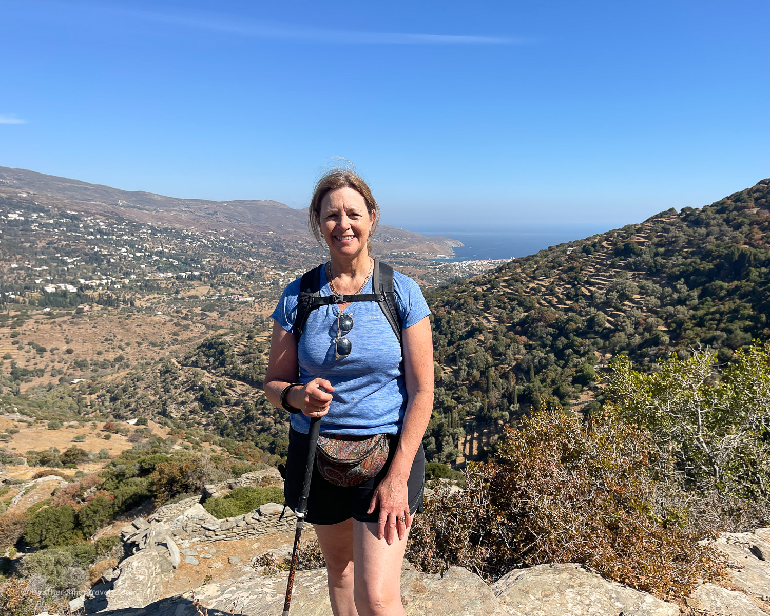
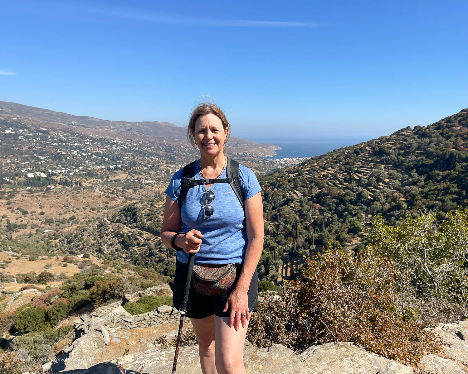
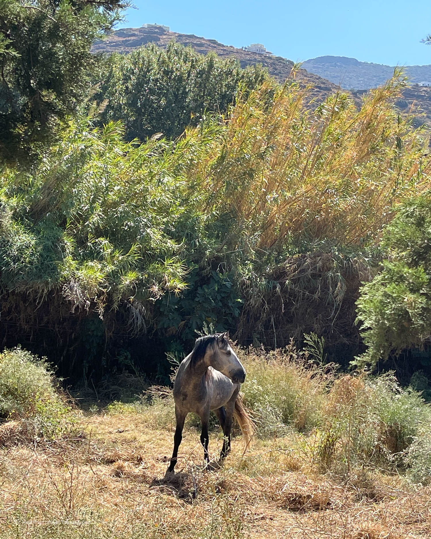
    • Unlike the other islands in the Cyclades group, Andros is relatively mountainous with elevations of up to 1000 metres. There are plenty of springs and rivers, that tumble down the hillside to the sea, creating a landscape with beautiful views, green wooded valleys and sheltered beaches for swimming.
    • While there is no airport, Andros is quick to access by ferry from Athens, making it an ideal add-on from a sightseeing trip in Greece’s capital. Andros is only 2 hours by ferry from the port of Rafina, which is 30 minutes from Athens airport or an hour from central Athens.
    • Like most of Greece, Andros enjoys a Mediterranean climate, with warm sunny days from March to November. So Andros is the ideal place for an active holiday in spring or autumn, to escape the cold of northern Europe.
    Andros Chora Greece Photo Heatheronhertravels.com
    Andros Chora Greece

    About Andros Routes

    Andros has established itself as a top Greek hiking destination, largely due to Andros Routes. The project was formed as a means of promoting sustainable tourism on Andros, to highlight the island’s unique landscapes and culture.

    Apikia - Hiking in Andros Greece Photo © Heatheronhertravels.com
    Apikia – Hiking in Andros Greece

    In 2012 an initiative was started to restore and repair the island’s ancient paths, traditionally used to get from village to village. Now 240km of paths have been restored and signposted by groups of volunteers, with regular meetups during the low season to walk and maintain the paths.

    In addition to the day hikes and shorter circular routes, there’s a 100km continuous long distance trail that links the north of the island with the south. In 2015 the Andros Routes paths were certified as one of the Leading Quality Trails by the European Rambler’s Association.

    Due to Andros Routes, we found the hiking trails on Andros extremely easy to follow, with plenty of information and maps on their website to help plan our trip.

    Pytharas waterfall Andros Greece Photo Heatheronhertravels.com
    Pytharas waterfall Andros Greece

    Our 5 days of hiking in Andros

    We planned for 5 full days of hiking, with a bit of sightseeing and relaxation thrown in. If you allow a day on either side to travel from Athens to Andros by ferry, this makes an ideal 1 week hiking holiday itinerary.

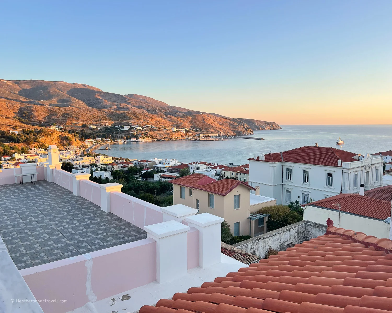
    We recommend staying in the island’s capital Chora, and there are some hotel recommendations later in the article.

    Apikia - Hiking in Andros Greece Photo © Heatheronhertravels.com
    Apikia – Hiking in Andros Greece

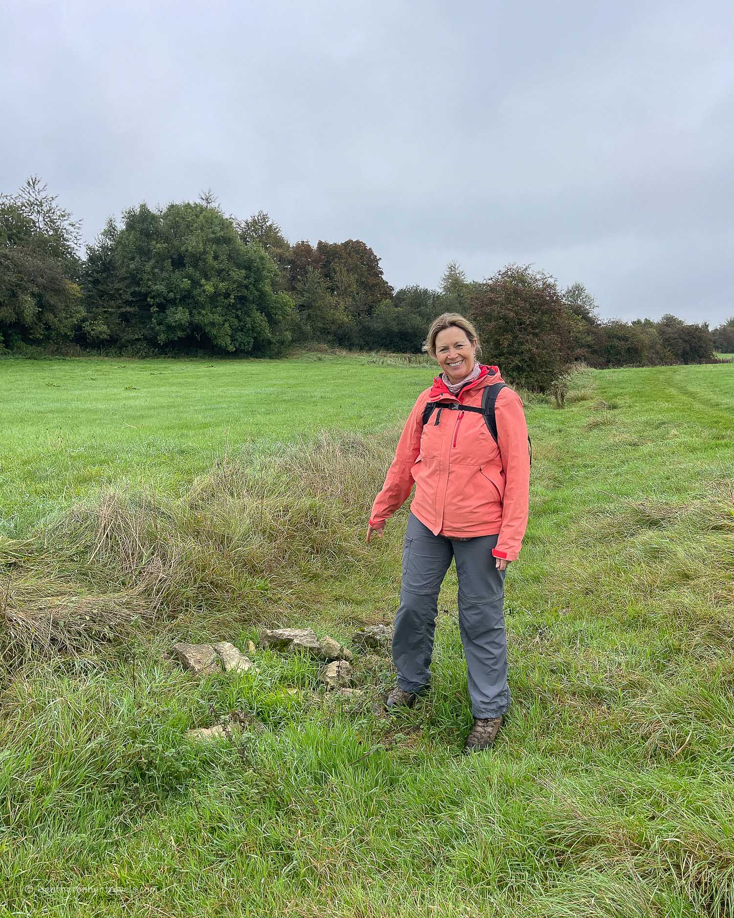
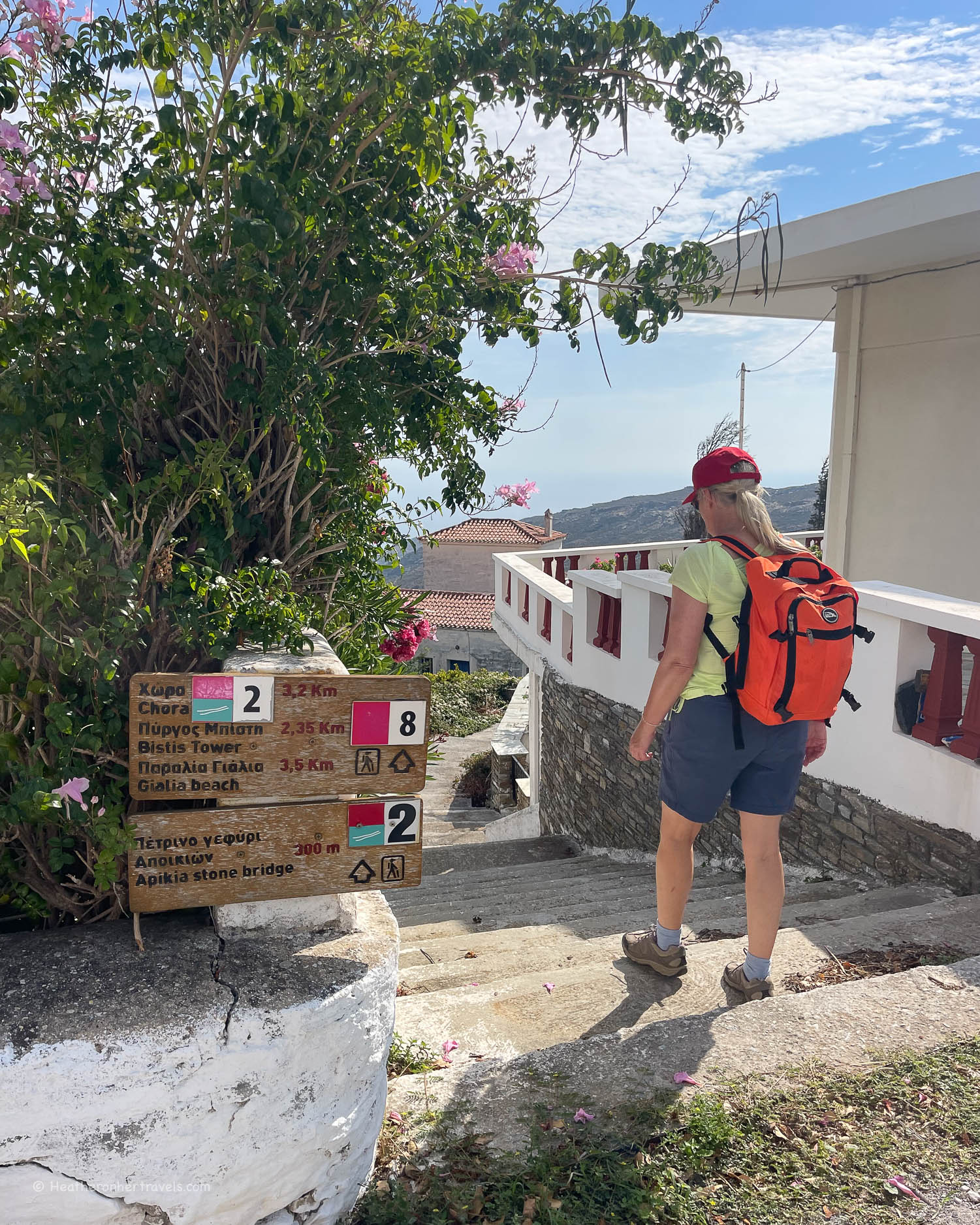
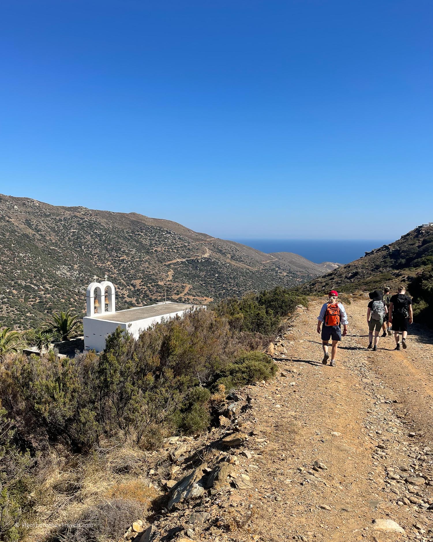
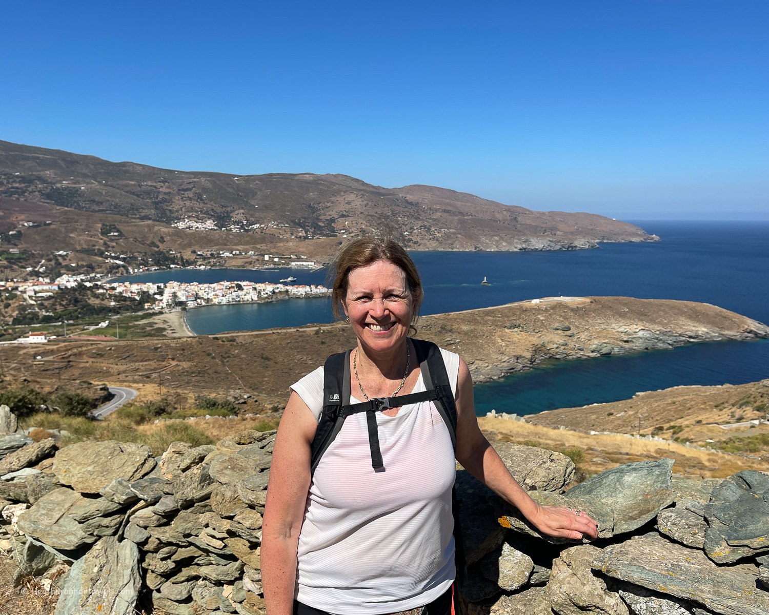
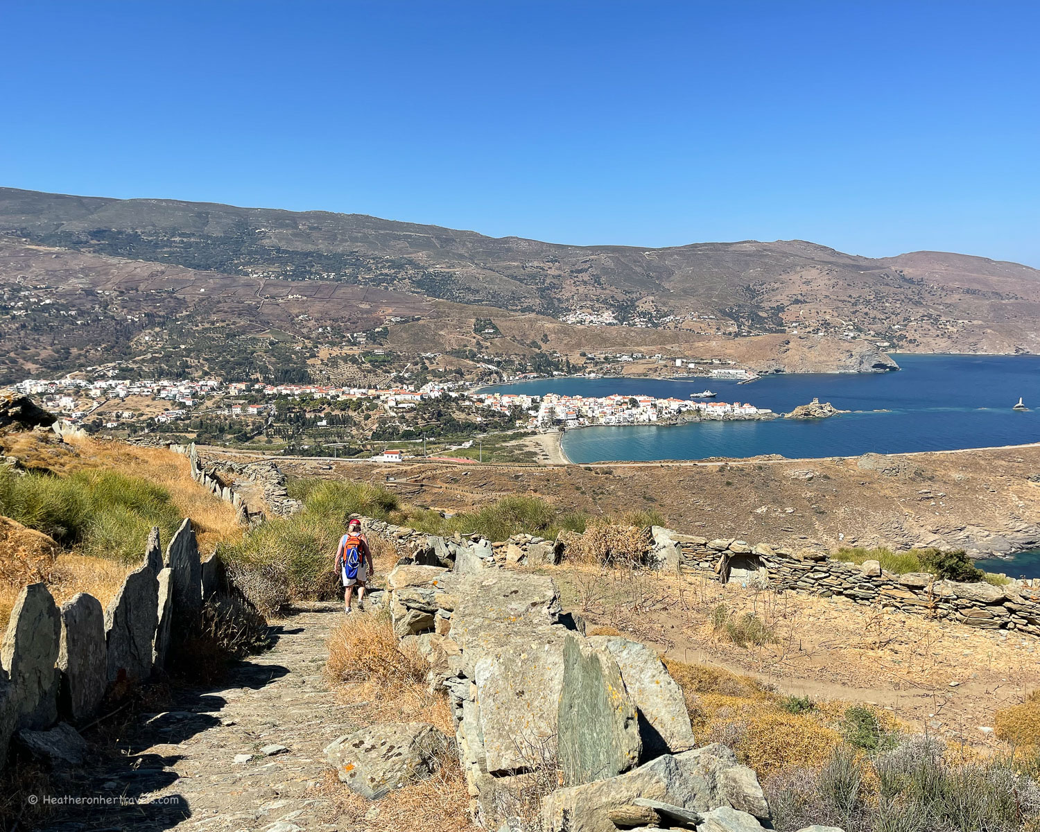
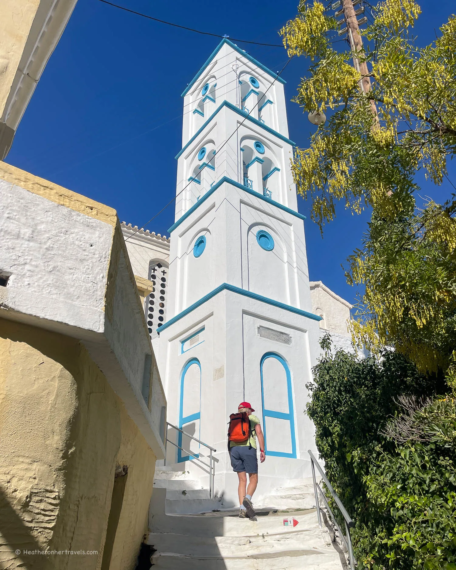
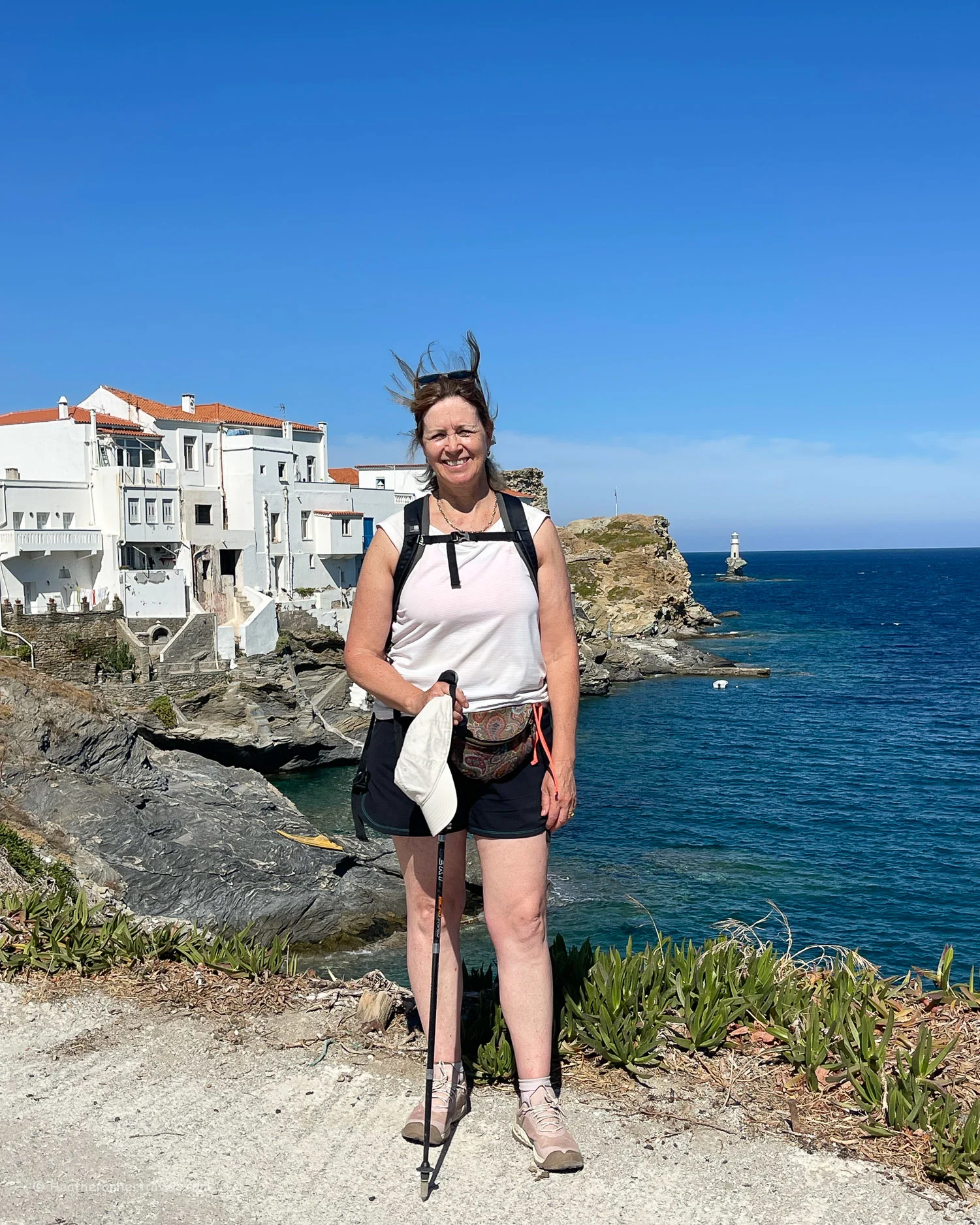
    Day 1 – Route 8 – Apikia – Stenies – Gialia Beach – Chora

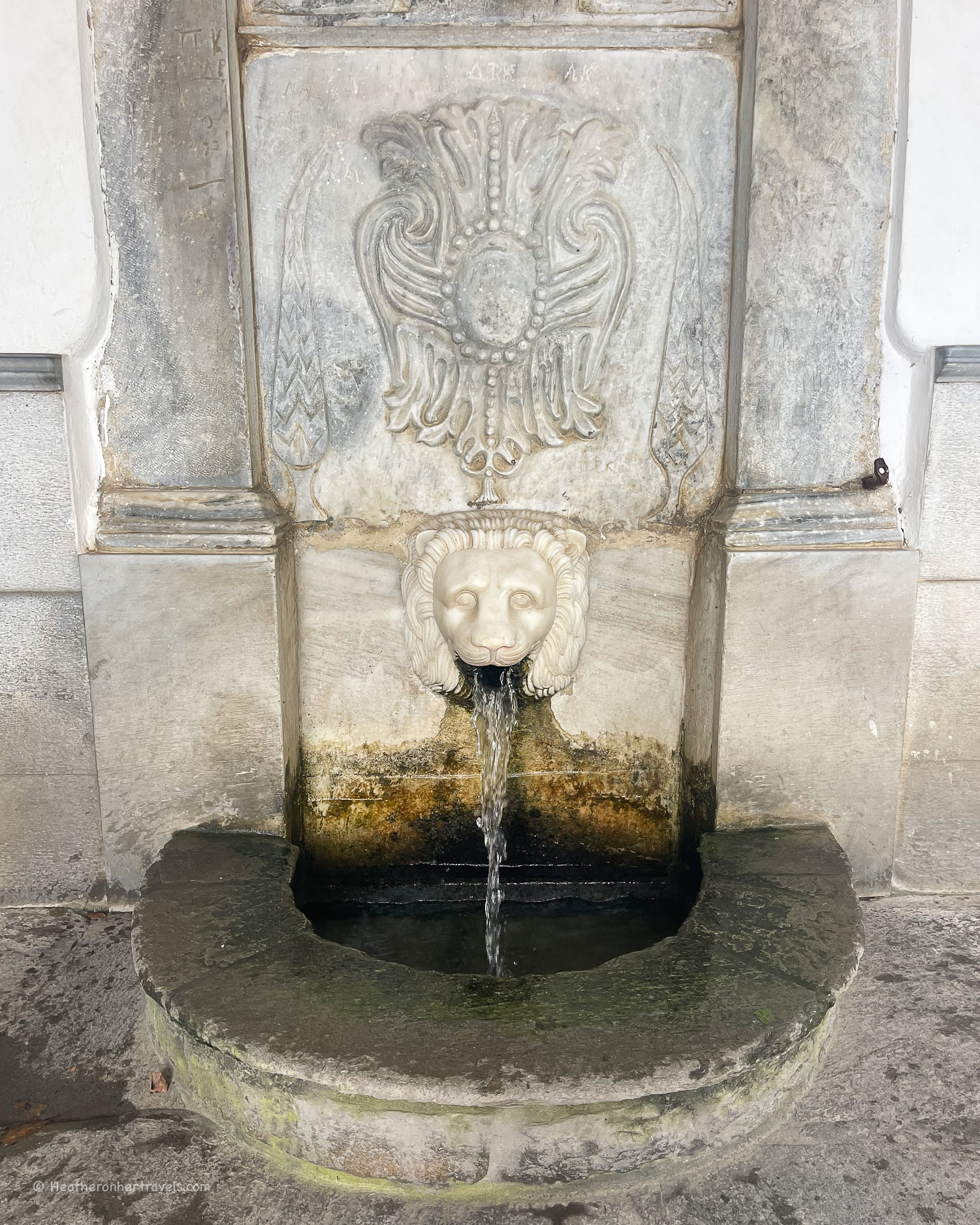
    We started our walk at Apikia, an attractive village in the hills, which is a 15 minute taxi ride from Chora. A few steps from the hiking information board is a marble water fountain for the Sariza Spring, which is known for its pure drinking quality.

    Apikia - Hiking in Andros Greece Photo © Heatheronhertravels.com
    Spring at Apikia – Hiking in Andros Greece

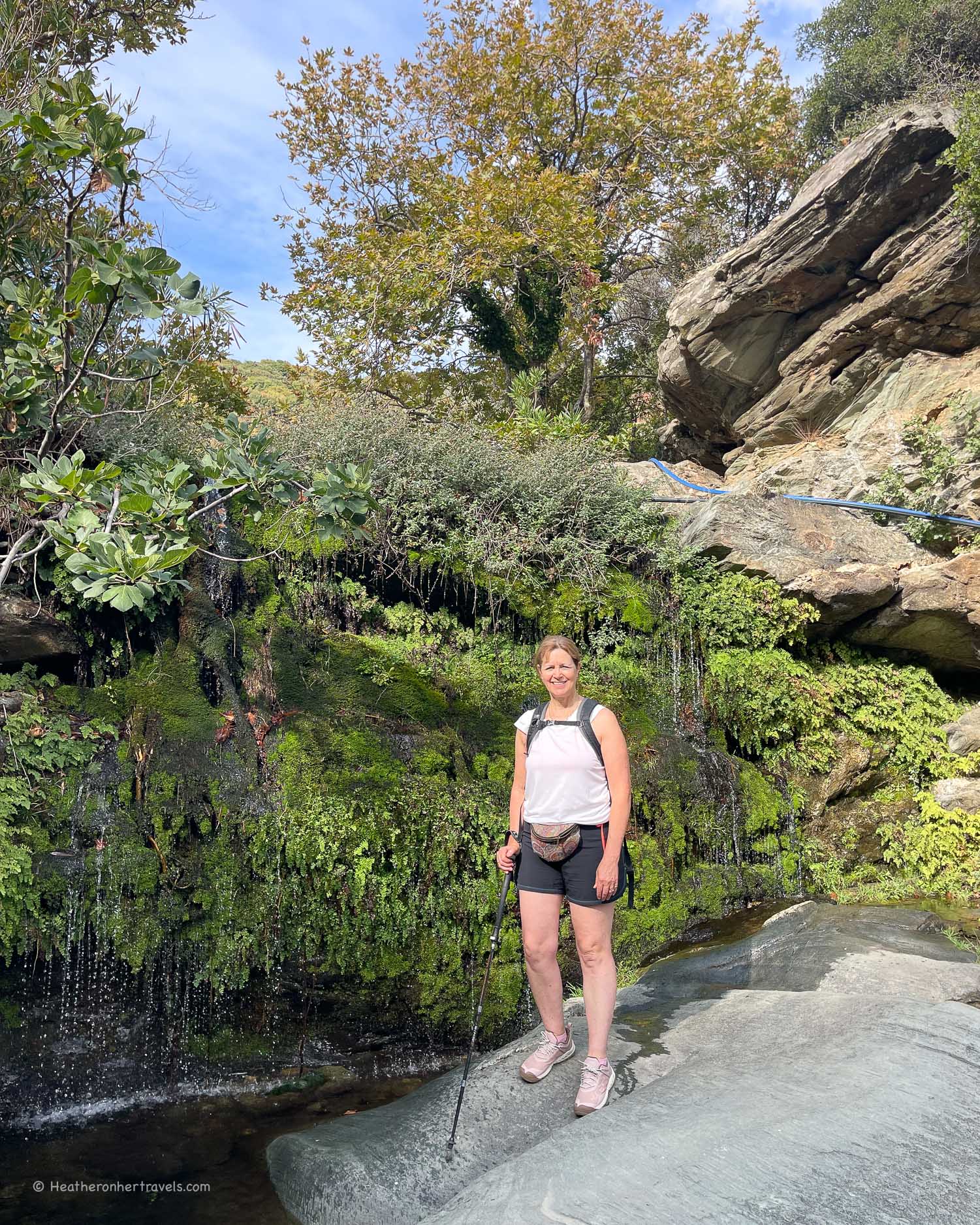
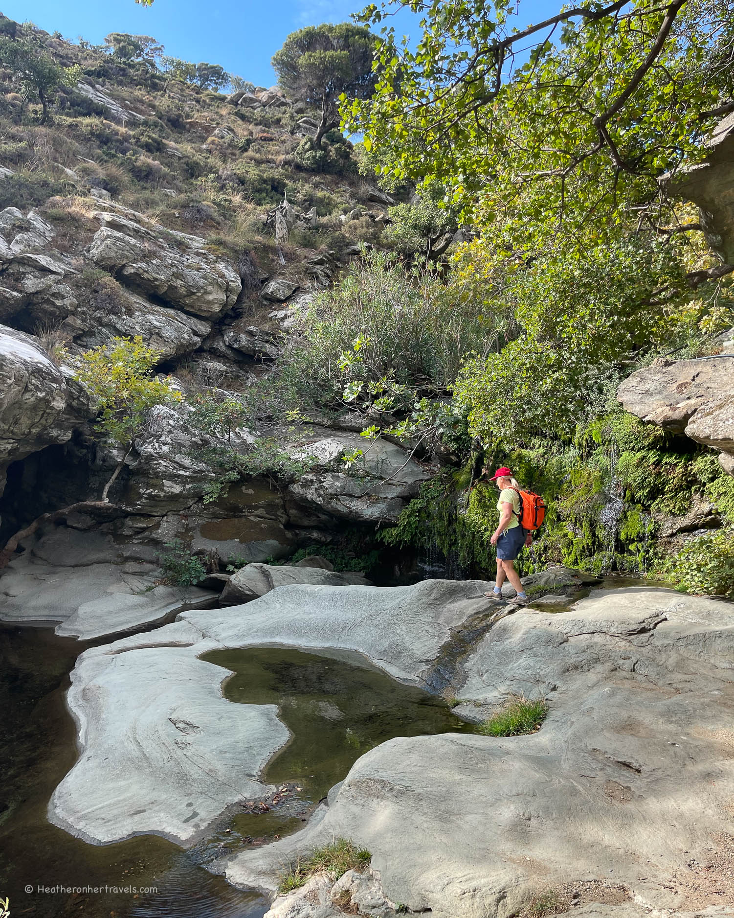
    From the road at Apikia, we made a 30 minute circular detour to see the Pytharas waterfalls (Route 2a). The path followed a mountain stream up through a series of shallow pools, to a spot with flat rocks and a small waterfall cascading over the lip.

    Pytharas waterfall - Hiking in Andros Greece Photo © Heatheronhertravels.com
    Pytharas waterfall – Hiking in Andros Greece

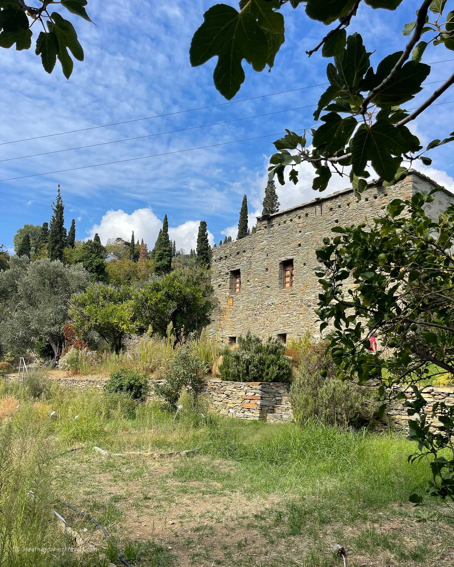
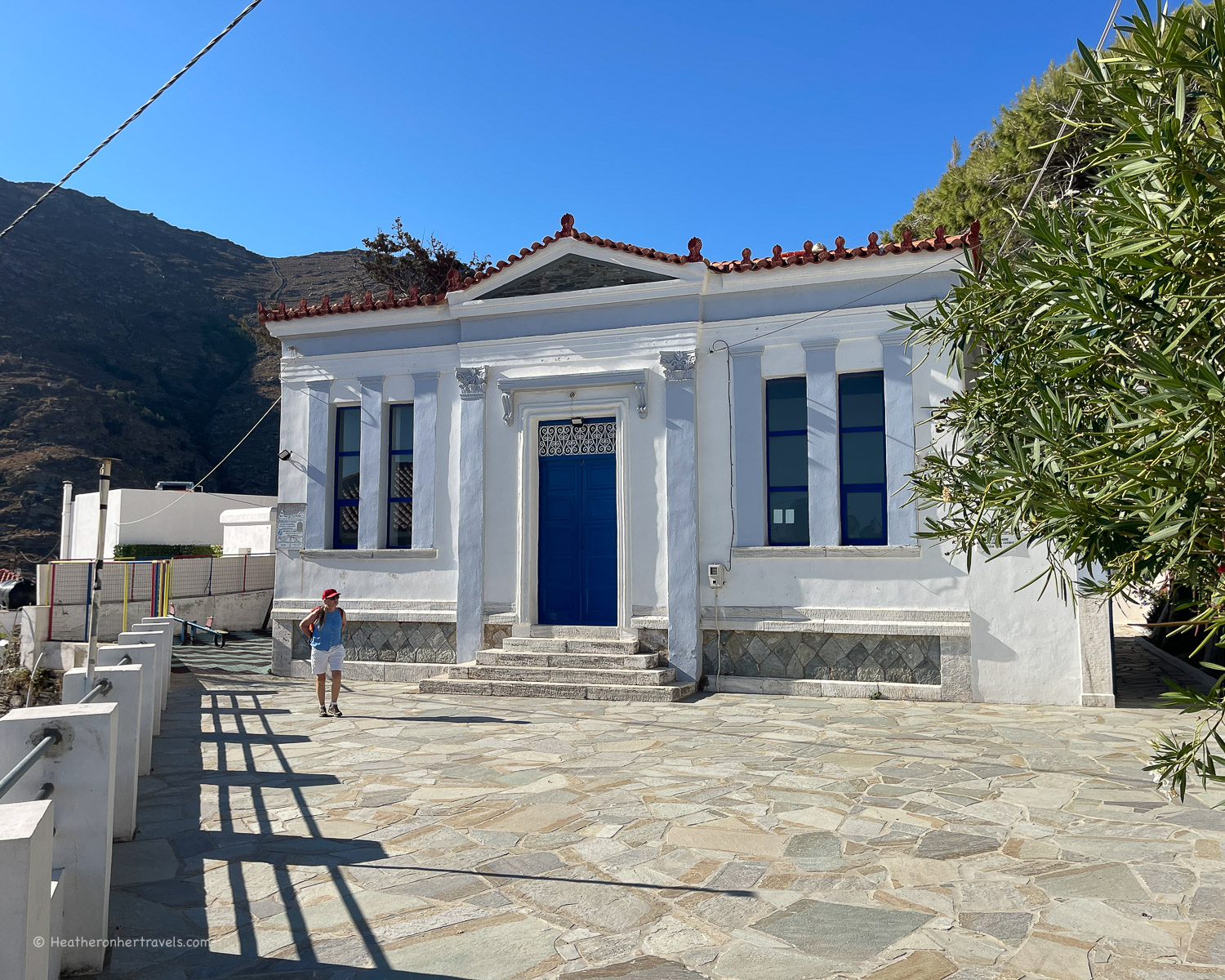
    Returning to Apikia, the path led us downhill through a pretty rural landscape. We enjoyed a stop at the Agadaki Estate Botanical Garden, with a small museum to explain the unique habitats of Andros with terraces of old olives, fruit trees and aromatic plants.

    Agadaki Estate Botanical Garden - Hiking in Andros Greece Photo © Heatheronhertravels.com
    Agadaki Estate Botanical Garden – Hiking in Andros Greece

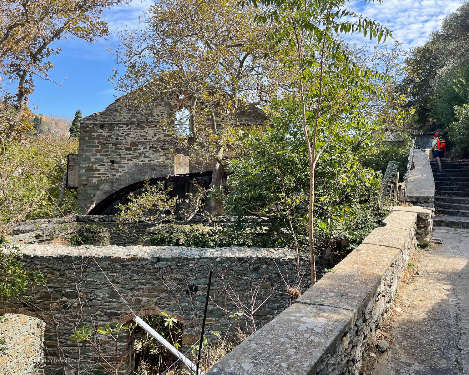
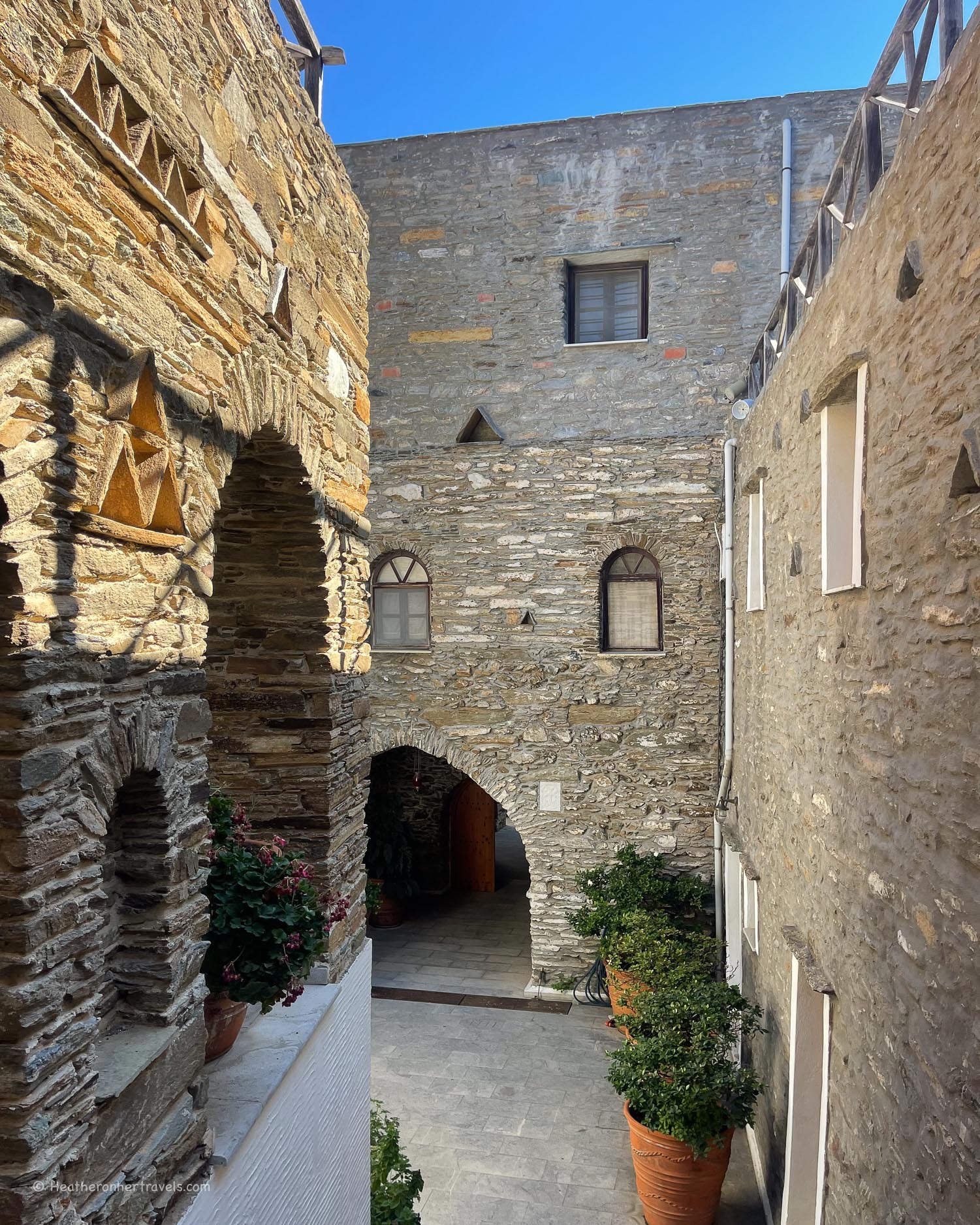
    At the next village of Stenies we climbed up a side path to see the abandoned stone water mill and ‘Fabrica’ meaning factory, which made bread and pasta in the past. We sat on the bridge below the mill for a picnic, and could have made a detour to see more of the village of Stenies set on the hillside.

    Fabrica factory Stenies - Hiking in Andros Greece Photo © Heatheronhertravels.com
    Fabrica factory Stenies – Hiking in Andros Greece

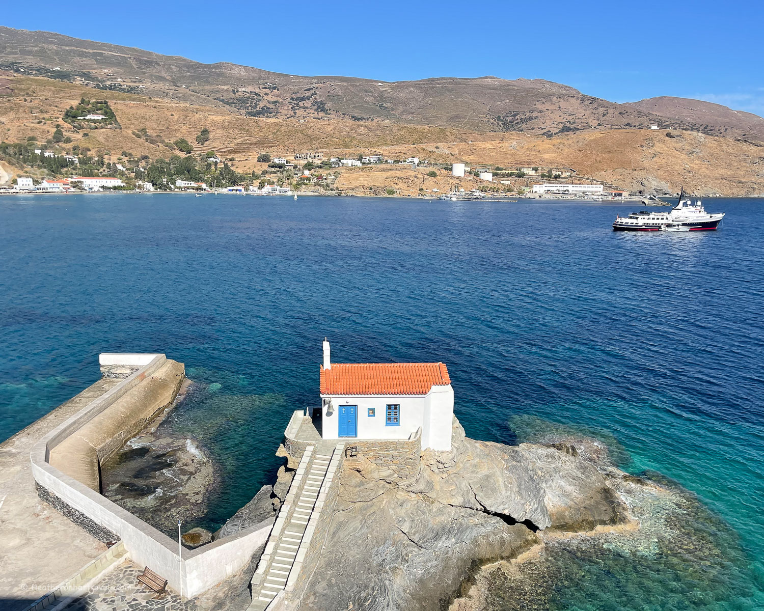
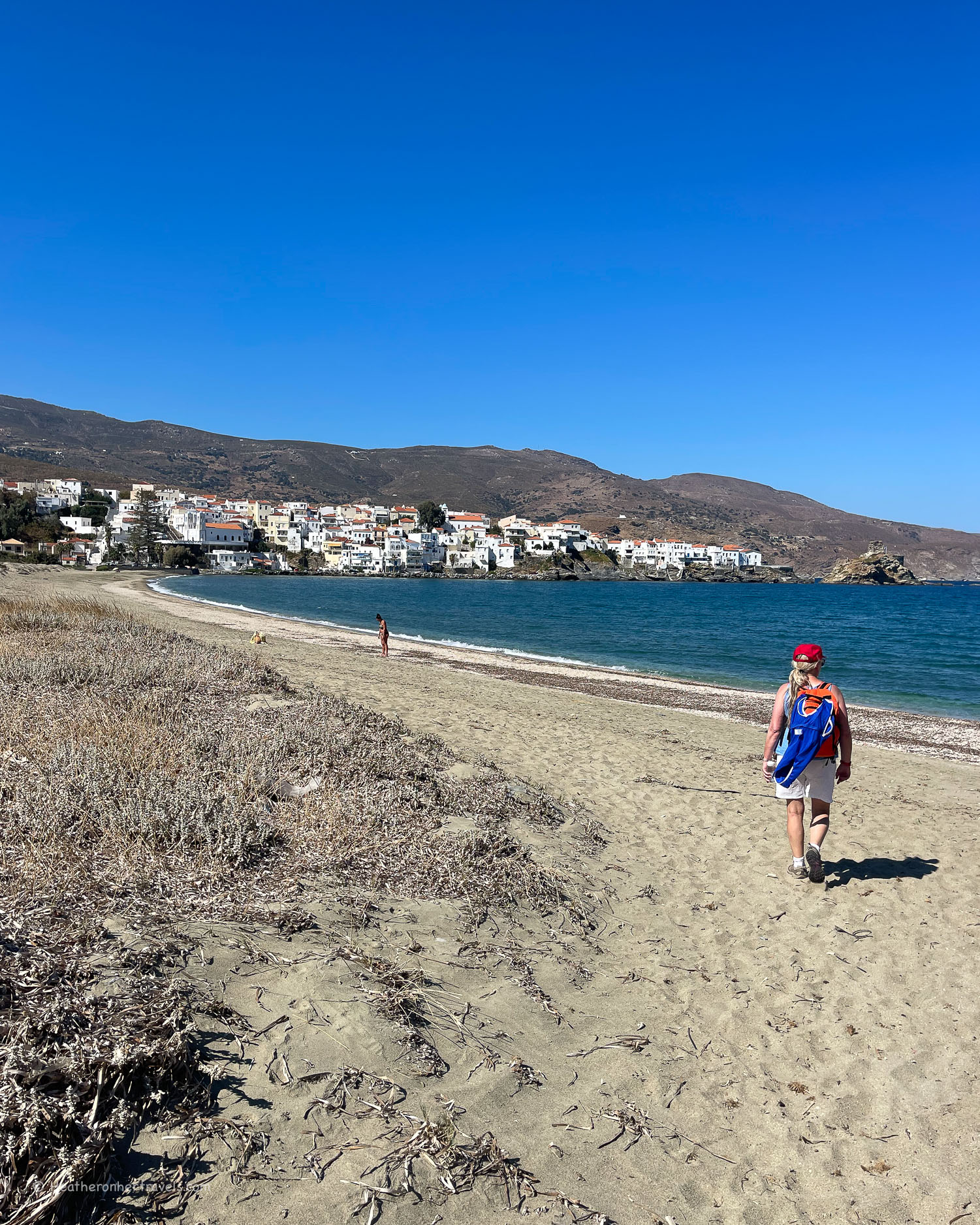
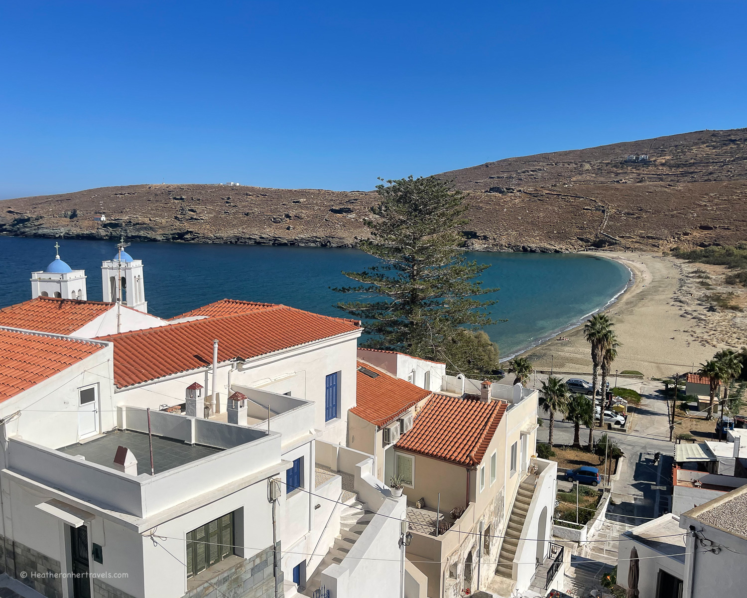
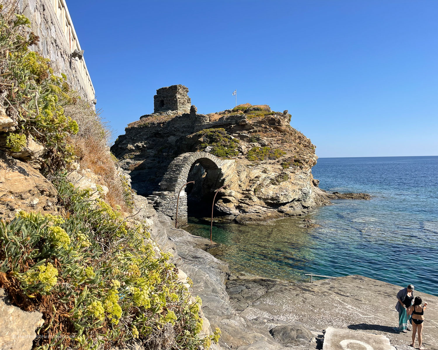
    With the sea in sight, it was an easy walk downhill to arrive at Gialia beach for a cool drink at the beach restaurant and refreshing swim in the quiet cove. Then we followed the road over the hill to Neimporio Beach, the main beach of Chora and back to the town.

    Gialia Beach Hiking in Andros Greece Photo © Heatheronhertravels.com
    Gialia Beach – Hiking in Andros Greece

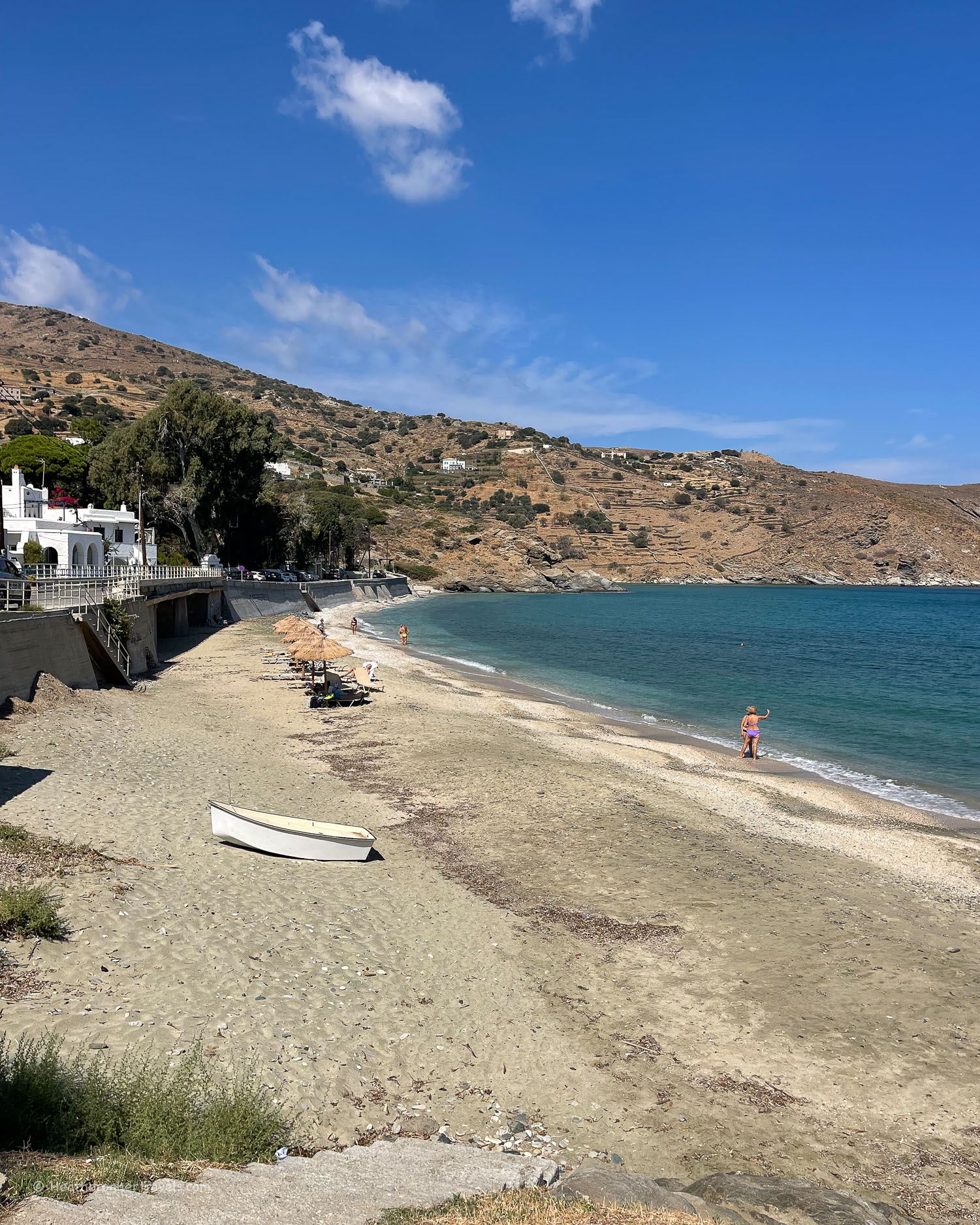
    Distance: 8.2 km Total time including stops: 6.5 hours

    Day 2 – Route 1 – Panachrantou monastery – Menites – Ypsilou – Chora

    This was the longest day we walked, but thanks to the 15 minute taxi ride from Chora up to the monastery, it was mostly downhill. Although we arrived at the Panachrantou monastery around 9.30am, it was a while before we were invited in, since the friendly monk was busy sweeping the courtyard and chasing away the peacocks.

    Panachrantou Monastery in Andros Greece Photo © Heatheronhertravels.com
    Panachrantou Monastery in Andros Greece

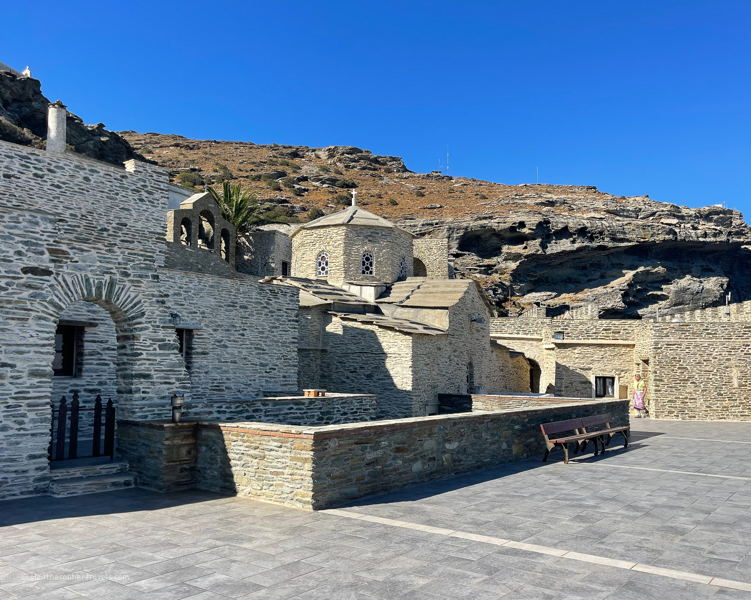
    Panachrantou monastery is well worth a visit, with fortress like walls and ramparts from which we had stunning views over the valley. The monastery is said to have been founded in 960 AD when two monks saw a light which led them to a cave, in which they found an icon of the Virgin Mary.

    Panachrantou Monastery in Andros Greece Photo © Heatheronhertravels.com
    Panachrantou Monastery in Andros Greece

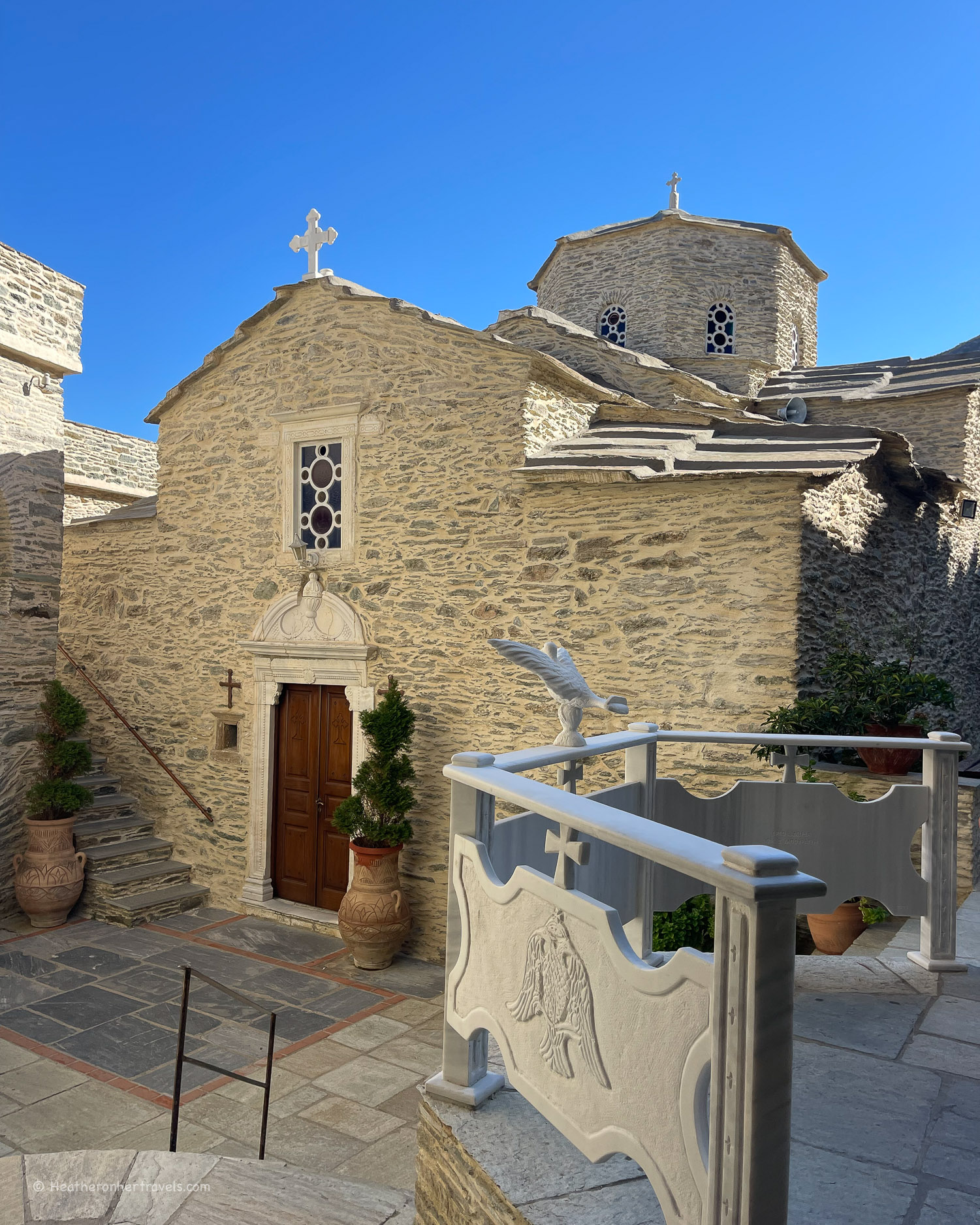
    The small church within the walls was unlocked by a monk, to show us the holy treasures of silver and gold, with beautiful icons and frescoes of the saints (unfortunately photos are not allowed). Then, as is traditional in Greek monasteries, we were offered a Loukoumi sweet in the monastery dining room.

    Panachrantou Monastery in Andros Greece Photo © Heatheronhertravels.com
    Panachrantou Monastery in Andros Greece

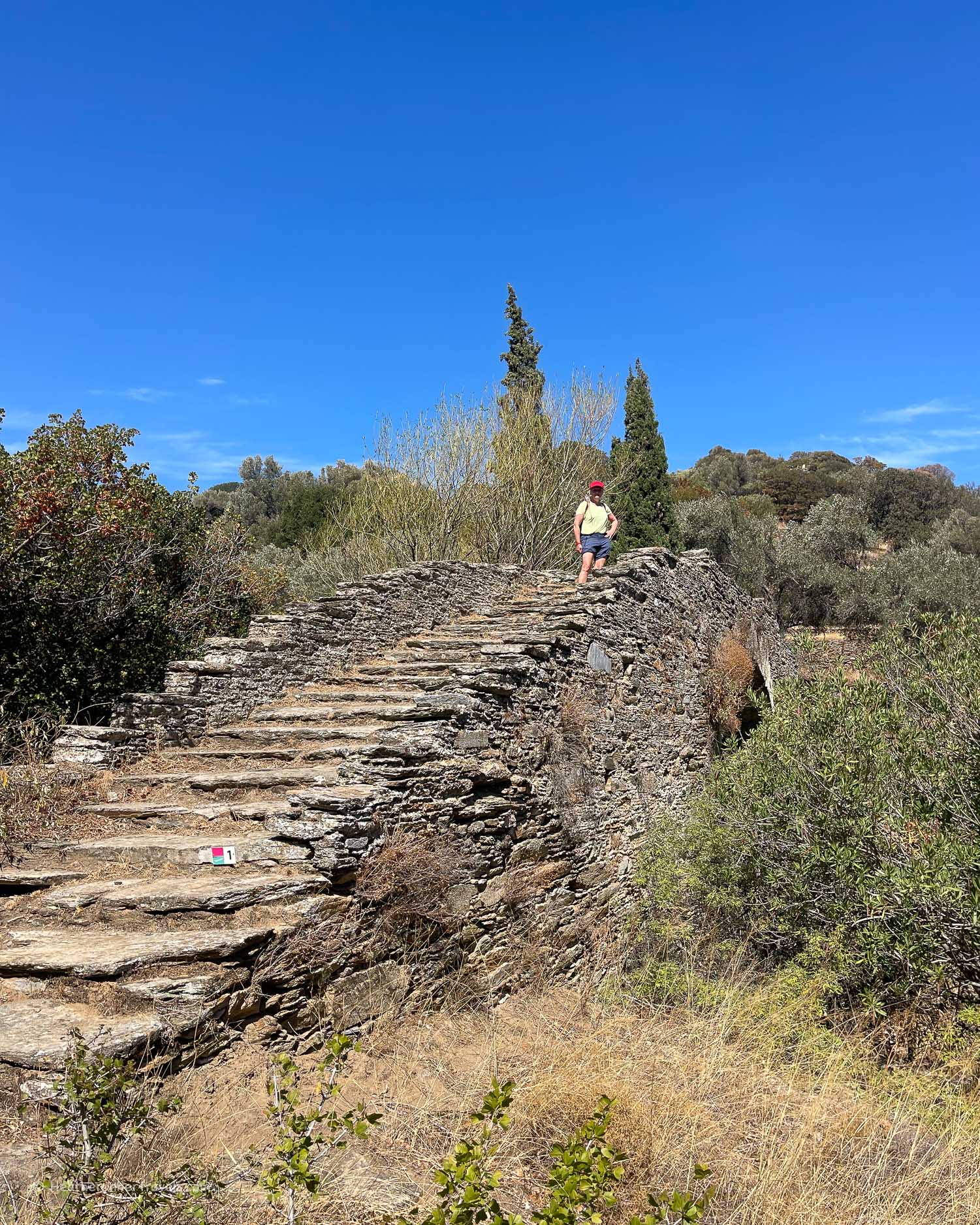
    From the monastery we followed the well marked Route 1 down the steep hill, passing the stone walls of a ruined hamlet. With beautiful views towards Chora, we traversed the hillside moving downhill until we crossed the stone arched bridge of Stoicheiomeni where the river bed was dry after the summer but would later fill up with winter rains.

    Hiking from Panachrantou Monastery in Andros Greece Photo © Heatheronhertravels.com
    Hiking from Panachrantou Monastery in Andros Greece

    From the bridge it was a hot uphill walk, crossing the road at the newer part of Menites village, and a short uphill stretch into the old village with its famous spring. The route between houses and stone terraces was pleasantly shady, alongside a water channel that brought water from the spring, and following the path of the mountain stream.

    Spring at Menites - Hiking in Andros Greece Photo © Heatheronhertravels.com
    Spring at Menites – Hiking in Andros Greece

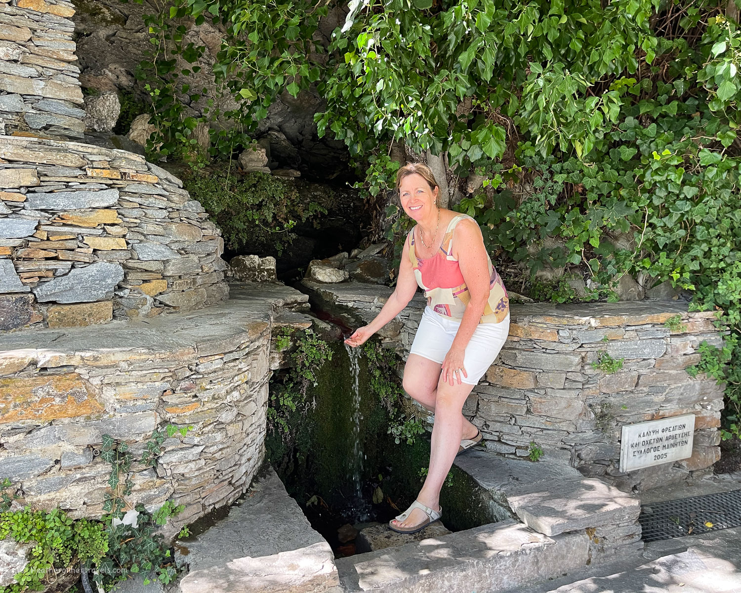
    We emerged back onto the road in the old village of Menites, to have a refreshing drink in one of the tavernas near the famous lion heads spouting the cold spring water.

    Menites - Hiking in Andros Greece Photo © Heatheronhertravels.com
    Menites – Hiking in Andros Greece

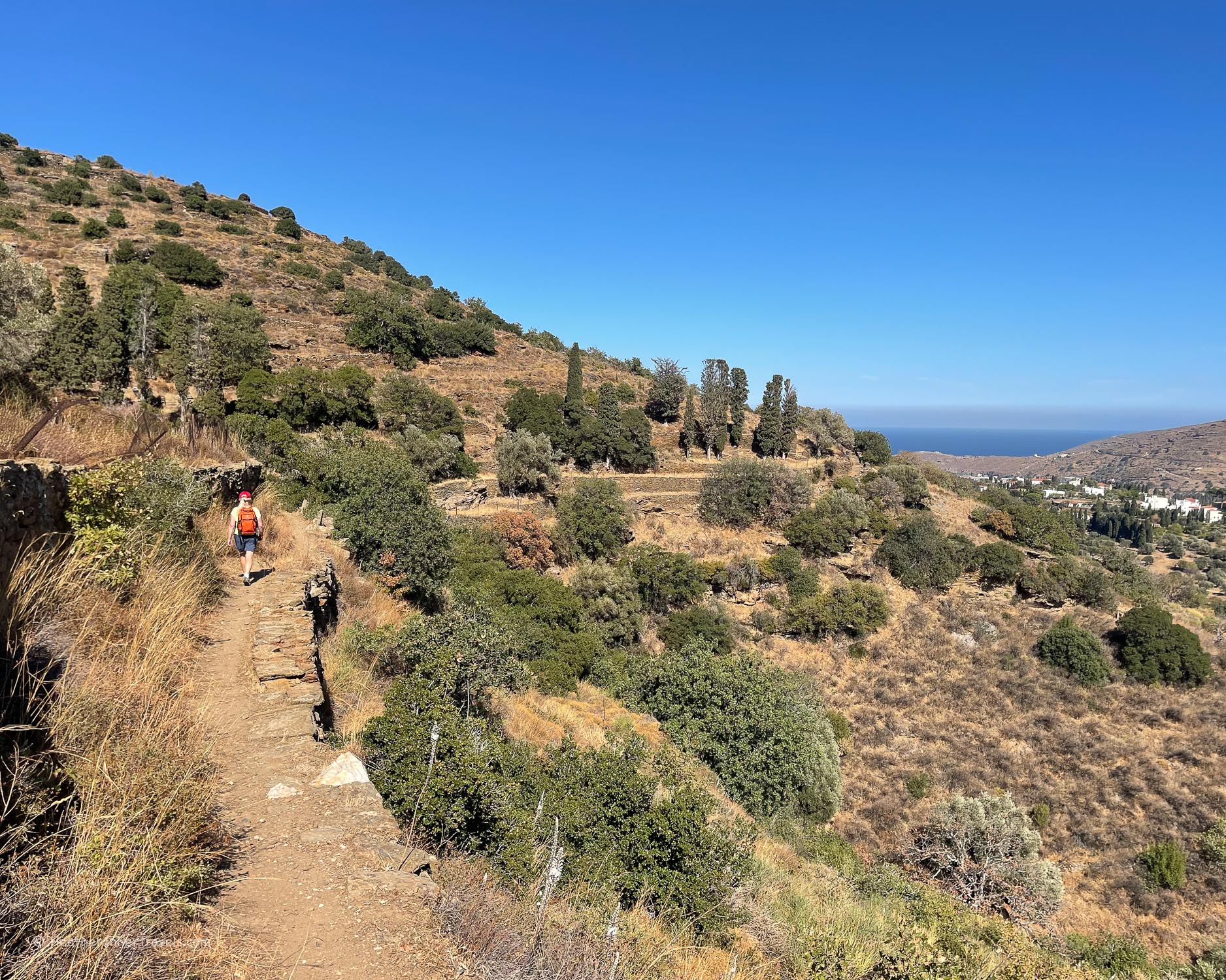
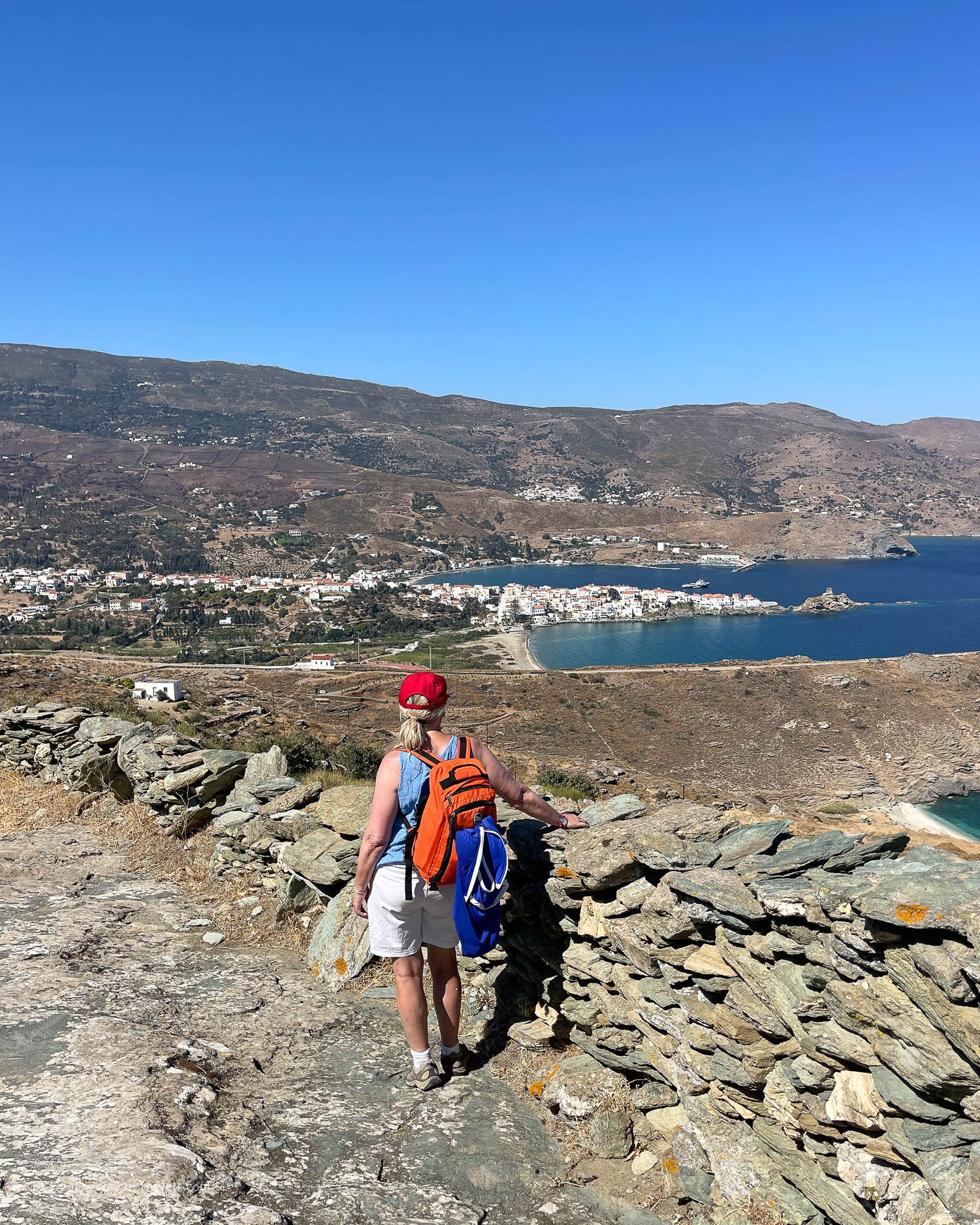
    From Menites it was a scenic walk along the valley past the scattered villages of Lamyra and Ypsilou before the path led us down to the beach just below Andros Chora.

    Distance: 11.5 km Total time including stops: 8 hrs

    Day 3 – River trekking to Gerolimni waterfall on Route 6

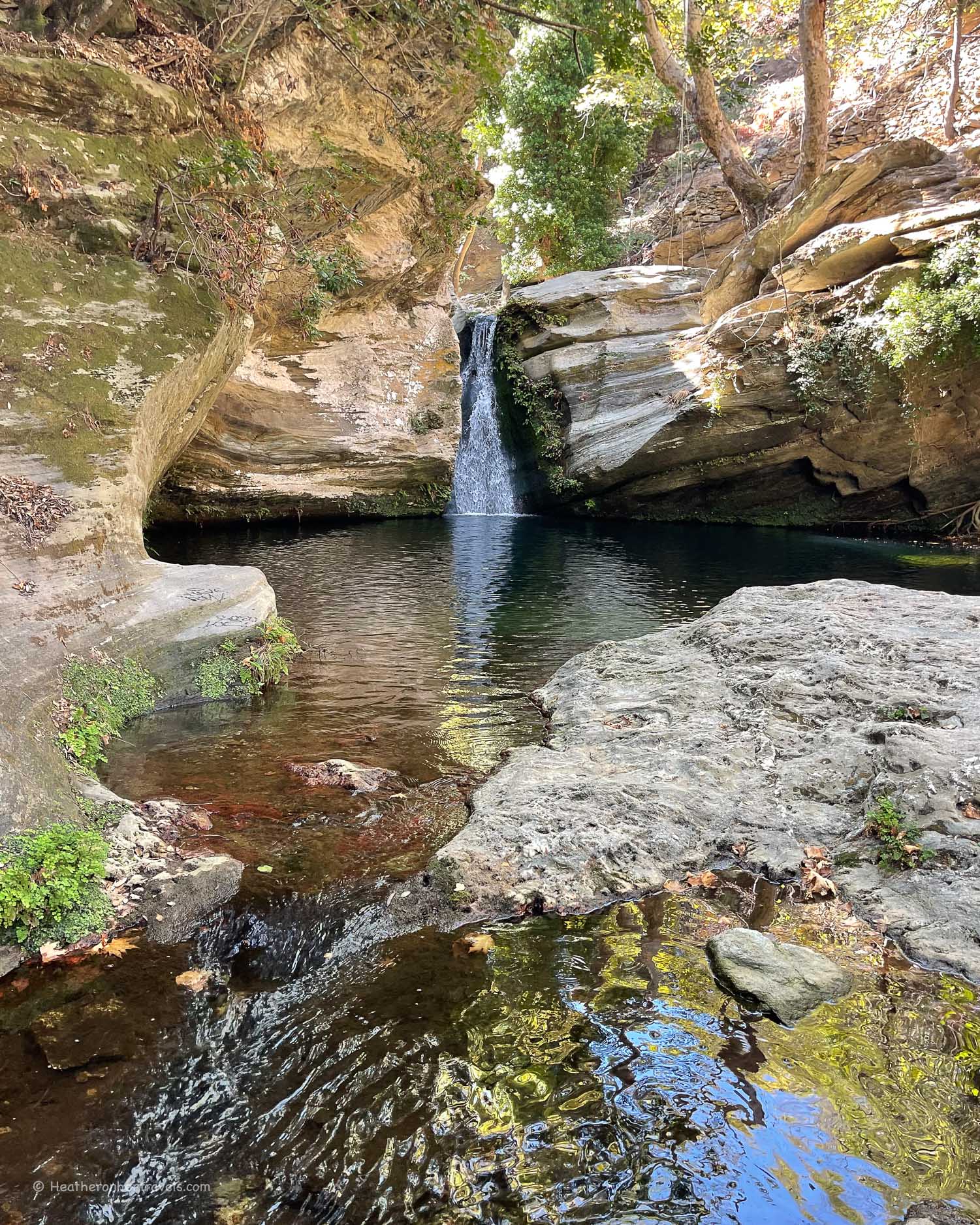
    We had seen enticing pictures of the Gerolimni waterfall, with its natural swimming pool, fed by icy water from the spring at Vourkoti mountain village. After a bit of research, we realised that it might be difficult to find on our own, so we decided to book the excursion run by Explore Andros, to take us there.

    Gerolimni waterfall - Achla river - Hiking in Andros Greece Photo © Heatheronhertravels.com
    Gerolimni waterfall – Achla river – Hiking in Andros Greece

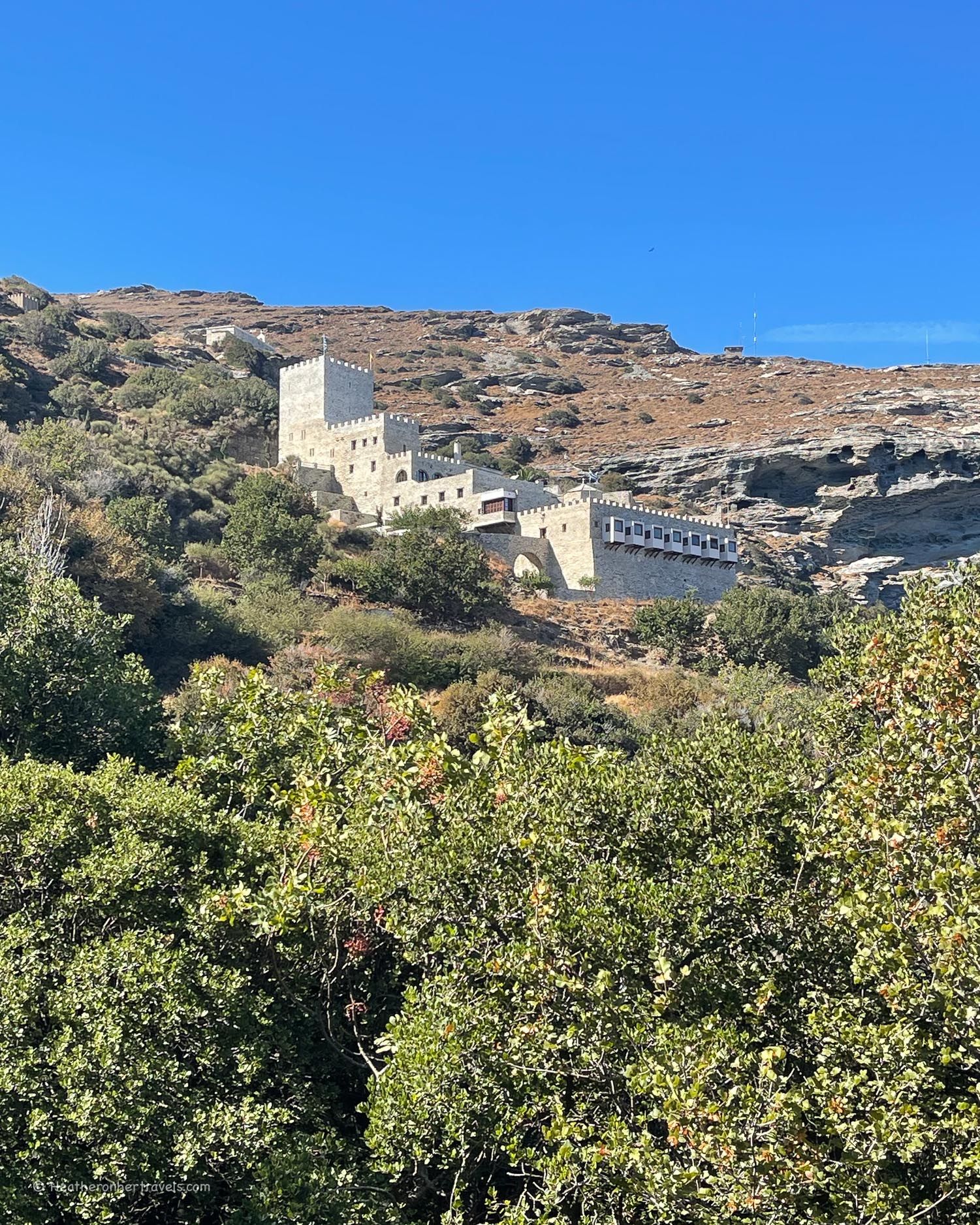
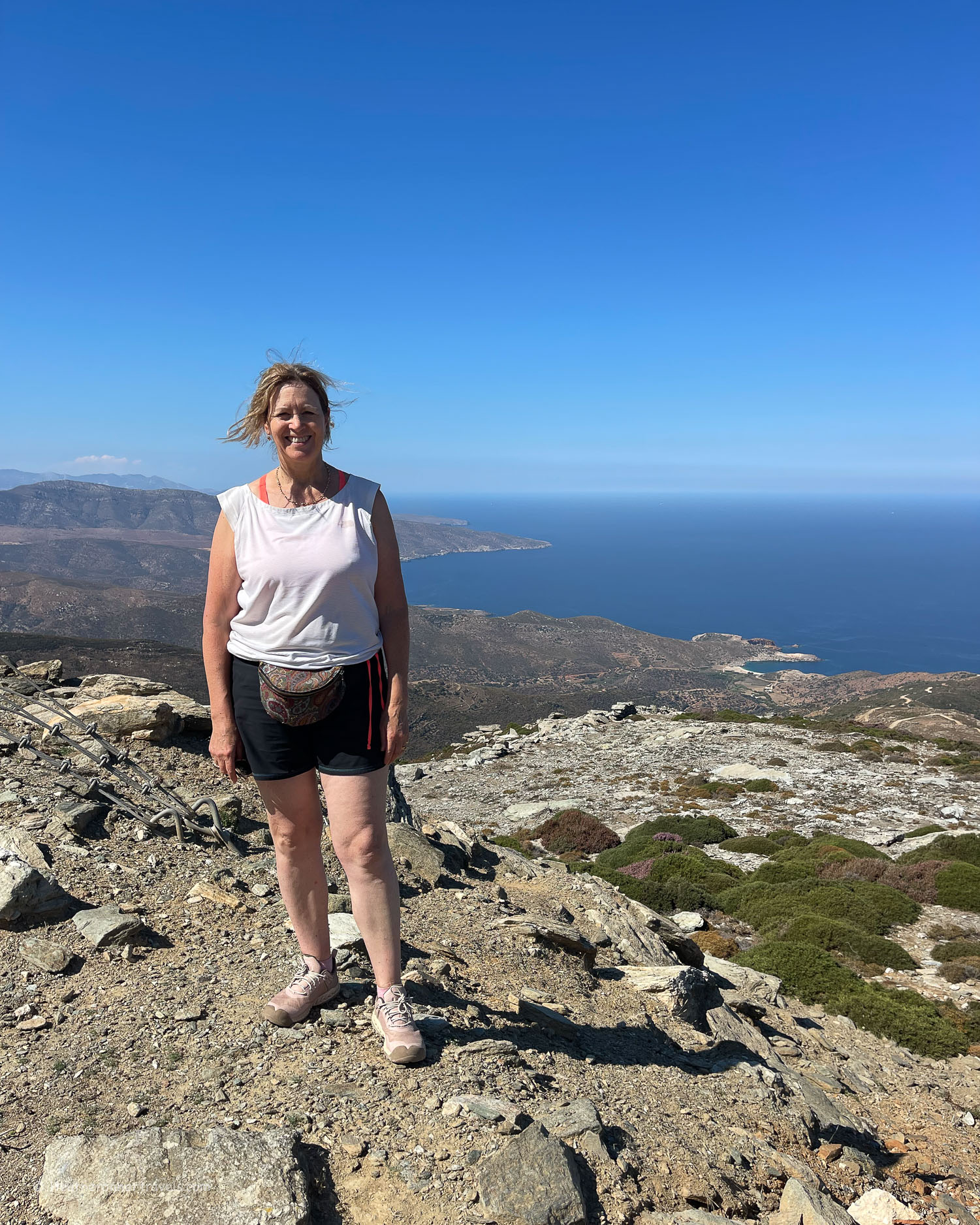
    Our guide from Explore Andros picked us up at the hotel in Chora and drove us on a steep, winding mountain road, past the scattered village of Vourkoti. This area is the highest point on Andros, often shrouded in cloud, although for us the skies were clear and the views amazing.

    We arrived at the monastery of Agios Nikolaos, where we parked the car in the parking area above. Since the monastery was open, we took the opportunity to make a visit, and a lady opened the church to show us the beautiful icons with silver lamps hanging from the ceiling.

    Agios Nikolaos monastery - Hiking in Andros Greece Photo © Heatheronhertravels.com
    Agios Nikolaos monastery – Hiking in Andros Greece

    By tradition the monastery is thought to have been built in the 8th century and is renowned for a miraculous icon that streams tears of fragrant myrrh. If you’d like to visit more of the mountain monasteries of Andros, Explore Andros offer this Monasteries of Andros half day tour.

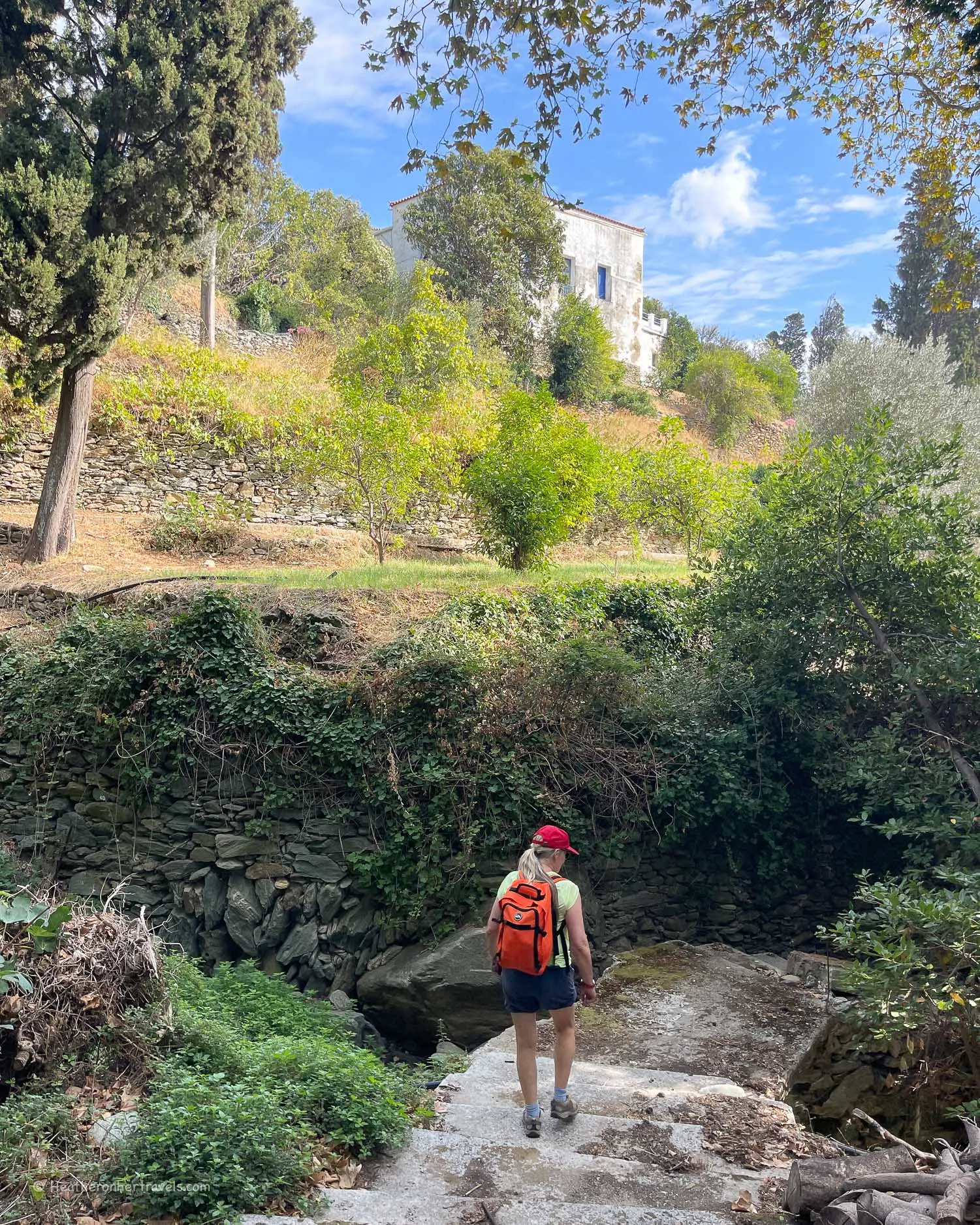
    From the monastery, we followed the zig zag path down into the valley of the Achla river, which reaches the coast at Achla beach. Soon, we were in shady woodland, crossing an arched stone bridge from the Venetian period and following the river upstream in the direction of Vourkoti.

    Agios Nikolaos monastery - Hiking in Andros Greece Photo © Heatheronhertravels.com
    Agios Nikolaos monastery – Hiking in Andros Greece

    At some point the official Route 6 path veered away from the river, but this is where we continued along a faint path. Sometimes we clambered over boulders and fallen trees, changing levels on the old farming terraces, always keeping the river in sight.

    Luckily our guide from Explore Andros knew the path well and was able to help us over any obstacles and guide us to the best footholds.

    Achla River - Hiking in Andros Greece Photo © Heatheronhertravels.com
    Achla River – Hiking in Andros Greece

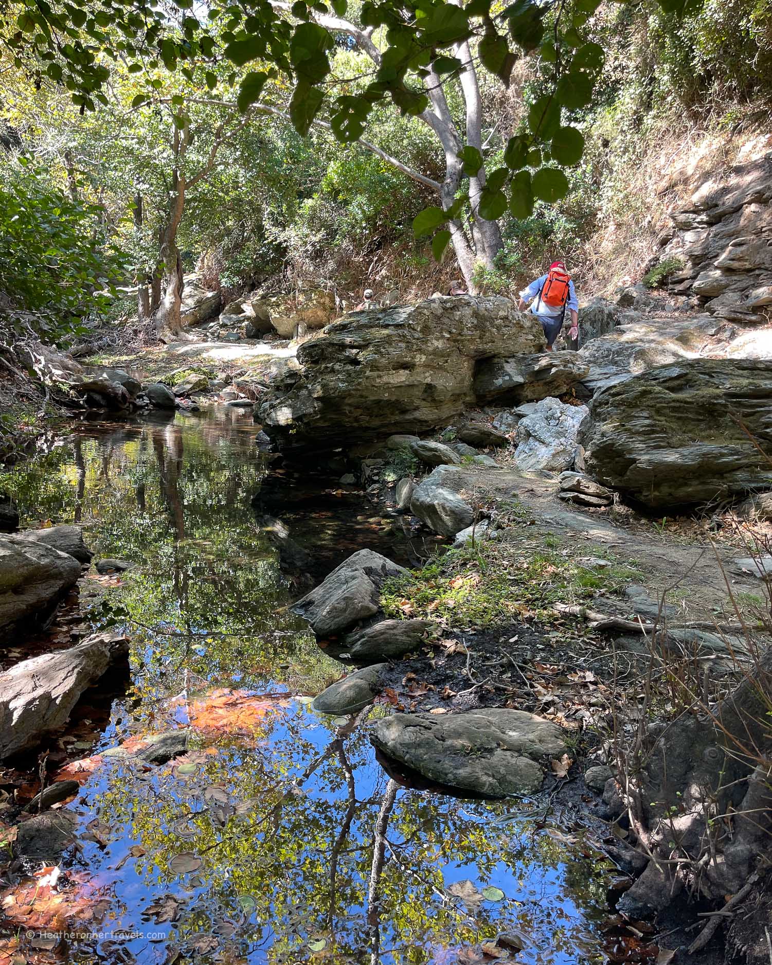
    After around an hour’s walking from the monastery, we could hear the waterfall gushing down the rockface, into a deep pool below us. Even though the walk had been mostly shaded by the trees, it was a refreshing sight, and we couldn’t wait to jump into the ice cold water.

    Gerolimni waterfall - Achla river - Hiking in Andros Greece Photo © Heatheronhertravels.com
    Gerolimni waterfall – Achla river – Hiking in Andros Greece

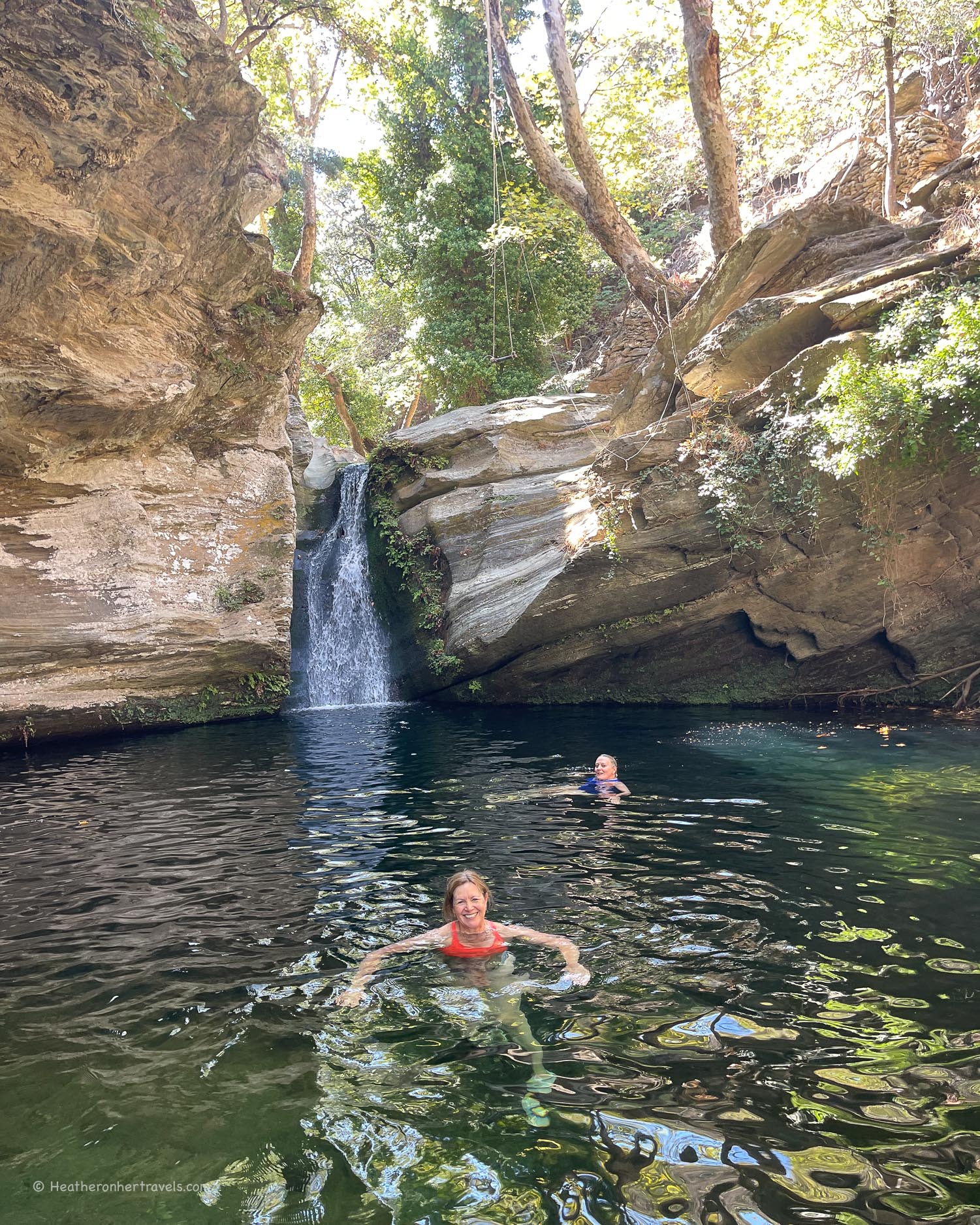
    While it was possible to jump or even dive in, I preferred to lower myself gingerly, despite the cold taking my breath away. First dip and we could barely breathe from the cold shock, second dip and we swam around briskly, third dip and we felt positively euphoric from the effects of the icy water!

    Stone bridge Achla River - Hiking in Andros Greece Photo © Heatheronhertravels.com
    Stone bridge Achla River – Hiking in Andros Greece

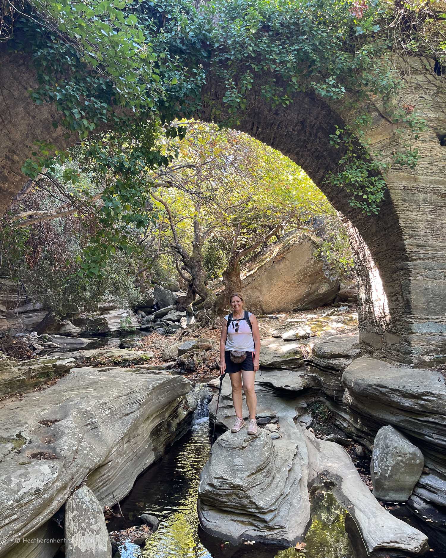
    After relaxing a while by the pool, we made our way back on the same route. This time we posed for photos under the old stone bridge, which looked even more impressive from the river level.

    Back at the monastery, we could see Achla Beach in the distance. It’s reputed to be one of the most beautiful beaches in Andros, but is only accessible on a long dirt track, or by hiking down from the monastery.

    It would be wonderful to walk the whole Route 6 hike, which runs from the mountain village of Vourkoti past Agios Nikolaos monastery to Achla Beach.

    The problem is that you need transport to reach the start of the walk at Vourkoti village, a 30-45 minute drive on the winding mountain road from either Batsi or Chora.

    Near Vourkoti - view to Achla beach - Hiking in Andros Greece Photo © Heatheronhertravels.com
    Near Vourkoti – view to Achla beach – Hiking in Andros Greece

    Achla beach where the walk ends is also very remote, with no bus service. If you want to visit the beach without the hike, it’s probably best to take a boat trip, like the one offered by Explore Andros, allowing you to see some of the more remote northern beaches and coastline.

    I’d highly recommend taking the River Trekking tour, but if you prefer to hike Route 6 independently using a hire car, I’d suggest parking at the Agios Nikolaos monastery. From the monastery it’s around 1 hour to hike downhill to Achla Beach and 1 hour back. You can also could attempt to hike in the other direction and try to find the Gerolimni waterfall and pool, again 1 hour there and 1 hour back.

    You can book the river trekking trip with Explore Andros here.

    Total time: 3hrs round trip hiking from the monastery to the waterfall, including the stop at the pool. Driving time to Agios Nikolaos monastery from Batsi 45 minutes. Driving time from Chora 30 minutes.

    Day 4 – Route 3 – Syneti village – Syneti Beach – Chora

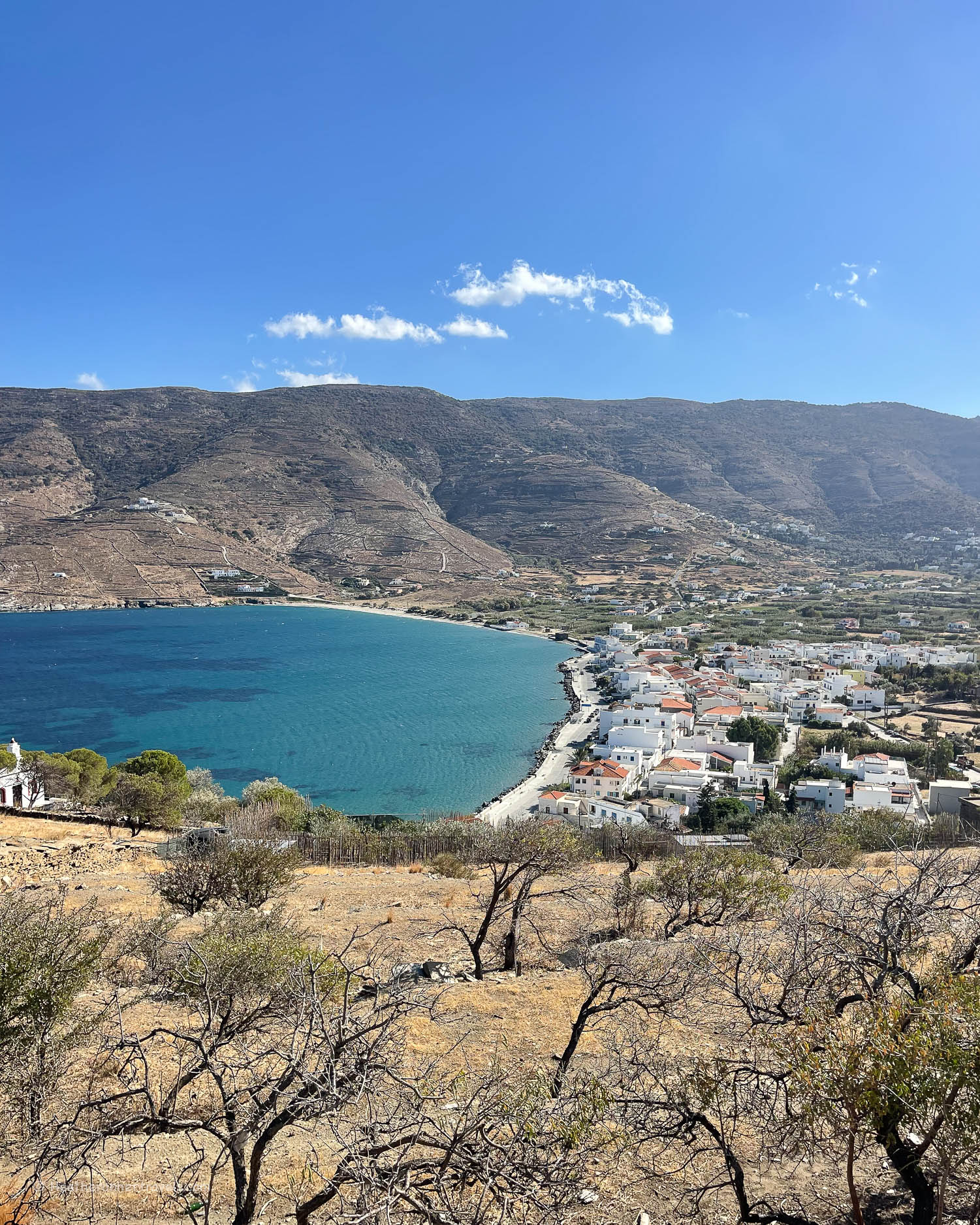
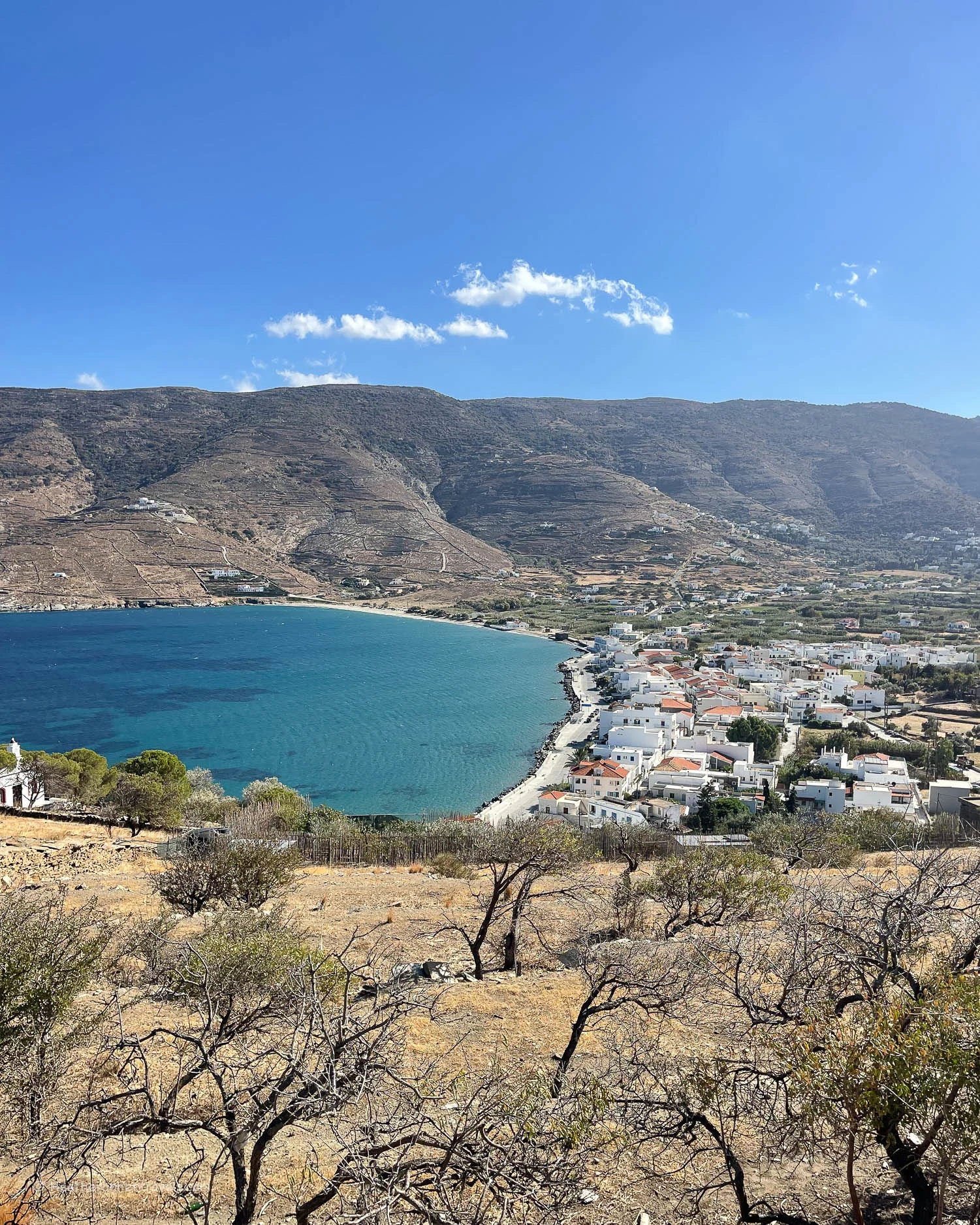
    We were hoping to hike to Korthi, the smallest of the four towns of Andros. It sits on the coast in a bowl of mountains, to the south of Chora where we were staying. Korthi is so sleepy, it’s where the residents of laid back Chora go to unwind even more!

    Ideally we would have taken a taxi part of the way to Syneti, and from there walked over the crest of the mountain downhill into Korthi. The timetable told us there would be an afternoon bus to bring us back to Chora.

    Syneti beach - Hiking in Andros Greece Photo © Heatheronhertravels.com
    Syneti beach – Hiking in Andros Greece

    But on checking at the bus station, the afternoon bus did not seem to run after the end of September. We were worried that a taxi might not be available in Korthi, or be too expensive for the 45 minute drive back. So we decided to cut the route in half and just walk back from Syneti, incorporating a swim at Syneti bay.

    Syneti village - Hiking in Andros Greece Photo © Heatheronhertravels.com
    Syneti village – Hiking in Andros Greece

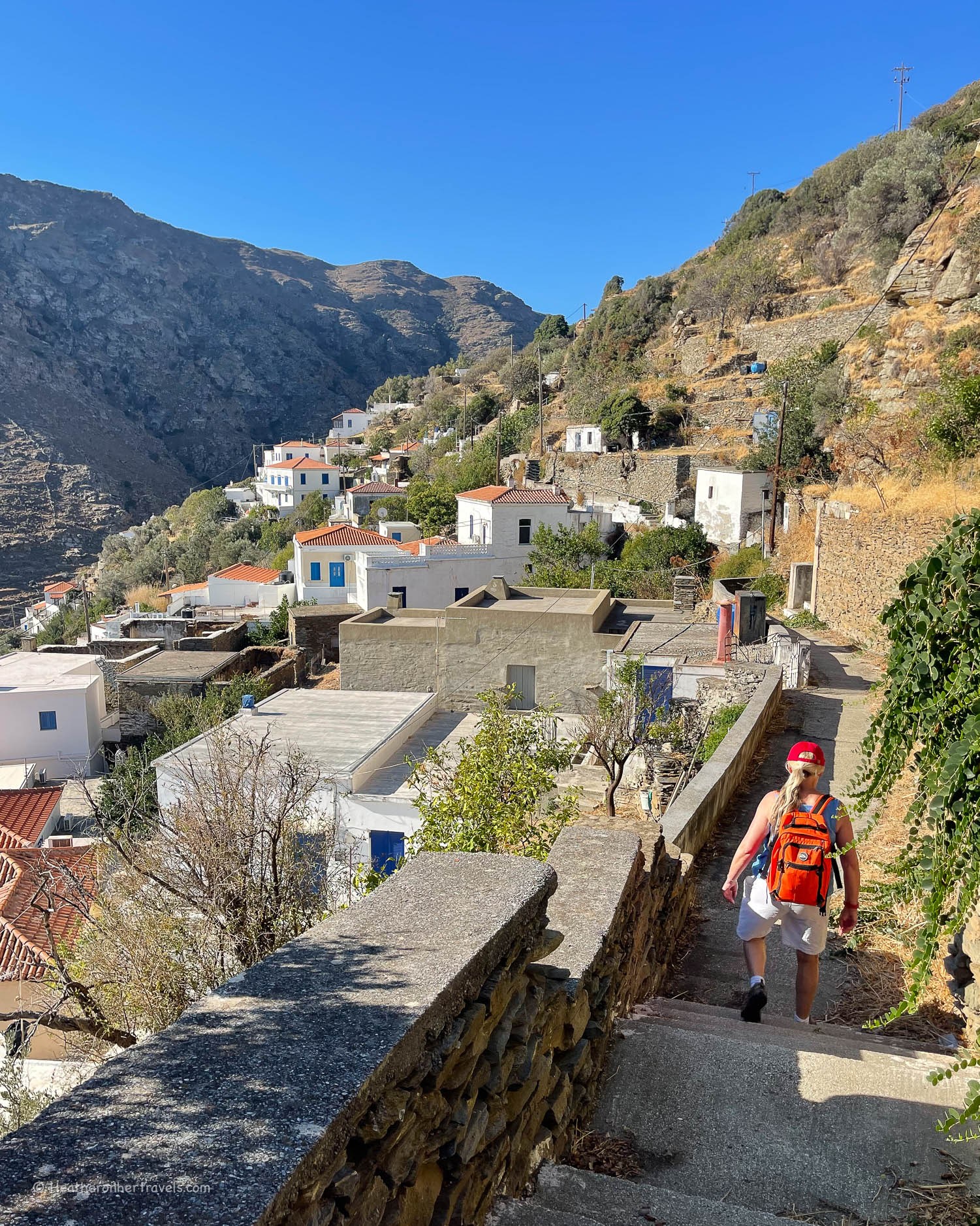
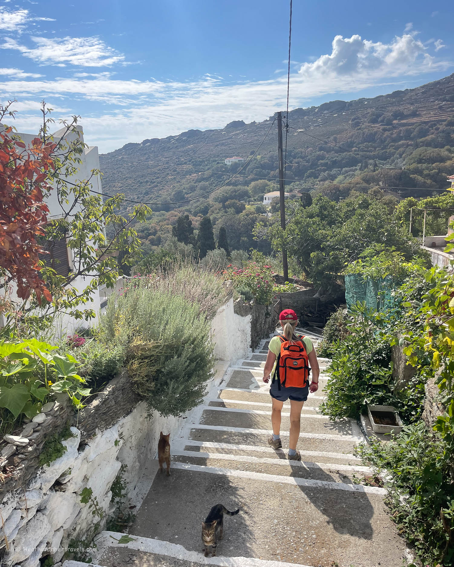
    Our taxi dropped us off by the road at the top of Syneti village, and we walked down through the mainly pedestrianised streets, with cute houses clinging to the hillside.

    Folk Museum at Syneti village - Hiking in Andros Greece Photo © Heatheronhertravels.com
    Folk Museum at Syneti village – Hiking in Andros Greece

    There’s a folklore museum in the middle of the village, housed in an attractive building that was once the village’s primary school. It was closed when we visited, so we continued down the narrow road that snaked down the hillside towards the beach.

    Syneti beach - Hiking in Andros Greece Photo © Heatheronhertravels.com
    Syneti beach – Hiking in Andros Greece

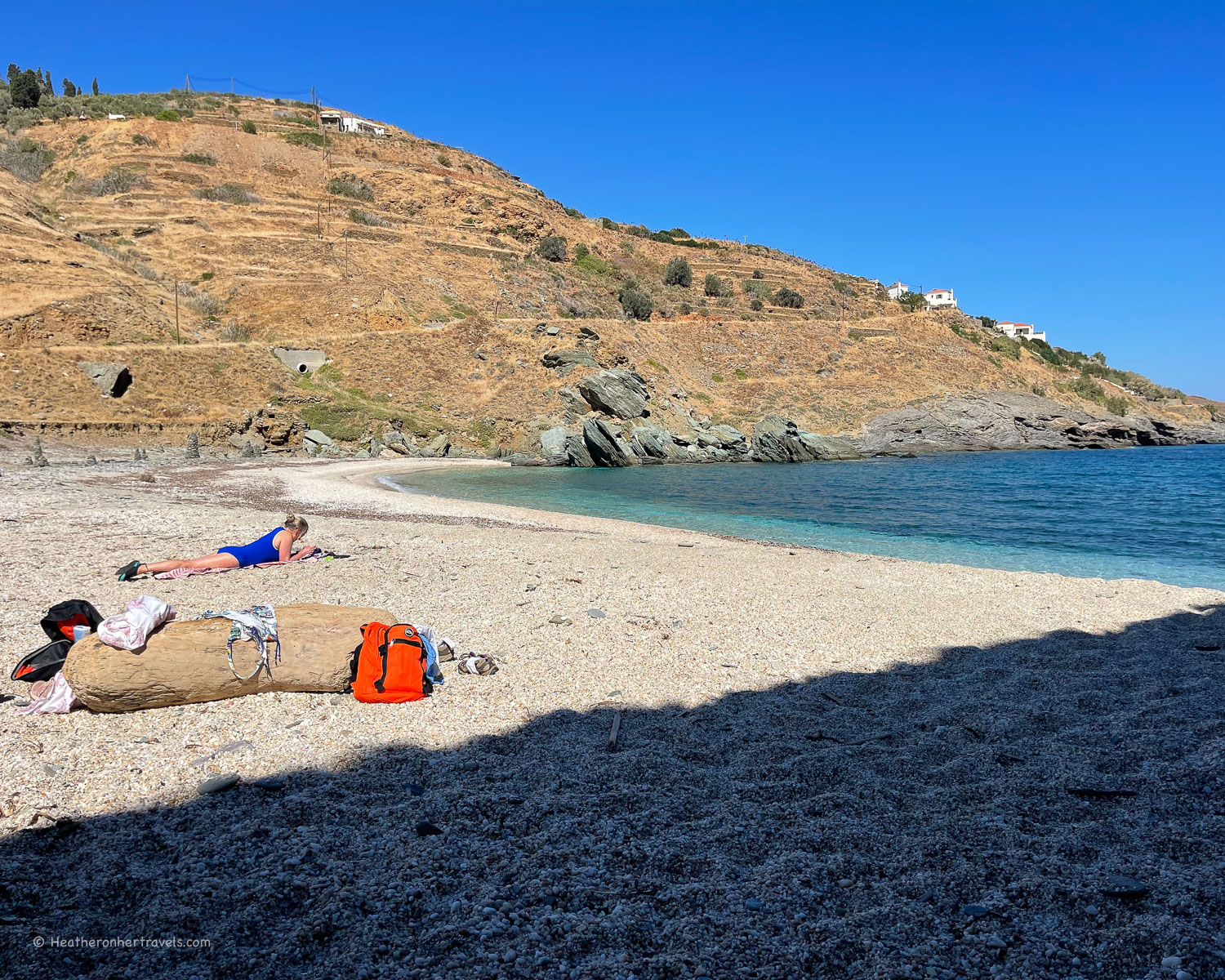
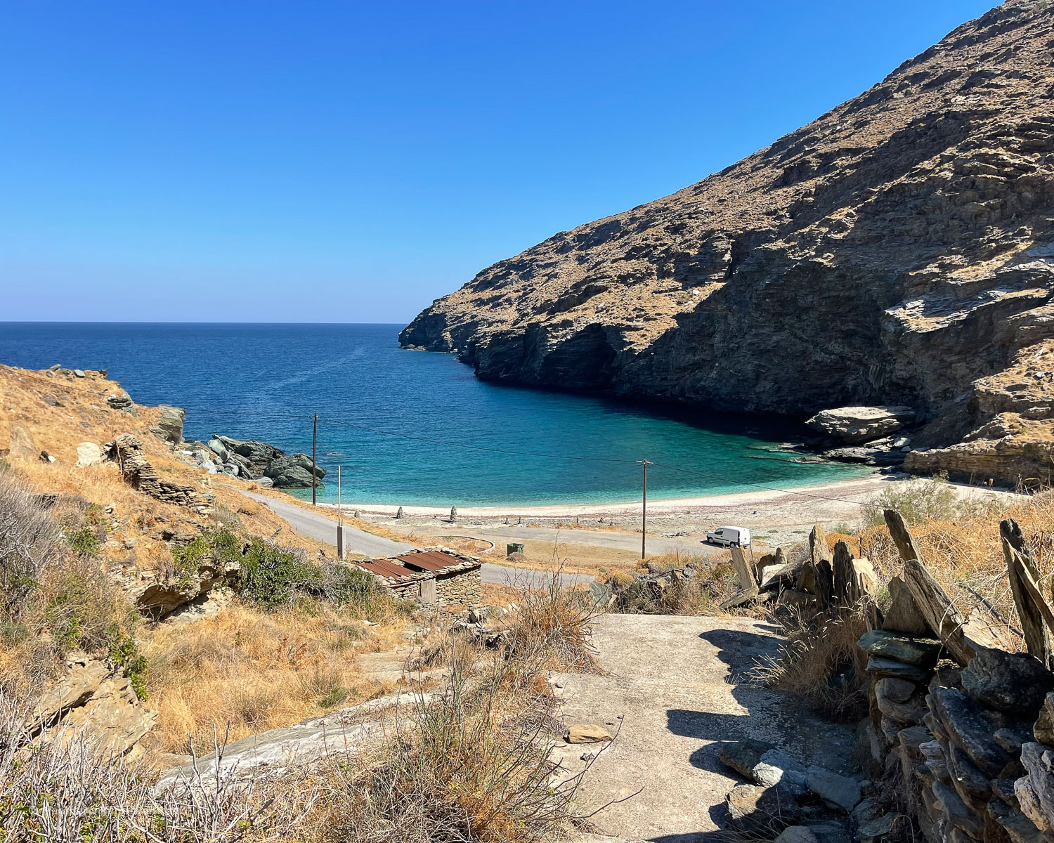
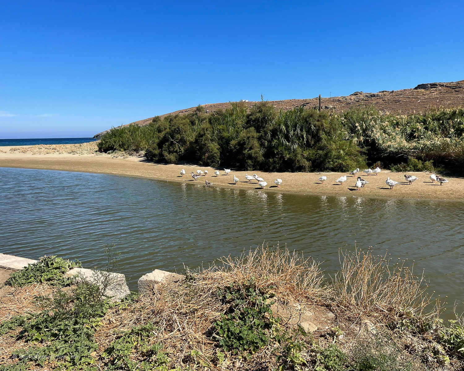
    The bay at Syneti is backed by a beach of small pebbles, with clear turquoise water and high rocky cliffs on the southern side. We had the beach entirely to ourselves, apart from a lone white goose who seemed to live there. After a refreshing swim, a couple of locals appeared who also enjoyed a solitary swim, one of them calling to the duck as if it was his friend.

    Hiking in Andros Greece - Syneti to Chora - Photo © Heatheronhertravels.com
    Hiking in Andros Greece – Syneti to Chora

    We discovered there was a direct path from the beach up the hillside, although a little overgrown, and used this as a short cut to get back to the village and the road. From there we picked up the Route 3 path, which mainly followed the road but short-cutting its curves.

    Hiking in Andros Greece - Syneti to Chora - Photo © Heatheronhertravels.com
    Hiking in Andros Greece – Syneti to Chora

    We had some lovely views over Chora and arrived at the broad sweep of Paraporti beach. Here there’s an area of wetlands along the Megalos river, with a larger flock of ducks, so perhaps our solitary feathered swimming companion was part of this group.

    Paraporti beach - Hiking in Andros Greece Photo © Heatheronhertravels.com
    Paraporti beach – Hiking in Andros Greece

    Later in the holiday I was able to visit Korthi by car, and the drive along the mountain road gave us stunning views, so it would definitely be worth trying to make the full hike down into Korthi if you get a chance.

    Korthi Andros Greece Photo Heatheronhertravels.com
    Korthi Andros Greece

    Day 5 – Route 17 – Easy circular walk from Chora around Livadia

    For our final day hiking we decided to make an easy walk from Chora around the area of Livadia.

    Livadia - Hiking in Andros Greece Photo © Heatheronhertravels.com
    Livadia – Hiking in Andros Greece

    This flat valley close to Chora is irrigated by the Megalos Potamos ( literally Great River ), so it’s full of small fields and citrus orchards, dotted with village houses.

    Livadia - Hiking in Andros Greece Photo © Heatheronhertravels.com
    Livadia – Hiking in Andros Greece

    It was a peaceful, rural setting, punctuated only by the ubiquitous barking dogs that most home owners seemed to keep as an early warning of visitors.

    Livadia - Hiking in Andros Greece Photo © Heatheronhertravels.com
    Livadia – Hiking in Andros Greece

    The hike meandered through the valley and up the slope on the other side, before circling back to bring us into Chora on a different path. Because we wanted to spend some of our last day on the beach, we retraced the same path back and arrived at Paraporti beach for a swim.

    Paraporti beach - Hiking in Andros Greece Photo © Heatheronhertravels.com
    Paraporti beach – Hiking in Andros Greece

    Other hikes to try in Andros

    There are numerous other Andros Routes hikes to try depending on where you are staying, whether that’s Chora, Gavrio, Batsi or Korthi. Rather than trying to list them all, we recommend that you buy the map showing all the Andros Routes and check the descriptions on the Andros Routes website.

    Ask a local or a taxi driver for the best place to be dropped off, and then walk from the high ground in the centre of the island, back down to the coast, to ensure the best views and minimise the uphill slog!

    View of Paraporti beach from Chora - Hiking in Andros Greece Photo © Heatheronhertravels.com
    View of Paraporti beach from Chora – Hiking in Andros Greece

    Best months to hike in Andros

    The main tourist season in Andros is relatively short, stretching from beginning of May to end of September. The high season months of July and August are too hot for hiking (above 30 degrees C), and even second half of June and first half of September may see days of 25-30 degrees Celcius.

    We found the optimum time on Andros to enjoy both good weather for hiking ( 20-25 degrees C) and also find most hotels, restaurants and tourism businesses open, is beginning May to mid June or mid September to mid October.

    Hiking to Andros Chora Greece Photo Heatheronhertravels.com
    Hiking to Andros Chora Greece

    If you are only there for the hiking and not so worried about having a smaller selection of hotels and restaurants to choose from, the shoulder season of March – April and October- November can have some sunny and warm days (18-25 degrees C) for hiking. Be aware that Greek Orthodox Easter usually falls in April and is a busy time for Greek visitors.

    We spent a week hiking in the last week of September and found it to be a perfect time of year to visit, with great weather for both hiking and swimming, as well as the chance to enjoy the atmosphere of restaurants where you could sit outside in the evening.

    I stayed on a further week at the beginning of October for sightseeing and noticed a big difference in atmosphere, as the temperatures started to drop in the evening and many restaurants and hotels had closed.

    Where to stay in Andros

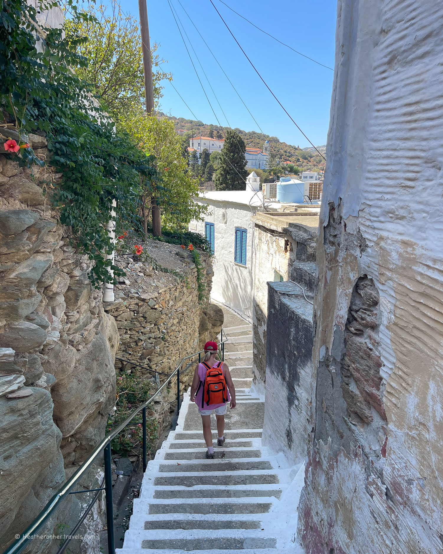
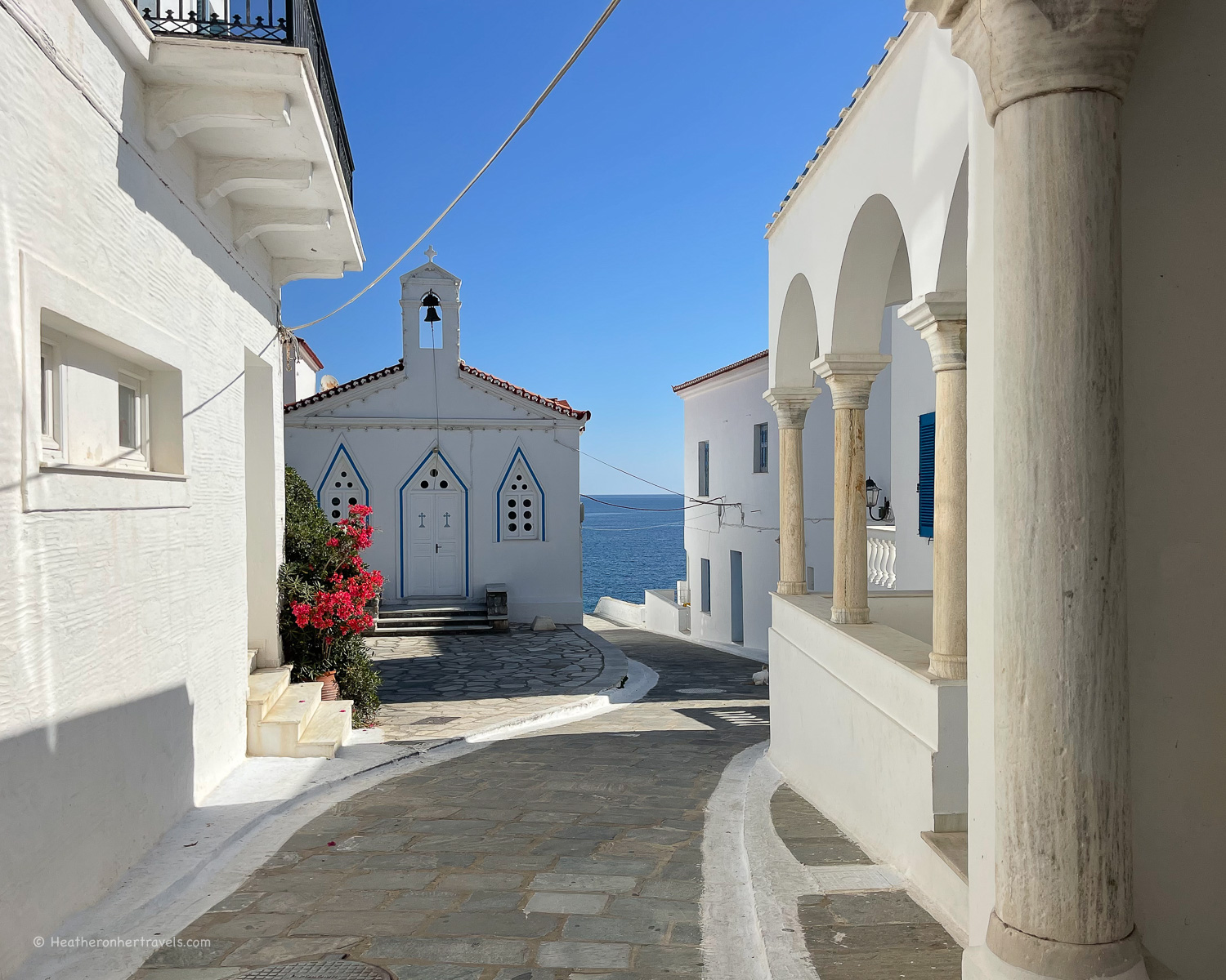
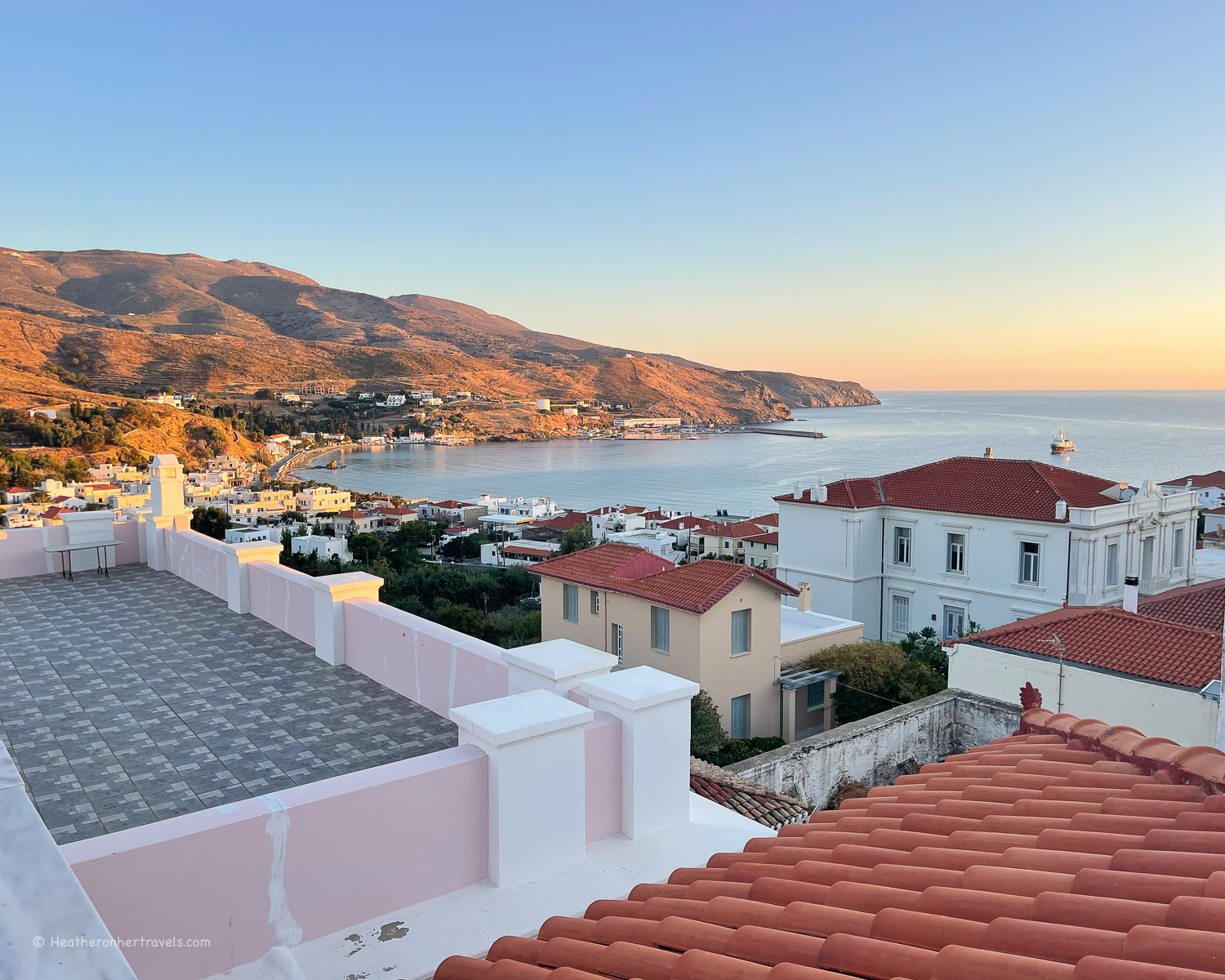
    If hiking is your main purpose, I’d strongly recommend basing yourself for all or most of the time in Andros Chora, also known locally as just ‘Chora’ (pronounced Hora). The island’s capital is a charming small town, with a wide range of accommodation, shops and restaurants.

    Andros Chora Greece Photo Heatheronhertravels.com-
    Andros Chora Greece

    Many of the island’s hiking trails start or end in this area. It’s also easy to find a taxi at the taxi rank in the square to take you to a start of the trails that lead back into Chora.

    Batsi Andros Greece Photo Heatheronhertravels.com
    Batsi Andros Greece

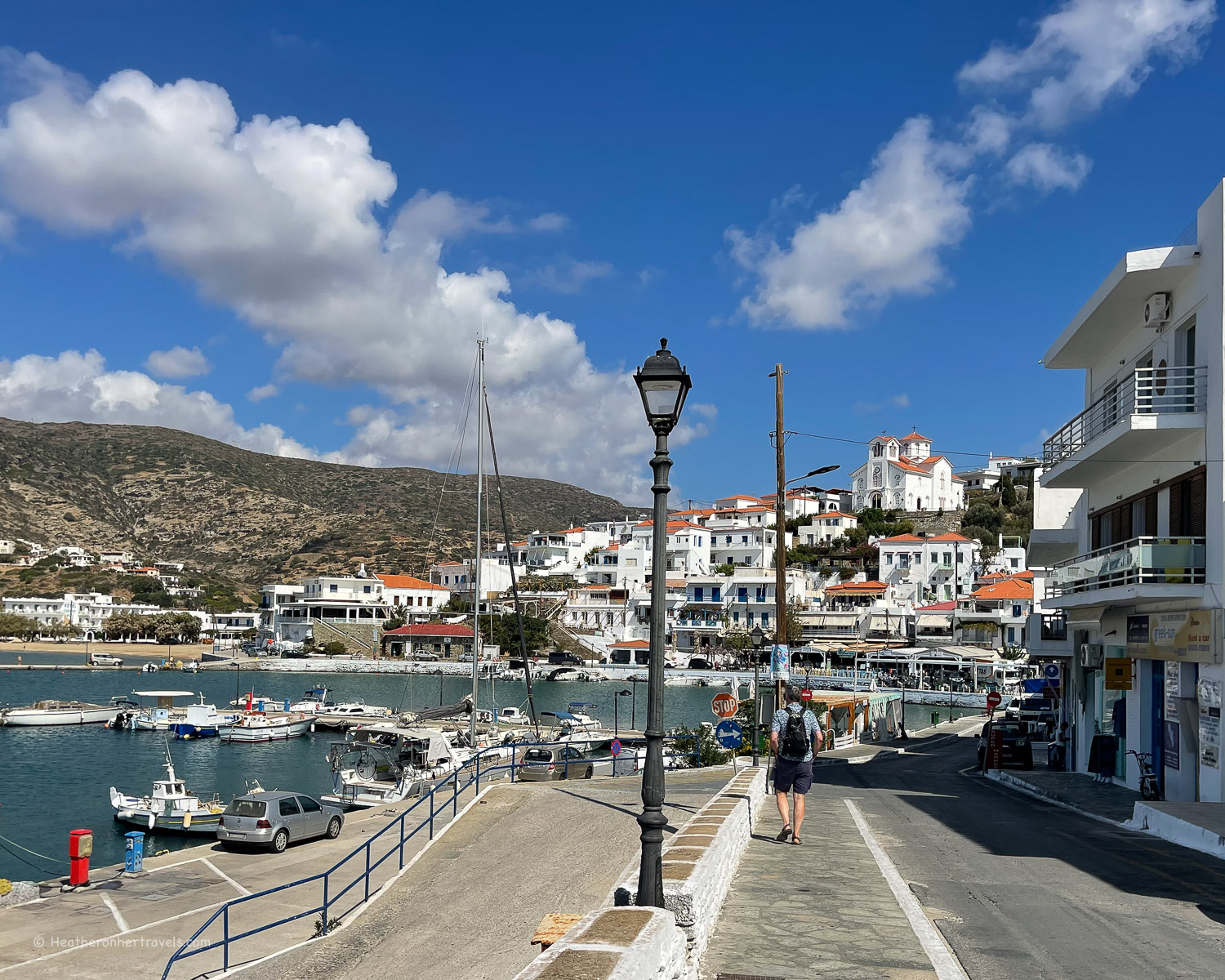
    Many other hiking routes can be accessed from the island’s other three main towns of Korthi, Batsi and Gavrio. If you have more time, you may wish to tack on a couple of days staying at any of these, to make it easier to hike these routes.

    Batsi Andros Greece Photo Heatheronhertravels.com
    Batsi Andros Greece

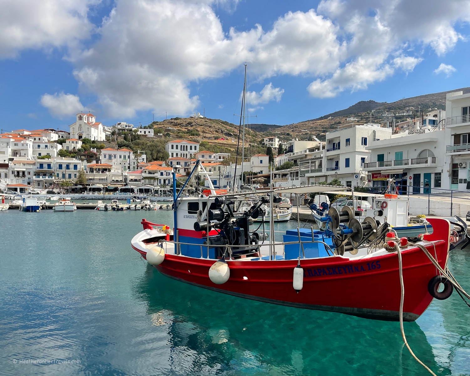
    If you want to do some more remote mountain trails, add on a couple of days in Korthi, while if you prefer some hiking combined with relaxation, choose Batsi for its holiday resort vibe. Gavrio is mainly a ferry port with no beach, but staying here would allow you to access some of the island’s northern trails.

    Korthi Andros Greece Photo Heatheronhertravels.com
    Korthi Andros Greece

    If you prefer to base yourself in one place, but are keen to hike some of the more remote routes to the north or south of Andros, I recommend contacting Explore Andros based in Chora. They have knowledgeable guides and can arrange a bespoke itinerary that includes drop off and pick ups in remote locations where there’s no public transport.

    Venetian fort Andros Chora Greece Photo Heatheronhertravels.com
    Venetian fort Andros Chora Greece

    They are also the ideal partner if you are arranging a group hiking trip, as they also own or manage a range of hotels and other accommodation, so can offer a complete package for a group hiking holiday.

    Recommended hotels in Chora

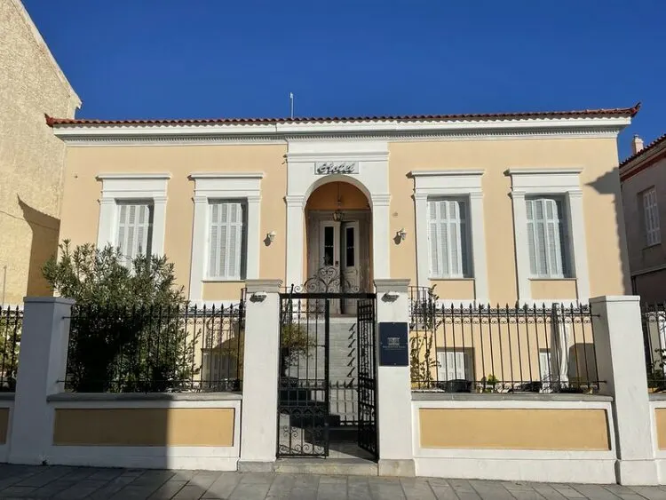
    Archontiko Eleni (we stayed here) – this small hotel in a neo-classical townhouse, is a good value option with elegant traditional style. It offers breakfast and is well located by the main square, a short walk from all the restaurants and shops.

    With only 8 rooms the hotel feels like staying in someone’s rather grand home. This is a good option for hikers since it opens all year round, and there’s public parking nearby if you have a hire car.

    Hotel Archontiko Eleni Andros, Chora Photo Heatheronhertravels.com

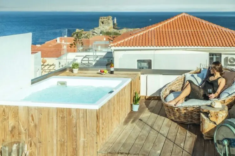
    Anemomiloi Andros Boutique Hotel (we stayed here) – a stylish boutique hotel with swimming pool on the edge of Chora town. They offer a good breakfast but there’s also a small kitchenette in the rooms.

    The hotel is attractively designed with different level rooms overlooking a central courtyard or countryside views. The family who own the hotel also run Explore Andros, making this a popular choice for walkers who use the tour company to arrange their transport.

    Anemomiloi Hotel Andros Greece

    Castel Abaso Boutique Apartments – a stylish self catering option in the oldest part of Chora, with 3 separate apartments, two of which have private roof terraces. This part of Chora is entirely pedestrianised and quiet at night, so it’s a good option for those who don’t have a hire car.

    The apartments are popular with couples, families or small groups who want to have a bit more space, while being a few steps away from the restaurants and amenities of Chora.

    Castel Abaso in Andros Chora Greece

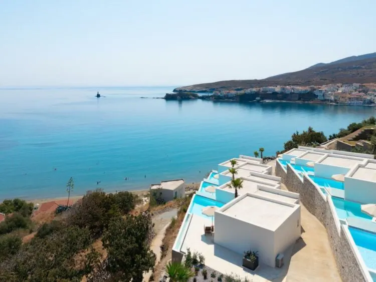
    If you want to treat yourself to a bit more luxury, try Micra Anglia Boutique Hotel in the old town or Golden Vista Suites with private pools overlooking Neimporio Beach near Chora.

    Golden Vista Beachfront suites

    Other recommended hotels

    In Batsi, we recommend Hotel Chryssi Akti, which is well located in the centre of the town opposite the beach, but there’s a wide range of accommodation in Batsi. In Korthi there are only a few studio or apartment options – check out the accommodation in Korthi here. Gavrio also has a limited range of accommodation, since it is the island’s main ferry port – check out accommodation in Gavrio here.

    What to pack for hiking in Andros

    Here’s what you need for tackling the Andros Routes hiking trails, assuming you are mainly doing the day hikes like us. The shorter, circular trails that take a couple of hours don’t need any special equipment, other than trainers or hiking shoes.

    Hiking in Andros Greece Photo Heatheronhertravels.com
    Hiking in Andros Greece

    Andros Routes map and guidebook

    Andros Routes produce a map of all the trails, which is recommended for planning and navigation. The map should be sufficient to guide you, as all the trails are well marked.

    However, if you want more information Andros Routes also produce a guidebook, with detailed descriptions of the trails. All profits from the map and guidebook go to support the work of Andros Routes in maintaining the trails – more information here.

    You can buy this map on arrival in Andros at a number of hotels and locations, or in the UK from Stamfords bookshops – online order here. The Andros Routes hiking guide can also be purchased on Andros, and the e-book is available to download in English and Dutch – more information here.

    Andros Routes Map

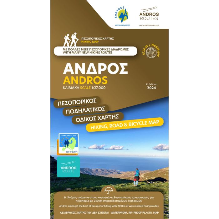
    Use the Andros Routes map and guidebook showing all the Andros Routes trails for planning and navigation

    Hiking / trail shoes

    I recommend sturdy hiking shoes, but if you only plan to do one or two trails, well supported trainers would also be fine. Hiking boots are too hot for most times of year in Greece, but fine for early (March / April) or late (November) in the season. My current summer hiking shoes are from Keen – I like the NXIS EVO or Terradora styles.

    Andros Chora Greece Photo Heatheronhertravels.com
    Andros Chora Greece

    Hiking shorts

    These are ideal for the warmer months May – September. Full or 3/4 length walking trousers would be suitable for early (March / April) or late (November) in the season. Quick dry fabric is ideal for overnight washing.

    A day backpack

    I find a 15L or 20L backpack is the ideal size for day hiking. In my backpack I carry water, picnic or snacks, map, small medical kit, sunscreen, spare socks, an extra layer for warmth or waterproof jacket for showery weather. I also keep valuables like cash, bank cards and mobile phone in a separate waist pouch.

    Hiking to Andros Chora Greece Photo Heatheronhertravels.com
    Hiking to Andros Chora Greece

    Hiking poles

    This is an optional item as not everyone likes hiking with poles. However, I always hike with them as they give support on steep or slippery paths and reduce the strain on knees and ankles. My favourites are these collapsible Leki poles.

    They aren’t the cheapest, but they are well made, sturdy and best of all collapse down for packing in a case or rucksack. I’ve had years of wear out of mine so they were a good investment.

    Other items of clothing

    Pack sports t-shirts or any t-shirt that’s comfortable for hiking, a light sweatshirt or waterproof, hiking socks, a hat or cap to protect from the sun, sunglasses.

    How difficult is the hiking in Andros?

    I’d rate most of the trails in Andros as easy to moderate. The longer day hikes are moderate in length and difficulty, with a few steep climbs or descents. However there are plenty of shorter or easier routes where you can park the car and make a circular trail for an hour or two. The trails are well marked and maintained by the Andros Routes volunteers, so it’s difficult to get lost.

    Andros Routes signposts Greece Photo Heatheronhertravels.com
    Andros Routes signposts Greece

    I consider myself moderately fit and was able to do the trails with no special training. Having said that, we did take care to start the trail at the highest points, so that we could walk downhill for most of the way, which was much more enjoyable than a gruelling uphill slog!

    Transport for hiking in Andros

    The biggest challenge was the logistics in reaching the start of some of the more remote trails, or how to get back at the end of a one way route, where there’s no public transport.

    Since public buses in Andros are designed mainly to take people to the ferry ports, you’ll need to overcome this issue, either by budgeting for longer taxi rides (€20-30) or by making transfer arrangements with a tour company like Explore Andros (ideal if there’s a group of you).

    A hire car can be used to reach all the trails, however most of the more remote or scenic trails are one way, so a drop off / pickup is preferable.

    Andros Chora Greece Photo Heatheronhertravels.com
    Andros Chora Greece

    How to get to Andros

    Ferry to Andros

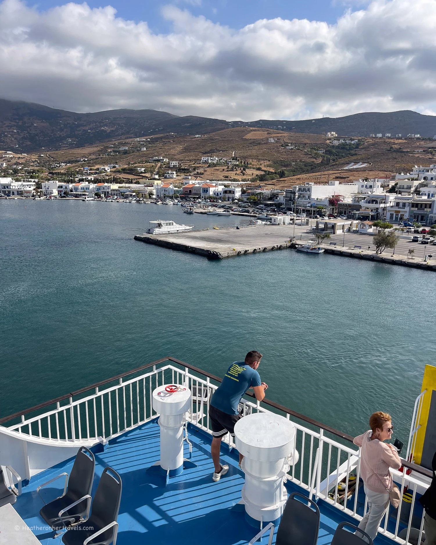
    There’s no airport on Andros, so most visitors will fly into Athens or Mykonos airports, then take the ferry. Ferries run from the Athens port of Rafina to Andros and then on to neighbouring Tinos and Mykonos. They come back from Mykonos by the same route, stopping at Tinos, Andros and then Rafina.

    Ferry at Gavrio Port Andros Greece Photo Heatheronhertravels.com
    Ferry at Gavrio Port Andros Greece

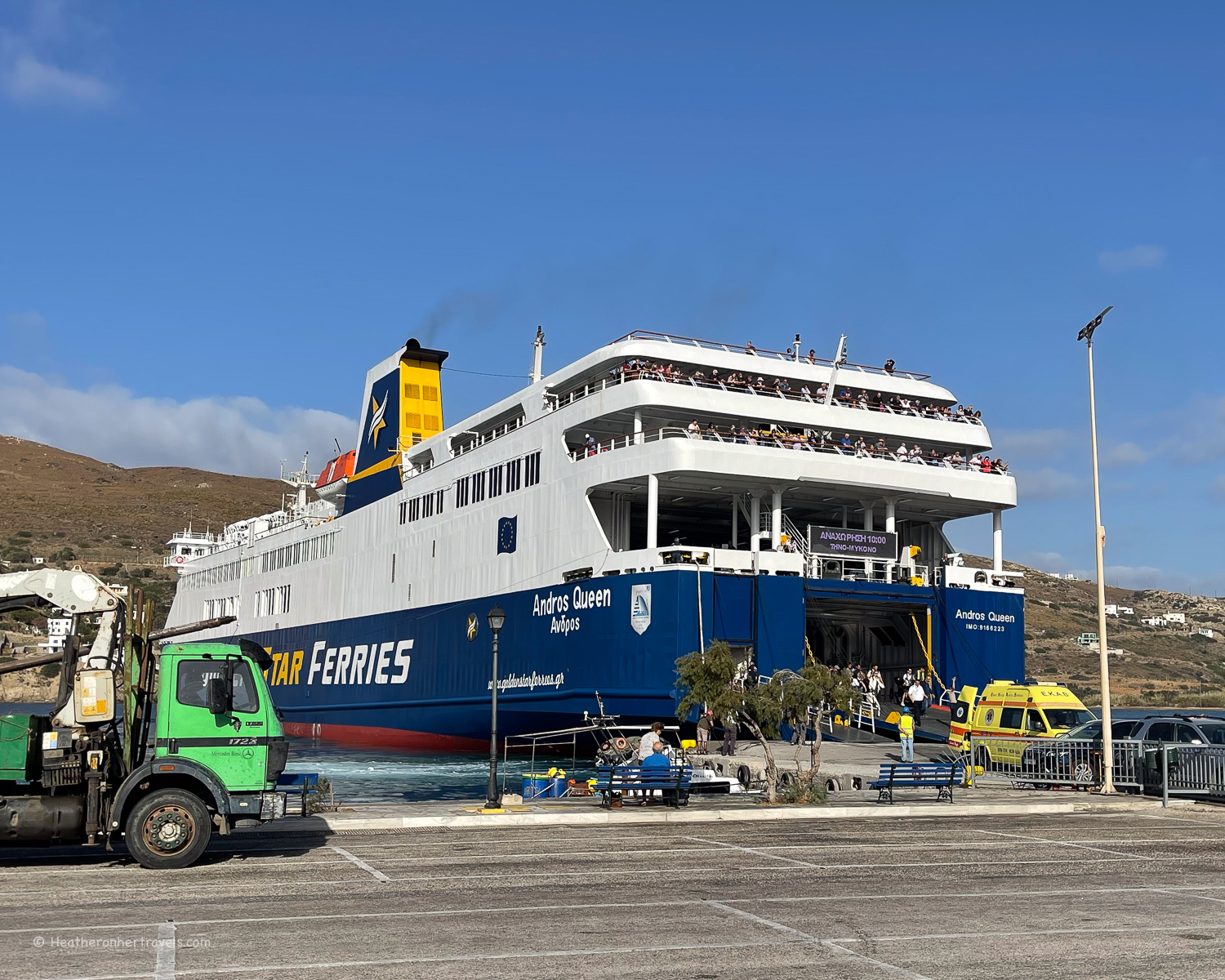
    Ferries run several times a day from Rafina ( Fast Ferries or Golden Star Ferries) and the journey takes 2 hours, or 1 hour 10 mins on the slightly more expensive Seajets ferry. From Mykonos, the ferry time is 2 hours 25 mins. When we travelled the one way ferry ticket from Rafina to Andros was from €25 per person for a foot passenger.

    Although you can buy ferry tickets at the port, we found it easier to book online in advance using a service like Ferryscanner. You’ll receive a ticket with bar code by email so that you can go straight on board the ferry. Check the ferry fares, timetables and book your ferry here.

    Ferry at Gavrio Port Andros Greece Photo Heatheronhertravels.com
    Ferry at Gavrio Port Andros Greece

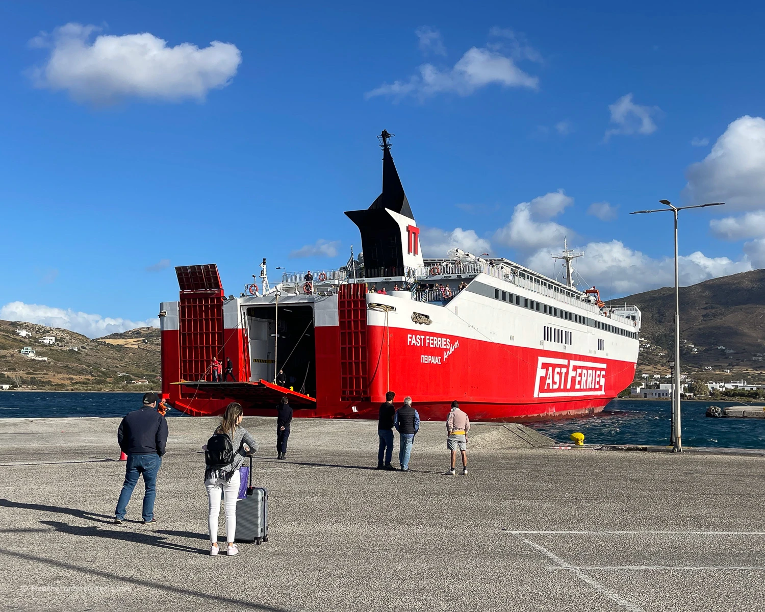
    On arrival in Andros

    The ferries arrive at Gavrio Port in Andros, so you will probably need to arrange a taxi transfer from the port to either Batsi (15 mins) or Chora (45-60 mins), depending on where you are staying. Alternatively, the KTEL public buses run from Gavrio port to Batsi and Chora, and are timed to leave soon after the ferry’s arrival.

    How to get to Rafina port

    To reach Rafina from Athens Airport, you can take a taxi (30 mins) or a regular KTEL Attikis bus (30 mins) – find the timetable here. The bus stop is opposite the Sofitel Hotel, leaving the arrivals hall by Exit 3.

    Ferry at Gavrio Port Andros Greece Photo Heatheronhertravels.com-
    Ferry at Gavrio Port Andros Greece

    To reach Rafina from central Athens you have a few options. You could take the KTEL Attikis bus from Nomismatokopio Station in Athens to Rafina (60 mins). Alternatively take Line 3 of the Athens Metro to Athens airport and from there take the bus or a taxi to Rafina. The most expensive option, but economic if there is a group of you, is to arrange a taxi from any point in Central Athens to Rafina (60 mins).

    Ferry at Gavrio Port Andros Greece Photo Heatheronhertravels.com
    Ferry at Gavrio Port Andros Greece

    Read Next

    Want to see more of Andros? Check out my travel guide about the best things to do in Andros.

    Andros travel guide - things to do in Andros © Heatheronhertravels.com

    More places to visit in Greece

    Hiking in Andros Greece Photo Album

    Pin it!

    Most of this trip was self-funded but some of the experiences and accommodation were kindly provided by Explore Andros.

    This article is originally published at Heatheronhertravels.com

    Subscribe to our newsletter and latest articles


    Source link

  • Walking the Thames Path National Trail

    Walking the Thames Path National Trail


    Read our tips for hiking the Thames Path National Trail, a 300km long distance path that runs from the source of the River Thames in Gloucestershire, to the start of the Thames estuary in London. On the way you’ll see the river transition from a muddy puddle, through tranquil water meadows and an ever more urban landscape, until you reach the historic landmarks of London.

    Tips for hiking the Thames Trail Photo Heatheronhertravels.com
    Tips for hiking the Thames Trail

    How long does it take to walk the Thames Path Trail?

    The path is divided into 15 day long stages, which can be walked consecutively or in any order. Some of the days break easily into a couple of shorter half day sections, if you want to add additional rest time or sightseeing stops.

    We chose to walk the trail in stages of 1-2 days over the course of a year. If want to walk the whole trail but have limited time, one option is to miss out some of the stages and just walk the parts that interest you most. I think this is better than trying to speed up the walk and then missing the points of interest along the way.

    Inglesham - Thames Path National Trail © Heatheronhertravels.com
    Inglesham – Thames Path National Trail

    We found the timings and distances in our guidebook to be pretty accurate, but they didn’t allow for any stops, so we normally added 1-1.5 hours to each day. Our average walking speed including all breaks was around 3.4 miles per hour and we normally walked around 6 hours each day.

    I’ve broken the trail into 4 separate articles, each covering 3-4 days that could be walked over a long weekend. You can read all the articles below.

    What can I expect to see on the Thames Path National Trail?

    Read about: Source to Oxford – Days 1-4

    From a trickle of water at its source, the Thames meanders through the Cotswolds in verdant fields and water meadows, transitioning from stream to navigable river. For these first four days, the path offers a taste of English rural life, strolling through fields and small villages.

    Thames Path National Trail Days 1-4 Kemble to Oxford © Heatheronhertravels.com

    Read about: Oxford to Henley – Days 5-8

    Along this part of the Thames lie charming towns and villages, that prospered from trade flowing down the river, transporting goods from the Cotswolds to London.

    You’ll enjoy wild and isolated water meadows, but there’s also the pleasant buzz of canalboats passing through flower filled locks and riverside towns going about their business.

    Hiking the Thames Path National Trail Day 5-8

    Read about: Henley to Kingston – Days 9-12

    This section offers a blend of rural to urban landscapes, as the river flows steadily towards the outskirts of London. You’ll pass the prosperous riverside towns of Henley and Marlow, known for their rowing traditions and ornate Edwardian boathouses.

    As the railways developed westwards from the 1850s, this stretch of the Thames came within the reach of Londoners for day trips, when regattas and rowing boats were all the rage.

    Thames Path 9-12 Henley to Kingston featured

    Read about: Kingston to Woolwich – Days 13-15

    The final section of the walk brings you through the centre of London. You’ll pass through the leafy suburbs of Richmond and Kew, past the historic landmarks of central London, ending in the old industrial area of London’s Docklands at Woolwich.

    Thames Path Trail Kingston to Woolwich featured

    How difficult is the Thames Path National Trail?

    I’d rate the Thames Path as an easy route, but one that’s most enjoyable for all ages and abilities. The Thames Path is well marked in all parts of the route, even the most rural.

    Mostly the path runs alongside the river, so it’s difficult to get lost. The path is flat and varies between rural grass or stone footpaths and, as you get closer to London, paved paths alongside the river.

    Approaching Richmond Bridge - Thames Path National Trail Photo Heatheronhertravels.com
    Approaching Richmond Bridge – Thames Path National Trail

    The exception is the first few stages in the Cotswolds that can be muddy and a bit slippery in autumn and winter. If this is a problem, I’d skip sections 1 and 2 from Kemble to Lechlade and start the walk at Lechlade.

    Oxford Towpath - Thames Path National Trail Photo © Heatheronhertravels.com
    Oxford Towpath – Thames Path National Trail

    The only challenge we found was that a couple of the rural sections between Lechlade and Oxford are quite long, without an obvious place to break the day’s walk. In this case you might have to plan for an early start with only short breaks.

    There are also a few sections where footbridges or parts of the path may be closed for repairs (often for months or years at a time). This is an annoyance, but there are always detours in place which may add to length of the walk. Where we encountered these, I’ve explained the options in my more detailed articles about each section of the walk.

    Where to stay on The Thames Path Trail

    In most of the small towns in the Cotswold sections of the walk, you’ll find a choice of pubs, B&Bs and hotels. We normally stayed in a pub, as they offer modest but comfortable accommodation and reasonably priced food in the evening.

    Beetle and Wedge pub Thames Path National Trail Photo Heatheronhertravels.com
    Stay in riverside pubs on the Thames Path National Trail

    Another great choice for walkers is a B&B, where you’ll normally find a friendly welcome and comfortable, well priced room. However, you’ll need to find a place to eat in the evening and these days breakfast may or may not be included, so check first.

    If you prefer something a bit more stylish and luxurious, some of the larger towns and villages have very nice hotels. If you like camping, there are some campsites on the route, but personally I’d rather pay a little more and not have to carry all the kit.

    I use Booking.com to book hotels, as it’s easy to see all information about the hotels and keep track of the bookings, as well as obtain their Genius discounts if you’re a regular user. You can also find all the places we stayed on Expedia if that’s your preference.

    Henley Thames Path National Trail Photo Heatheronhertravels.com
    Henley Thames Path National Trail

    We didn’t find any hostels along the trail, although once you reach the London sections of the route, these may be a short bus or train ride away. A couple of the more rural stretches of the trail only have one or two options for accommodation, in which case you’ll need to book up in advance.

    List of recommended accommodation for each day

    Here’s our list of recommended places to stay at the end of each day’s walk, and you can find more options in the relevant articles.

    What to wear on the Thames Path Trail

    The trail is mostly easy and flat, so if walking short sections of the trail you don’t need any special clothing. However as we wanted to be comfortable for full day walks in all weathers here’s what we used.

    Marlow Bridge Thames Path National Trail Photo Heatheronhertravels.com
    Marlow Bridge Thames Path National Trail
    • Hiking boots, hiking shoes or supportive trainers – the more rural sections of the walk can get muddy or even waterlogged outside the summer months. My favourite hiking shoes are from Keen as I find their wide toe-bed very comfortable and I’d recommend the Keen Targhee or Nxis Evo hiking shoes for this kind of trail.
    • Quick drying walking trousers, leggings or shorts. Avoid materials like denim or heavy cotton that won’t easily dry after a rain shower.
    • T-shirts that are comfortable and breathable – I usually wear a sports t-shirt.
    Richmond on the Thames Path National Trail © Heatheronhertravels.com
    Wearing a sports t-shirt on the Thames Path National Trail
    • A necker like the ones from Buff guards against chills around the neck in Spring and Autumn and can also double up as a beanie style hat. A hat for either cold weather or to shade against the sun like this sports cap is also useful.
    Eaton meadows - Hiking on the Thames Path National Trail Photo_ © Heatheronhertravels.com
    Using my hiking pole on the Thames Path National Trail

    Packing for the Thames Path Trail

    If walking just a day at a time, where you can leave most of your luggage in a car or hotel, you’ll need a day sack. I find 15 – 20 Litres is about the right size for me, like this Osprey Hikelite 18L day sack.

    If you are walking for several days at a time from hotel to hotel, you’ll need a slightly larger rucksack to accommodate overnight clothes. In this case I’d recommend a 25 – 30L rucksack like the Osprey Hikelite 26L rucksack.

    Fiddler's Bridge Oxford - Thames Path National Trail Photo © Heatheronhertravels.com
    Fiddler’s Bridge Oxford – Thames Path National Trail

    In my day sack I normally pack;

    • Tissues / wet wipes / a small amount of toilet paper
    • A small home made first aid kit with plasters and basic medication
    • The Thames Path National Trail guide book
    • A few reuseable ziplock bags for picnics and other small items
    • Water bottles – I don’t have a special water bottle but instead have several 500ml plastic water bottles which I refill and re-use, then recycle once beyond reuse. For this walk I carried 3 x 500ml water bottles as there were plenty of places to fill up along the route.
    • Picnic items and snacks – these can easily be purchased in a convenience store at the start of each day.
    • A spare pair of socks in case your feet get soaked
    • My lightweight fleece and waterproof jacket are stored in my backpack when not worn.

    Best time of year to walk the Thames Path National Trail

    The optimum months for walking the Thames Path Trail as a whole are May, June and September. These are the months when you’ll find most sunny days and the river and surrounding meadows are less likely to be waterlogged.

    Flooding can be an issue along the Thames, especially in the winter months. Before making firm plans you can check for flood warnings along the Thames Path Trail here and for detours on the path here.

    Isleworth Wharf - Thames Path National Trail Photo Heatheronhertravels.com
    Hiking the Thames Path National Trail in early summer

    Spring (March – May) – you may get bright sunny days for day walks. However until May the more rural sections of the path may experience flooding or be waterlogged.

    Summer (June – August) – warm sunny days and the riverside meadows and footpaths will be at their driest. These are the months when temperatures can climb so check the weather forecast and avoid really hot days. Accommodation will be most expensive in summer, especially in July and August. On the sections that run through London you may find a lot of tourists.

    Bisham Thames Path National Trail Photo Heatheronhertravels.com
    Hiking the Thames Path National Trail in Autumn

    Autumn (September – October) – the weather is normally bright and sunny, but as you move into winter the paths may become more muddy after rain. Check for flood warnings after heavy rain.

    Winter (November – February) – avoid walking the more rural sections of the trail during the winter months due to muddy paths and flooded water meadows that lead to endless detours. However, on bright winter days it is possible to walk the paved sections of the path in and around London. Check first for flood warnings, as the river may overflow even paved riverside paths.

    Thames Path at Marlow Bridge Photo Heatheronhertravels.com
    Hiking the Thames Path in winter

    Best day walks on the Thames Path National Trail

    If you only have time to walk a few sections of the whole trail, these were our favourites;

    Day 4 – Newbridge to Oxford – an idyllic rural stretch with pretty stone bridges and locks, although it’s difficult to get to Newbridge by public transport – Read more about this stretch.

    Northmoor Lock on the Thames path national trail July 24 Photo Heatheronhertravels.com
    Northmoor Lock on the Thames path national trail

    Day 5 – Oxford to Abingdon – from the ancient university town through leafy water meadows to the attractive town of Abingdon – Read more about this stretch.

    Osney Lock Oxford Thames Path National Trail © Heatheronhertravels.com
    Osney Lock Oxford Thames Path National Trail

    Day 9 – Henley to Marlow – pretty villages and riverside spots on part of the river famous for its rowing regattas (although you may have to make a detour if Temple Bridge is closed) – Read more about this stretch.

    Thames Path at Marlow Bridge © Heatheronhertravels.com
    Thames Path at Marlow Bridge

    Day 10 – Marlow to Windsor – picturesque riverside towns with views of Edwardian mansions and boathouses – Read more about this stretch.

    Cliveden Boathouse - Hiking on the Thames Path National Trail Photo_ © Heatheronhertravels.com
    Cliveden Boathouse – Hiking on the Thames Path National Trail

    Day 13 – Kingston to Putney – past the prettiest London suburbs of Teddington, Richmond, Kew and Putney – Read more about this stretch.

    Richmond on the Thames Path National Trail © Heatheronhertravels.com
    Richmond on the Thames Path National Trail

    Day 14 – Putney to Tower Bridge – covering the South Bank and most of London’s historic landmarks – Read more about this stretch.

    South Bank on the Thames Path National Trail © Heatheronhertravels.com
    South Bank on the Thames Path National Trail

    Attractions to visit on the Thames Path National Trail

    If you are interested in visiting historic attractions on your journey, these are worth a stop, although you may need to build in extra days to do them justice. Check opening times of individual attractions as some may not be open all year round.

    Kelmscott Manor on the Thames path national trail July 24 Photo Heatheronhertravels.com
    Kelmscott Manor on the Thames path national trail

    Stage 3 – Kelmscott Manor – the manor house and gardens were owned by 19th century artist William Morris, whose designs epitomise the ‘Arts and Crafts’ movement.

    Day 4 & 5 – Oxford – this ancient university town is worthy of adding an extra day to soak up the beautiful architecture of the colleges. Read more about things to do in Oxford.

    Day 10 – Cookham – the pretty village has the Stanley Spencer gallery dedicated to the 20th century artist Stanley Spencer who lived here.

    Stanley Spencer Gallery Cookham - Hiking on the Thames Path National Trail Photo_ © Heatheronhertravels.com
    Stanley Spencer Gallery in Cookham – Hiking on the Thames Path National Trail

    Day 10 & 11 – WindsorWindsor Castle is one of the main residences of the English Royal Family with a chapel where many of them were married.

    Day 11 – Runnymede Meadow – this is the location of an historic meeting in 1215 between King John and his barons, leading to the Magna Carta, which curtailed the powers of the monarchy.

    Day 12 – Hampton Court – the royal palace with extensive gardens was the home of King Henry VIII and later monarchs.

    Gates of Hampton Court - Thames Path National Trail Photo Heatheronhertravels.com
    Gates of Hampton Court – Thames Path National Trail

    Day 13 – Ham House – a 17th century mansion with formal gardens, managed by the National Trust.

    Day 13 – Kew Gardens – the Royal botanical gardens with floral displays, exhibitions and Victorian glasshouses.

    Day 13 – Barnes Wetland Centre – a nature reserve that was created from the Barn Elms reservoir.

    Day 14 – London – this stretch into London offers numerous riverside attractions which include the South Bank arts complex, Tate Modern, Shakespeare’s Globe, Southwark Cathedral, Borough Market, Tower Bridge.

    Day 15 – Greenwich – there are several historic attractions here that come under the Royal Museums Greenwich, including the Royal Naval College, Queen’s House, National Maritime Museum and Royal Observatory.

    Where to take a rest day on the Thames Path National Trail

    The best places to plan a rest day are;

    Oxford – Days 4 & 5 – explore the ancient colleges and soak up the history of this university town. Read about all the things to do in Oxford.

    Henley Thames Path National Trail Photo Heatheronhertravels.com
    Henley on the Thames Path National Trail

    Henley – Day 8 & 9 – a pretty riverside town famous for its rowing regatta in July.

    Windsor – Day 10 & 11 – a sizeable town with the attractions of Windsor Castle and nearby Cliveden.

    Views from Richmond Hill - Thames Path National Trail Photo Heatheronhertravels.com
    Richmond Hill – Thames Path National Trail

    Richmond – Day 13 – a pretty riverside suburb of London with a park, green spaces, riverside walks, shops and restaurants. Read about the view from Richmond Hill.

    London – Day 14 & 15 – the city has numerous cultural attractions, museums, shops and interesting neighbourhoods to explore.

    Tower Bridge on the Thames Path National Trail © Heatheronhertravels.com
    Tower Bridge on the Thames Path National Trail

    Can you camp on the Thames Path National Trail?

    Wild camping without permission is not permitted by the Thames Path, which mainly passes across privately owned farmland. The first few stages between the Thames Source and Oxford are quite rural but the landscape is open fields with few secluded spots.

    After Oxford the area around the river becomes more heavily populated, so it would be difficult to find a quiet camping spot other than in an official campsite.

    Thames Path National Trail Pangbourne to Goring Photo Heatheronhertravels.com
    Thames Path National Trail Pangbourne to Goring

    There are a few campsites that are close to the Thames Path, although some only operate in the summer months.

    Day 1 – Source to Cricklade – Elm Lea Camping near Cricklade (Camping and Caravanning Club members only site)

    Day 2 – Cricklade to Lechlade – Bridge House Campsite near Lechlade (closed in winter)

    Day 4 – Newbridge to Oxford – Valley Farm Campsite near Oxford

    Day 6 – Abingdon to Wallingford – High Lodge Farm near Abingdon

    Day 7 – Wallingford to Pangbourne – Bridge Villa Camping and Caravan Park near Wallingford

    Where to eat on the Thames Path national Trail

    We found it easy to find picnic supplies and places to eat along the trail. Most of the start and end points of the day’s stage are in small towns or villages, with a convenience store selling a range of picnic supplies.

    The place you stay overnight will have at least one pub and often a range of restaurants for an evening meal.

    Paper Boat Cafe Oxford Thames Path National Trail © Heatheronhertravels.com
    Paper Boat Cafe Oxford Thames Path National Trail

    Every stage also passes at least one pub or cafe on the route, although most pubs don’t open until around 11am in case you are looking for an early coffee. On the more rural section in Gloucestershire and Oxfordshire, you may need to check what’s available at your start and end point, since occasionally it’s just a pub with no convenience store.

    In this case you’ll need to carry enough picnic supplies for a two days. We would typically pack a picnic and snacks to eat throughout the walk, but make one or two stops for coffee or a drink at a pub or cafe. Tap water in England is fine to drink and any pub or cafe will fill up your water bottle for you.

    Tearoom at Cookham - Hiking on the Thames Path National Trail Photo_ © Heatheronhertravels.com
    Tearoom at Cookham – Hiking on the Thames Path National Trail

    Transport on The Thames Path Trail

    I walked the Thames Path trail with my sister in 2 day stages and we tried to use public transport where possible.

    We found the closer you get to London, the more regular and easy the public transport becomes. In the more rural sections of Gloucestershire near the Thames source, there is more limited public transport and even the buses may not take you where you need to go.

    On the upper part of the river, from the Thames source to around Reading we found transport needed to be planned carefully.

    Cows near Cookham - Hiking on the Thames Path National Trail Photo_ © Heatheronhertravels.com
    Cows near Cookham – Hiking on the Thames Path National Trail

    As we live fairly locally, we were able to get around this by driving to a start or end point and then using the bus or train to return to the car at the end of the day. On some occasions we had to use two cars, positioning one at either end of the day’s walk.

    Of course, transport is much less of an issue if you plan to walk all 15 days sequentially. Another good option is to break the walk into sections of 2-4 days, starting and ending at the locations that are most accessible by bus or train (use Trainline to plan your train journeys).

    For this reason I have written separate articles, each covering a 3-4 day section of the trail, that starts and ends at a convenient point with good transport links. The articles below have more detailed public transport information for each day’s walk.

    Hiking the Thames Path National Trail – from Source to Oxford – Days 1-4

    Hiking the Thames Path National Trail – from Oxford to Henley – Days 5-8

    Hiking the Thames Path National Trail – from Henley to Kingston – Days 9-12

    Hiking the Thames Path National Trail – Kingston to Woolwich – Days 13-15

    Pangbourne Station Thames Path National Trail Photo Heatheronhertravels.com
    Pangbourne Station Thames Path National Trail

    Train and bus options

    Many of the points along the Thames Path are accessible by train, especially the Great Western Railway line that runs from London to Bristol. We recommend using Trainline to check timings and book train tickets online.

    There’s also a pretty good network of local buses running between smaller towns and villages, but you need to check timetables carefully as they may run every hour or less.

    I used my mapping app to identify which buses serve which routes, then used the bus provider’s website to check exact timings. Once you get close to London, there’s an excellent network of overground trains, underground trains and local buses.

    In the rural areas there aren’t lots of taxis, but calling one from a pub (they can often give you the number of a local taxi company) would be an option if you are really stuck.

    You can find detailed transport information for each day in my individual articles about the Thames Path National Trail.

    From Source to Oxford – Days 1-4

    From Oxford to Henley – Days 5-8

    From Henley to Kingston – Days 9-12

    From Kingston to Woolwich – Days 13-15

    Goring Lock Thames Path National Trail Photo Heatheronhertravels.com
    Goring Lock Thames Path National Trail

    Which direction is best to walk the Thames Path?

    We walked the Thames Path from its source in the Cotswolds to its end in London. This seemed to us the most logical route, since we saw the river’s evolution from a muddy ditch to a mighty flow through London’s impressive urban landscape.

    Thames Source - Thames Path National Trail © Heatheronhertravels.com
    Thames Source – Thames Path National Trail

    We were also influenced by living in Bristol, so we started at the point closest to us. However, if you live in London it might make sense to start there and follow the river to its source.

    You might also be influenced by the season you decide to walk, since the more rural sections closest to the source can be very muddy and waterlogged through autumn and winter. Other than these considerations there is no right or wrong place to start and end the Thames Path.

    Lechlade on Thames Trail Photo Heatheronhertravels.com
    Lechlade on Thames Trail

    Is the Thames Path easy to follow?

    We found the Thames Path extremely easy to follow. All the sections are well marked with clear signposts and wherever we met a diversion, due to flooding or building works, this was also well signposted. There are other footpaths that cross the Thames Path, but it was easy to distinguish between the Thames Path and other footpaths.

    As it generally follows the river, you can’t go far wrong if you have it in your sight, although it’s worth mentioning that sometimes the path does divert a little way from the Thames river itself. It would certainly be possible to follow the Thames Path Trail by just following the signposts.

    Wandsworth - Thames Path National Trail © Heatheronhertravels.com
    Wandsworth – Thames Path National Trail

    However, we do recommend taking a guidebook to get more information about the places you’ll pass, distance and timings and some history and context for the walk.

    The guidebook we used and recommend is the Trailblazer Thames Path Guide. We liked the easy to follow maps and the fact that it’s just as easy to follow for walking in either direction.

    Resources for hiking the Thames Path National Trail

    Train bookings – we recommend Trainline for easy online rail bookings. Buses can be paid for by tapping on and off with your debit card.

    Book accommodation: to book hotels online and conveniently have all your bookings in once place, we used Booking.com but if you prefer you could also use Expedia.

    Guidebook – we used and recommend the Trailblazer Thames Path Guide – this is the one we used and we liked the easy to follow maps and the fact that it’s just as easy to follow for walking in either direction.

    The Thames Path National Trail website is a useful source of information about the trail as a whole.

    If you have questions about our walk on the Thames Path National Trail, feel free to email me at heather(at)heatheronhertravels(dot)com

    Read Next

    Hiking the Thames Path National Trail – from Source to Oxford – Days 1-4

    Thames Path National Trail Days 1-4 Kemble to Oxford © Heatheronhertravels.com

    Read more about our walk on the Thames Path Trail

    Hiking the Thames Path National Trail – from Oxford to Henley – Days 5-8

    Hiking the Thames Path National Trail – from Henley to Kingston – Days 9-12

    Hiking the Thames Path National Trail – Kingston to Woolwich – Days 13-15

    Walking the Thames Path National Trail – our top tips (this article)

    Thames Path Tips Photo Album

    Pin it

    Tips Thames Path trail Pinterest 1

    This article is originally published at Heatheronhertravels.com

    Subscribe to our newsletter and latest articles


    Source link