برچسب: Walks

  • 13 Amazing Kakadu National Park Walks (2025 Guide)

    13 Amazing Kakadu National Park Walks (2025 Guide)


    Here is your guide to the best Kakadu National Park walks, including scenic lookouts, ancient Aboriginal rock art sites, and more.

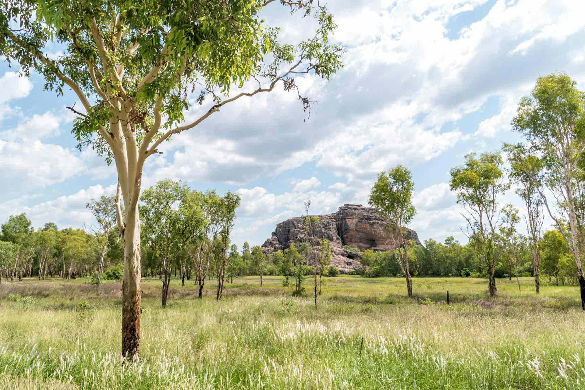
    Located in the Northern Territory, about three hours from Darwin, Kakadu National Park is Australia’s largest national park.

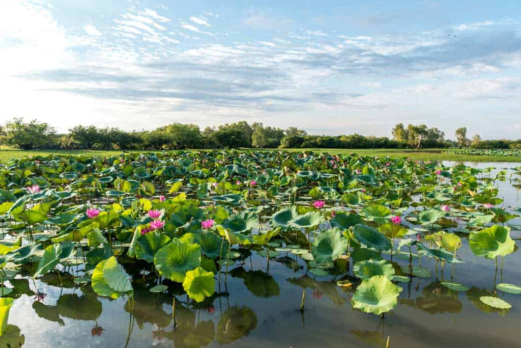
    With stunning waterfalls tumbling into natural swimming holes, ancient rock art older than the pyramids, and lush landscapes that change with the seasons, Kakadu is also one of the country’s most impressive parks.

    Kakadu National Park is also a UNESCO World Heritage site, celebrated for its cultural significance and breathtaking natural beauty. One of the best ways to truly appreciate it is on foot.

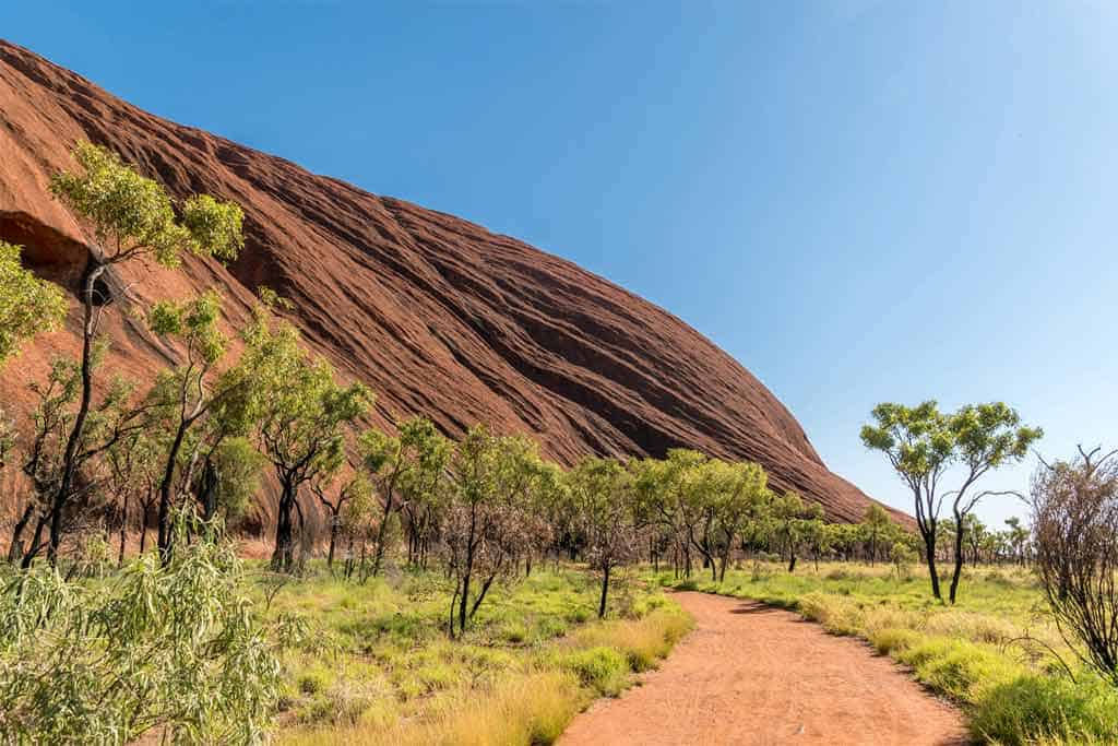
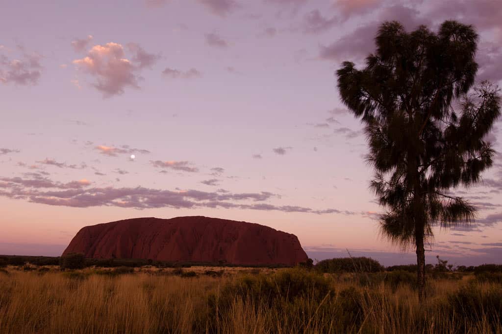
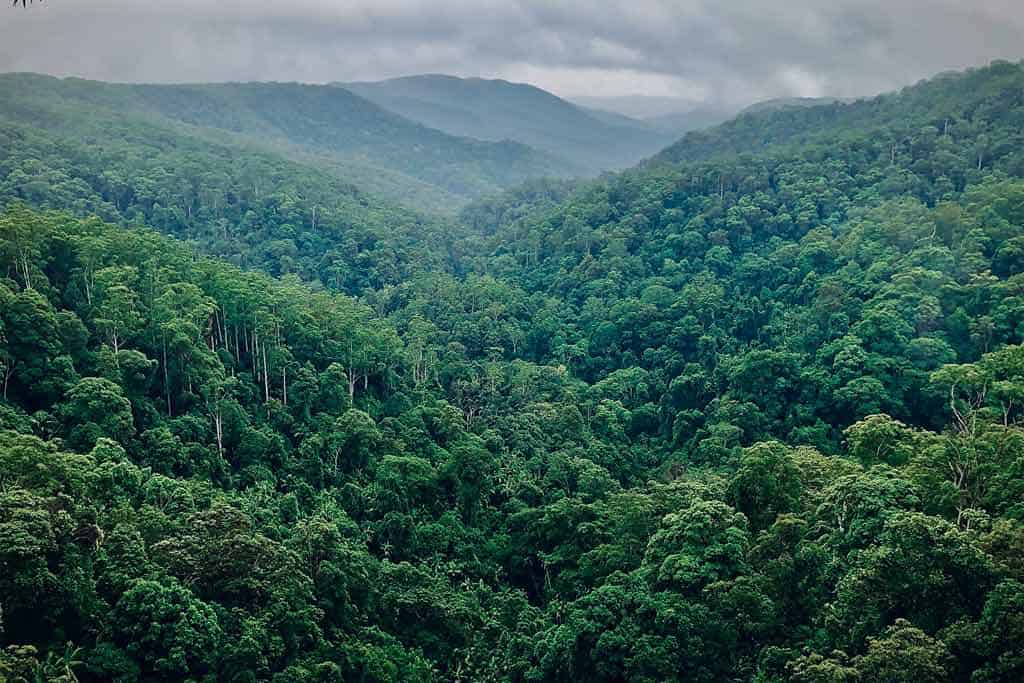
    During your walks, expect to find bird-filled wetlands, dramatic escarpments, tranquil billabongs, and lush patches of monsoon forest.

    In addition, Kakadu is home to the world’s oldest living culture. The park is jointly managed by traditional Aboriginal owners and Parks Australia, which makes a visit here even more meaningful.

    If you’re into hiking, you’re definitely in for a treat. The walks here range from short and easy to long and rewarding.

    Find more self-drive adventures with these epic Northern Territory road trips!

    13 Amazing Kakadu National Park Walks

    There’s no better way to experience the magic of Kakadu than by hitting its trails. The park has a variety of walking tracks that showcase its most iconic landscapes and cultural sites.

    From breathtaking escarpment views to wildlife-rich wetlands and fascinating rock art, these walks take you deep into the heart of Australia’s Top End, where you can watch the beauty of Kakadu unfold before your eyes.

    We’ve put together this list to help you choose the best walks for your visit, whether you’re up for a short scenic stroll or a more challenging adventure.

    Please note that some trailheads are only accessible by 4-wheel drive, especially during certain times of the year. Check the national parks website for alerts and other info!

    The best way to get around is to rent a car and explore on your own! We recommend Rental Cars, which has the largest range of vehicles for the best value on the market.

    1. Burrungkuy (Nourlangie) Rock Art Walk

    • Distance – 1.5 km loop
    • Duration – 45 minutes
    • Difficulty – easy
    • Start / Finish Points – Burrungkuy (Nourlangie) car park

    If you’re interested in the area’s culture and history, the Burrungkuy (Nourlangie) Rock Art Walk is a great trail to explore. This easy 1.5 km loop takes you through ancient rock shelters and escarpments where you can view some of the park’s most impressive rock art.

    One of the highlights along this trail is the Anbangbang Gallery, a well-known rock art site featuring vibrant depictions of ancestral beings, including Namarrgon, the Lightning Man, and traditional hunting scenes.

    The galleries, created by Aboriginal people over thousands of years, offer a powerful glimpse into their stories, spirituality, and way of life.

    Interpretive signs along the trail help bring the artwork to life and explain the deep connection between the Traditional Owners and the surrounding landscape.

    The Burrungkuy Rock Art Walk is accessible year-round, including during the wet season, when the escarpment country bursts into color. It is suitable for a reasonably fit person and can be completed in under an hour.

    Rugged Cliffs In Kakadu
    Kakadu is home to rugged cliffs and ancient artworks.

    2. Gubara Pools Walk

    • Distance – 6 km return
    • Duration – 2 to 3 hours
    • Difficulty – moderate
    • Start / Finish Points – Gubara car park (accessed via Nourlangie Road)

    The Gubara Pools Walk is a rewarding 6 km return trail that takes you through savanna woodland and stone country to a series of shady rock pools fed by stunning waterfalls during the wet season.

    This relatively gentle walk takes you to sun-exposed stretches and sheltered sections of rainforest, making it a great choice for those looking to escape the crowds and soak in Kakadu’s more tranquil side.

    At the end of your adventure, you’ll reach the plunge pool area. Stop by for a refreshing dip when water levels allow.

    While the waterfalls here are most active during or after the wet season, there’s water at the plunge pool year-round. It’s one of Kakadu’s quieter gems, ideal for those seeking nature, solitude, and a bit of swimming along the way.

    3. Bowali Track

    • Distance – 4 km return
    • Duration – 1 to 1.5 hours
    • Difficulty – easy
    • Start / Finish Points – start at the opposite of the Mercure Kakadu Crocodile Hotel in Jabiru and end in the visitor centre

    The Bowali Track links the Bowali Visitor Centre with the township of Jabiru. It’s perfect for stretching your legs while taking in some of Kakadu’s natural beauty at a relaxed pace.

    The hiking trail winds through open woodland and clusters of paperbarks, where you can spot fascinating bird life, especially in the late afternoon when the area comes alive with movement and birdsong.

    As you set out on your walks, take a moment to appreciate the deep connection the traditional owners, the Bininj/Mungguy people, have with this land.

    The visitor centre itself is a fantastic place to learn more about their culture, as well as the plants, animals, and landscapes that make Kakadu so amazing.

    4. Nawurlandja Lookout Walk

    • Distance – 600 m return
    • Duration – 30 minutes
    • Difficulty – easy
    • Start / Finish Points – Nawurlandja car park (near Burrungkuy/Nourlangie)

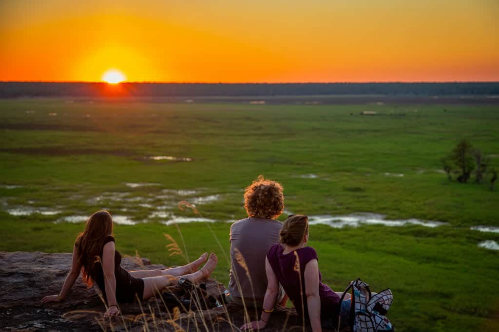
    The Nawurlandja Lookout Walk may be a short hike, but it is a rewarding one. It’s a gentle climb up a sandstone slope that leads to one of the most breathtaking views in Kakadu National Park.

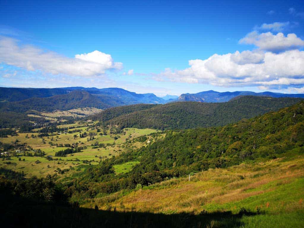
    From the top, enjoy sweeping vistas over the Arnhem Land escarpment, Anbangbang Billabong, and the surrounding stone country.

    The Nawurlandja Lookout may require a climb, but it’s one of those spots that gives you a real sense of Kakadu’s scale and ancient beauty, something you might also glimpse on a Kakadu scenic flight.

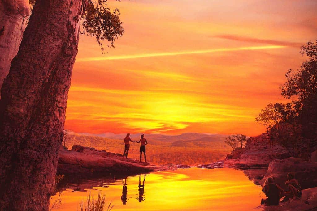
    But hiking allows you to experience it up close, with the stillness and birdsong in the background. The lookout is especially magical around sunset, when the escarpment glows gold and red.

    Although the trail is short, it’s important to come prepared, as conditions can be unpredictable.

    5. Ubirr Walk

    • Distance – 1 km loop + 250 m optional lookout
    • Duration – 1 hour
    • Difficulty – easy to moderate
    • Start / Finish Points – Ubirr car park

    The Ubirr Walk is one of the most iconic hiking trails in Kakadu National Park, and for good reason. This easy/moderate loop takes you through Ubirr rock, a site known for its stunning Aboriginal rock art, some of which is believed to be over 20,000 years old.

    As you walk among the ancient galleries, you can gain insight into the stories and traditions of the traditional owners, the Bininj/Mungguy people, who have cared for this land for countless generations.

    The hiking trail finishes with a short climb to the top of Ubirr rock, where you’ll be met with incredible sunset views over the Nadab floodplain and the distant Arnhem Land escarpment. This hiking adventure perfectly captures the sheer scale and beauty of this World Heritage area.

    Sunrise Lookout Kakadu National Park
    Kakadu National Park has some amazing lookouts.

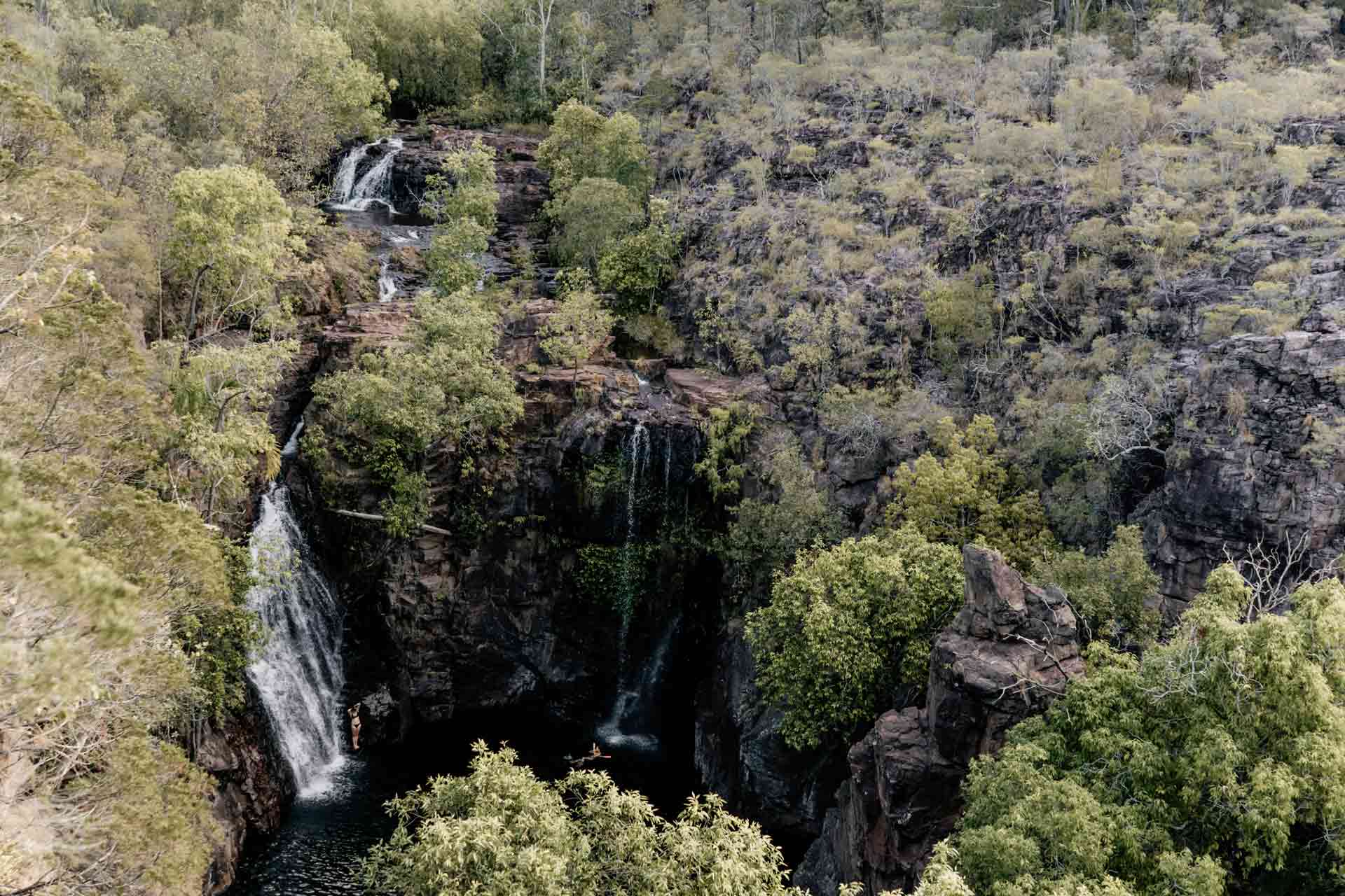
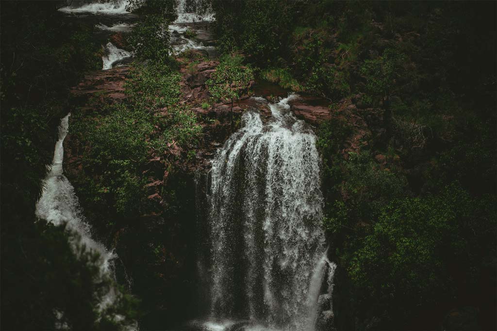
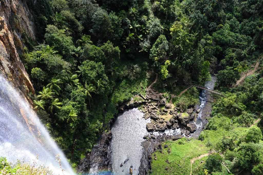
    6. Jim Jim Falls Walk

    • Distance – 2 km return
    • Duration – 1 to 2 hours
    • Difficulty – moderate to difficult
    • Start / Finish Points – Jim Jim Falls car park (dry season access only; 4WD required)

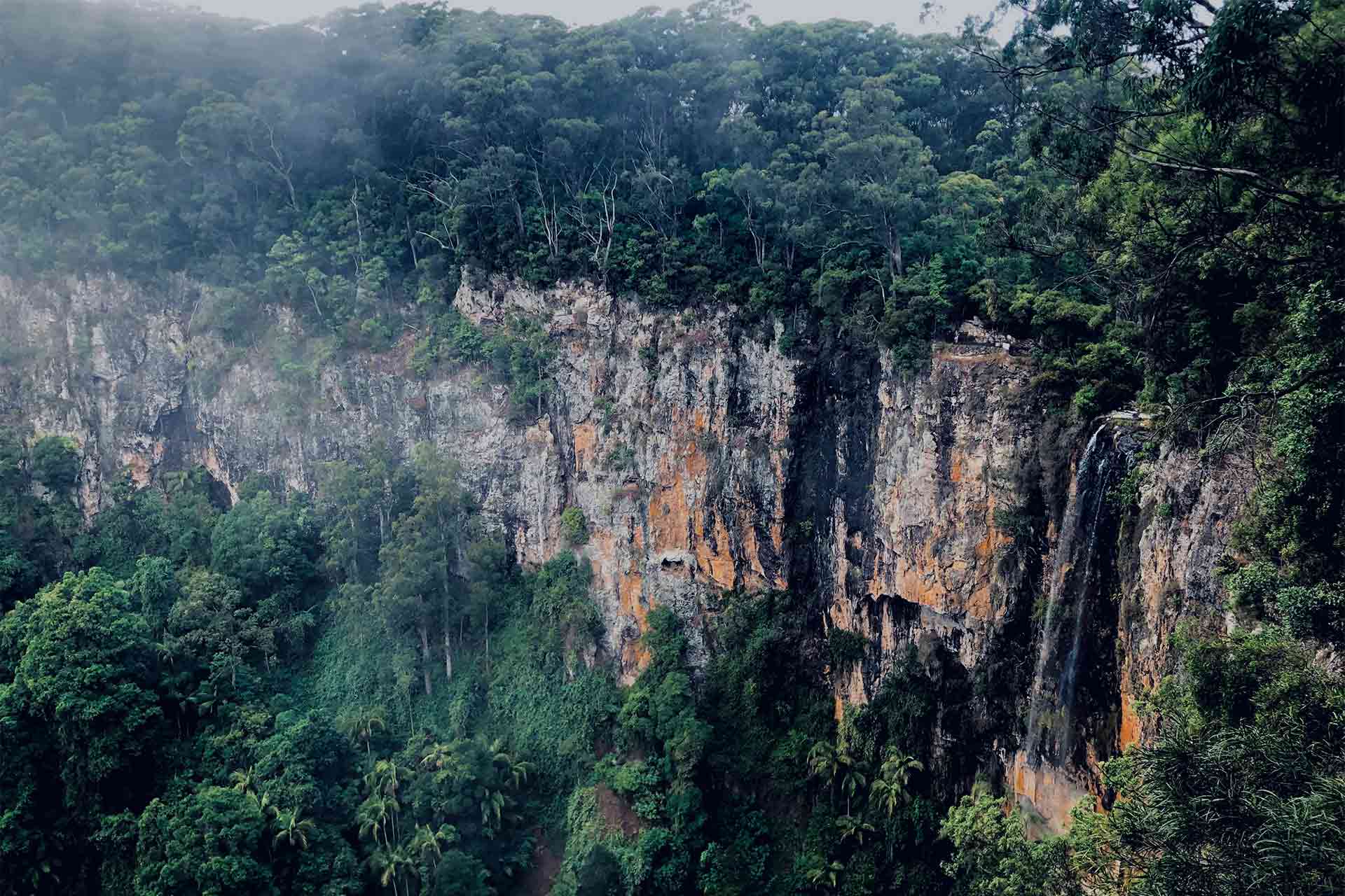
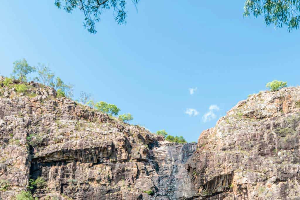
    The Jim Jim Falls Walk takes you deep into Kakadu’s dramatic stone country, where towering cliffs and lush forest surround one of the park’s most stunning waterfalls.

    The 2 km return trail is a bit of a rocky scramble in parts, but the reward at the end is well worth it, especially in the dry season, when you can reach the plunge pool and gaze up at the sheer cliffs where the water drops from 200 meters above!

    During the wet season, hiking trips to the plunge pool is not permitted. However, you can still take in their full glory on a scenic flight, an exciting way to see this iconic spot and appreciate the scale of Kakadu’s wild terrain.

    Visit Jim Jim Falls on a guided multiday 4WD adventure of Kakadu from Darwin!

    7. Twin Falls Gorge Walk (via boat shuttle and boardwalk)

    • Distance – 1.8 km return
    • Duration – 1 hour
    • Difficulty – moderate
    • Start / Finish Points – After the boat shuttle, via Twin Falls car park (4WD + seasonal access)

    The Twin Falls Gorge Walk is a true Kakadu highlight, leading you into one of the most spectacular corners of the national park.

    After a short boat shuttle through the gorge (operates in the dry season), follow a scenic hiking trail that winds over rocks and alongside the crystal-clear creek. At the end, you’re rewarded with views of the stunning waterfalls that give the trail its name – twin streams plunging over towering cliffs into a shady gorge.

    While swimming may not always be possible at the base of the falls, the views of these stunning waterfalls are epic! Plus, there are designated spots nearby where you can relax and dip your feet.

    A park pass is required to visit this area. And if you’re coming here during the dry season, a 4WD vehicle may be necessary to access the site.

    Read next: The Ultimate 7 Day Darwin Itinerary, NT, Australia

    8. Gunlom Lookout Walk

    • Distance – 1 km return
    • Duration – 30 minutes
    • Difficulty – moderate to difficult
    • Start / Finish Points – Gunlom car park

    The Gunlom Lookout Walk is one of the most iconic trails in Kakadu National Park, featuring incredible views over the southern hills and stone country. The short but steep walk rewards you with panoramic scenery and access to the famous Gunlom plunge pool at the top.

    As you go hiking along the Gunlom Lookout Walk, you’ll pass through classic outback terrain before reaching the natural infinity-edge plunge pool, which has become a favorite for many visitors to the national park.

    Please note that the Gunlom plunge pool may be closed for cultural reasons at the request of Traditional Owners.

    When planning your visit, check the official Kakadu National Park website for current access status and other info to help you plan a safe and respectful trip.

    The Gunlom Lookout Walk is also considered one of the trickiest trails in the park due to its steep incline and rugged surface. For a safer and more enjoyable adventure, consider booking tours through operators like Willis’s Walkabouts. They have in-depth knowledge of the area and offer guided tours.

    Kakadu National Park Walks Gunlom Falls
    Gunlom Falls during a fiery sunset

    9. Mardukal Billabong Walk

    • Distance – 1 km loop
    • Duration – 30 minutes
    • Difficulty – easy
    • Start / Finish Points – Mardukal campground trackhead

    If you’re looking for a peaceful hiking experience with a high chance of spotting wildlife, the Mardukal Billabong Walk is a great trail to tackle.

    Due to its flat terrain, it’s considered one of the easiest walks in the park, winding through thick woodlands and alongside tranquil billabongs.

    Located near the famous Yellow Water Billabong, this walk is ideal for birdwatchers. During your hiking adventure, keep an eye out for magpie geese, kingfishers, and even the occasional jabiru.

    Many visitors also choose to take a Yellow Water cruise to explore the billabong by boat, which offers a unique and equally stunning perspective of the wetlands and their wildlife.

    Some travellers who book nature tours or stay at a nearby camp would walk this trail for its calm, accessible setting.

    If you’ve done similar trips in Yellow Water, this walk makes a perfect addition. It’s a lovely way to start or end your day at Kakadu Park and a great chance to spot local wildlife without needing to go far.

    10. Nanguluwurr Rock Art Site Walk

    • Distance – 3.4 km return
    • Duration – 1.5 to 2 hours
    • Difficulty – easy to moderate
    • Start / Finish Points – just off the Kakadu Highway, west of Burrungkuy (Nourlangie)

    Nanguluwurr Rock Art Site Walk is a fantastic trail for those interested in hiking through Kakadu’s ancient landscapes while diving deep into its cultural history.

    The 3.4 km return trail leads you through sparse bushland to a rock shelter that features a stunning collection of Aboriginal rock art.

    The Nanguluwurr Rock Art Site features hand stencils, animal figures, and even contact-era depictions, such as sailing ships, which provide a powerful glimpse into thousands of years of storytelling and tradition.

    This is one of those trails that have become a favorite stop on cultural walks with Willis’s Walkabouts, which offer immersive adventure experiences across Northern Australia.

    Explore more walks around Australia with our complete Australia hiking guide!

    11. Maguk (Barramundi Gorge) Walk

    • Distance – 2 km return
    • Duration – 1 to 1.5 hours
    • Difficulty – moderate
    • Start / Finish Points – Maguk car park (4WD access only)

    If you’re craving a bit of adventure in Kakadu National Park, the Maguk (Barramundi Gorge) Walk should be on your list.

    This short but rewarding hiking trail leads you through light-dappled woodlands and over gentle rock crossings before arriving at a spectacular plunge pool.

    At the end of your adventure, you’ll be greeted by one of the most stunning waterfalls in the park, cascading into a crystal-clear plunge pool that’s perfect for a refreshing swim.

    Maguk offers that quintessential Australian outback experience. It’s raw, rugged, and incredibly spectacular!

    This is one of those Kakadu walking trips that appeal to nature lovers, photographers, and anyone looking to escape the crowds and enjoy the peaceful side of the national park. If you want to explore with a guide, join a 3-day camping tour from Darwin!

    12. Mamukala Wetlands Walk

    • Distance – 3 km loop
    • Duration – 1.5 hours
    • Difficulty – easy
    • Start / Finish Points – Mamukala Wetlands car park, off the South Alligator Road

    The Mamukala Wetlands Walk is one of the best ways to experience the amazing wildlife and birdlife of Kakadu National Park. Located just a short drive from Jabiru, this easy walk takes you through different areas of wetland and woodland, with incredible views and a peaceful atmosphere that’s perfect for nature lovers.

    Expect to see thousands of birds and other interesting wildlife species during your walks, especially at the end of the dry season. You will usually find them gathering around the water’s edge.

    There are interpretive signs along the trail that help you understand the area’s delicate ecosystems, making this an ideal stop for educational trips, self-guided walks, or guided tours.

    Kakadu National Park Wetlands
    Kakadu’s wetlands are stunning!

    13. Bardedjilidji Walk

    • Distance – 3.4 km return
    • Duration – 1.5 to 2 hours
    • Difficulty – easy to moderate
    • Start / Finish Points – small car park located 500 m from the upstream boat ramp on the East Alligator River

    If you’re seeking a real adventure in the heart of Australia, hike along the Bardedjilidji Walk.

    This loop trail winds through sandstone formations, lush forested pockets, and paperbark groves near the East Alligator River, creating a landscape that feels otherworldly and deeply connected to the land.

    Along the way, you’ll have the chance to explore caves and crevices, many of which were used by Aboriginal people for thousands of years. The area is rich in wildlife, so keep an eye out for birds, reptiles, and other creatures that thrive in this unique habitat.

    Ideal for short trips or daytime hiking tours, the Bardedjilidji Walk is a true adventure for those wanting to connect with Kakadu’s rugged beauty and vibrant wildlife.

    DISCLAIMER: Some of the links in this article are affiliate links, which means if you book accommodation, tours or buy a product, we will receive a small commission at no extra cost to you. These commissions help us keep creating more free travel content to help people plan their holidays and adventures. We only recommend the best accommodations, tours and products that ourselves or our fantastic editorial team have personally experienced, and regularly review these. Thanks for your support, kind friend!


    Source link

  • 8 Amazing Litchfield National Park Walks (2025 Guide)

    8 Amazing Litchfield National Park Walks (2025 Guide)


    Let’s explore the top Litchfield National Park walks, perfect for those looking to explore this breathtaking gem of the Top End in Australia.

    Litchfield National Park is one of those places you shouldn’t miss if you’re heading to the Northern Territory. It’s best known for its rugged beauty, crystal-clear swimming holes, and iconic waterfalls.

    At 1,500 square kilometres, there’s a vast area to explore at the park.

    As you wander around, you’ll come across towering termite mounds, lush monsoon forests, rocky escarpments, and plunge pools for a refreshing dip.

    You could come across some fascinating wildlife, too! Watch out for wallabies, flying foxes, or even the odd croc (keep a safe distance, of course!).

    Litchfield is located 100 km southwest of Darwin, making it an easy day trip. But if you have more time, consider spending a few days. There’s so much to see and do here, especially for avid walkers visiting the Northern Territory.

    Exploring Litchfield National Park
    Explore the stunning waterfalls of Litchfield National Park!

    8 Best Litchfield National Park Walks

    There are many fantastic walking tracks in Litchfield National Park showcasing the very best of what this park has to offer.

    We’ve put together this list so you can easily pick the best walks for your visit to this beautiful slice of the Northern Territory. Be sure to check local alerts on the official website to ensure your chosen attractions and walks are open.

    If you’re not joining a guided tour, the best way to get around the park is with your own car. Rent one in Darwin and set off on your adventures!

    The best way to get around is to rent a car and explore on your own! We recommend Rental Cars, which has the largest range of vehicles for the best value on the market.

    1. Walker Creek

    • Distance – 3.5 km return
    • Duration – 1–1.5 hours
    • Difficulty – moderate
    • Start / Finish Points – Walker Creek car park, off Litchfield Park Road near Batchelor.

    If you prefer to walk in a peaceful spot away from Litchfield’s busier waterfalls, you’ll love the Walker Creek Trail. This is one of those hidden trails that feels like your own little slice of the park.

    The trail is about 3.5 km return. It’s an easy-to-moderate walk that winds alongside a scenic creek. Along the way, you’ll find eight numbered campsites, each with a private swimming hole. Even if you’re not camping, feel free to stop, dip your feet, and soak up the tranquillity of the place.

    One of the best things about this trail is how peaceful it is. You can often have the creek all to yourself. You’ll also love the lush greenery, gentle cascades, and plenty of birdlife. Keep an eye out for little fish and water monitor lizards too.

    If you want to see a different side of Litchfield, one that’s slower, quieter, and full of shady spots to cool off, Walker Creek is hard to beat!

    Read next: 9 Best Day Trips From Darwin, NT, Australia

    2. Tabletop Track

    • Distance – 39 km circuit
    • Duration – 3–5 days (multi-day hike)
    • Difficulty – hard (remote terrain, limited facilities)
    • Start / Finish Points – multiple access points, commonly at Florence Falls, Greenant Creek, Wangi Falls, or Walker Creek trailheads

    If you’re keen for a real adventure in Litchfield National Park, the Tabletop Track is the way to go. This epic 39 km circuit takes you deep into the park’s rugged heart. It’s a multi-day hike that shows off parts of Litchfield that many visitors never see.

    Along the way, you’ll pass through pockets of shady monsoon forest, cross open sandstone ridges, and come across hidden waterfalls. Highlights of the Tabletop Track include stunning lookouts, peaceful creeks, and plenty of native wildlife, such as wallabies, goannas, and even dingos at night.

    The Tabletop track links up with popular spots like Florence Falls, Greenant Creek, and Wangi Falls, allowing you to cool off with a refreshing swim after a long day’s walk. Campsites are dotted along the trail, making it perfect for a few days of real bush camping under the stars.

    Note that the Tabletop Track is not for beginners. But if you’re up for the challenge, the Tabletop Track is hands down one of the best hikes in Litchfield National Park.

    Florence Falls Litchfield National Park
    Florence Falls, a gem of Litchfield National Park

    3. Wangi Falls Walk

    • Distance – 1.6 km loop
    • Duration – 30–45 minutes
    • Difficulty – easy to moderate (short and steep sections and steps)
    • Start / Finish Points – Wangi Falls car park, off Litchfield Park Road

    The Wangi Falls Walk is one of the easiest ways to see just how gorgeous Litchfield National Park can be. It’s a short 1.6 km loop that starts right at the Wangi Falls car park.

    The track takes you up through lush rainforest, across a little creek, and then rewards you with views back over the twin falls and the surrounding sandstone cliffs. It’s especially pretty early in the morning when everything is cool and the birds are out.

    Back at the base, you can take a swim in the large plunge pool (always check for croc warnings!). It’s a great spot to cool off and float around while gazing up at the waterfalls.

    If you want a walk that’s quick, beautiful, and ends with a swim, the Wangi Falls Walk is perfect!

    Explore more with these amazing Northern Territory road trips!

    4. Florence Falls Walk

    • Distance – 3.2 km return
    • Duration – 1–1.5 hours
    • Difficulty – easy
    • Start / Finish Points – starts and ends at the Florence Falls car park

    The Florence Falls Walk or Shady Creek Walk is one of the highlights of Litchfield National Park, giving you a taste of everything, from shady monsoon forest to dramatic views, and a cool plunge pool waiting at the end.

    Starting and finishing at the Florence Falls car park, this track leads you down into the gorge, with a fantastic lookout where you can take in sweeping views of Florence Falls and the rugged sandstone country around it.

    As you make your way along the trail, you’ll spot Florence Creek winding through the trees below, part of the same lush area locals sometimes call Shady Creek because of its cool, sheltered feel.

    Follow the trail along the Florence Creek until you reach the plunge pool at the base of Florence Falls, where you can stop for a swim or to capture that iconic photo of water cascading into the pool.

    The Florence Falls Walk, often called Shady Creek by locals, is a short trail packed with things to see. It’s one of the best places to soak up the shady, peaceful side of Litchfield.

    5. Buley Rockhole to Florence Falls Track

    • Distance – 3 km return
    • Duration – 1–1.5 hours
    • Difficulty – easy
    • Start / Finish Points – starts at Buley Rockhole and finishes at Florence Falls

    The Buley Rockhole to Florence Falls Track is one of the short walks to enjoy two of Litchfield National Park’s favourite spots in one easy walk.

    Starting at Buley Rockhole, you’ll follow a gentle trail alongside Florence Creek, passing through shady monsoon forest all the way to Florence Falls.

    As you get closer to Florence Falls, you’ll notice the landscape starts to change. The hiking trail moves out of the thick greenery and into the end sandstone country, with rocky ground and more open views.

    The walking trail is especially spectacular in the dry season, when the track is easy to follow and the water is clear and calm.

    In the wet season, flows are stronger and some areas might be closed, so it’s always good to check conditions first.

    At the end, cool off with a swim at the waterfall, or head back to relax in the cascading plunge pools at Buley Rockhole.

    Read next: Amazing Adelaide To Darwin Road Trip Itinerary

    6. Tolmer Falls Walk

    • Distance – 1.6 km return loop
    • Duration – 30–45 minutes
    • Difficulty – easy
    • Start / Finish Points – Tolmer Falls car park, off Litchfield Park Road

    The Tolmer Falls Walk is a lovely loop walk that starts right from the car park, making it super easy to access. It’s about 1.6 km return and takes you through some beautiful monsoon forest before opening up into the end sandstone country, where the views are mindblowing!

    Along the way, you’ll follow part of the Tolmer Creek walk, with the track gently winding near Tolmer Creek as it heads upstream.

    In the dry season, the trail is clear and perfect for spotting wildlife, while in the wet season, the area comes alive with rushing water and lush green growth.

    The real highlight is the Tolmer Falls lookout. From here, you get a breathtaking view of Tolmer Falls plunging into a deep pool below, surrounded by rugged cliffs. The Tolmer Falls Lookout is also one of the best spots in Litchfield National Park to capture that classic photo op.

    Llizard  Litchfield National Park
    Look out for wildlife on your hikes in Litchfield National Park!

    7. Greenant Creek Walk to Tjaetaba Falls

    • Distance – 2.7 km return
    • Duration – 1–1.5 hours
    • Difficulty – moderate (steady uphill climb)
    • Start / Finish Points – Greenant Creek car park, off Litchfield Park Road; the track heads up along Greenant Creek to a lookout above Tjaetaba Falls, then returns the same way

    The Greenant Creek Walk to Tjaetaba Falls is one of the best short walks in Litchfield National Park.

    It starts right from the car park, making it super easy to access for walkers of all levels. The track winds steadily uphill through lovely monsoon forest, following Greenant Creek as it makes its way toward the falls.

    It’s about 2.7 km return, so perfect if you want a gentle adventure that still gets your legs working. In the dry season, the trail is clear and the forest is alive with birds and rustling leaves. Come the wet season, everything turns lush and green, though it’s worth checking track conditions, as heavy rain can change things fast.

    At the top, you’ll reach a lookout above Tjaetaba Falls, where the creek spills into a hidden gorge. There’s also a small plunge pool above the falls. It’s a great swimming hole to cool off in. But remember, swimming is only allowed upstream from the falls for safety and cultural reasons.

    8. Tjaynera Falls Walk (Sandy Creek Falls)

    • Distance – 3.4 km return
    • Duration – 1.5 hours
    • Difficulty – moderate (some rocky sections and short climbs)
    • Start / Finish Points – Tjaynera Falls car park, off the Reynolds River 4WD track in Litchfield National Park

    The Tjaynera Falls Walk is a real treat if you’re looking to explore one of the quieter corners of Litchfield National Park. This trail follows Sandy Creek, with the track winding through open woodland and past palms and paperbarks.

    As you make your way along the creek, keep an eye out for little waterholes and the occasional tiny pool, perfect for dipping your feet in. The trail leads you upstream to the main highlight – a stunning plunge pool at the base of Sandy Creek Falls, surrounded by rugged red cliffs!

    If you’ve still got energy after this walk, or plan to explore more, you could pair it with a visit to places like Cascades Creek, where small waterfalls tumble over rock ledges into more hidden pools.

    DISCLAIMER: Some of the links in this article are affiliate links, which means if you book accommodation, tours or buy a product, we will receive a small commission at no extra cost to you. These commissions help us keep creating more free travel content to help people plan their holidays and adventures. We only recommend the best accommodations, tours and products that ourselves or our fantastic editorial team have personally experienced, and regularly review these. Thanks for your support, kind friend!


    Source link

  • The 6 Best Uluru Walks, Red Centre (2025 Guide)

    The 6 Best Uluru Walks, Red Centre (2025 Guide)


    Explore the Red Centre, learn from the Traditional Owners, and stretch your legs with these incredible Uluru Walks!

    There’s something truly spellbinding about Uluru. Towering above the glorious red sands of the Outback, this ancient rock is mesmerising at any time of day.

    Whether it’s your first time seeing Uluru or back for more, its sheer presence is always jaw-dropping. The best way to connect with it? Hit the trails and walk!

    Uluru is more than just a rock. For the Anangu people, the Traditional Owners of the land, it holds profound significance that you can feel as soon as you arrive.

    The majestic domes of Uluṟu Kata Tjuṯa rise like a mythical desert fortress, with trails that lead deep into its rugged heart.

    Whether you’re here for a day or a week, walking is one of the most rewarding ways to connect with this extraordinary part of Australia.

    Explore more of the Outback on a Adelaide To Darwin Road Trip!

    6 Best Uluru Walks

    Uluṟu and Kata Tjuṯa offer some of the most unforgettable walks in Australia. Each walk features incredible views, cultural significance, and that raw Red Centre magic!

    Ready to hit the trails? Grab your hat, sunscreen, and a pair of sturdy walking shoes. Here are the 6 best walks to truly experience the spirit of this special place on foot.

    Find more info about each of these walks on the National Park website!

    The best way to get around is to rent a car and explore on your own! We recommend Rental Cars, which has the largest range of vehicles for the best value on the market.

    1. Uluṟu Base Walk

    • Distance: 10km
    • Difficulty: Easy/Moderate

    The Uluṟu Base Walk highlights the grandeur of Uluṟu within the Uluṟu-Kata Tjuṯa National Park. This 10.6 km loop takes you around the base of the iconic monolith, where you can marvel at the breathtaking views of its changing colors, ancient rock art, and sacred sites.

    The walk is mostly flat, making it accessible to most fitness levels and even wheelchair accessible in some parts. Therefore, everyone can enjoy the stunning natural wonder of Uluru (Ayers Rock).

    Along the route, you can learn about the area’s rich cultural significance to the Anangu people and the national park’s unique desert ecosystem.

    It doesn’t matter if you’re a beginner or a seasoned hiker – the Uluṟu Base Walk is an incredible way to connect with the natural and spiritual beauty of Uluru.

    Uluru Walking Trail
    Walking the base of Uluru is the best way to absorb the area’s natural beauty.

    2. Mala Walk

    • Distance: 2km
    • Difficulty: Easy

    The Mala Walk is one of the most popular and accessible walks in Uluṟu-Kata Tjuṯa National Park, and for good reason.

    This easy, 2 km return trail takes you along the base of Uluru, past towering rock faces, ancient caves, and Aboriginal rock art that tells powerful Tjukurpa (Anangu creation stories).

    The Mala Walk is especially popular because it’s one of the tracks that is wheelchair accessible, making it suitable for almost everyone.

    As you hike along the Mala Walk trail, interpretive signs reveal stories of the Mala people and their connection to the land.

    Whether joining a ranger-led walk or exploring solo, the Mala Walk is a fascinating way to experience the true spirit of Uluṟu and Kata Tjuṯa.

    3. Kuniya Walk

    • Distance: 1km
    • Difficulty: Easy

    The Kuniya Walk is a short but powerful trail in Uluṟu-Kata Tjuṯa National Park that takes you deep into the heart of the landscape and the culture of Uluṟu-Kata Tjuṯa.

    It’s a gentle 1 km return walk that leads to the peaceful Mutitjulu Waterhole, one of the few permanent water sources around Uluru.

    Along the way, you’ll pass ancient rock art sites and learn about the Kuniya Tjukurpa – a key creation story of the Anangu people.

    The walk takes visitors close to some culturally sensitive sites within Uluru, so walking respectfully is important.

    4. North-east Face Walk

    • Distance: 5km
    • Difficulty: Easy/Moderate

    The North-East Face Walk is a peaceful and scenic section of the Uluṟu Base Walk, and takes you on a close-up look at the mind-blowing rock formations and textured surface of Uluṟu (Ayers Rock).

    Located within the breathtaking Uluṟu-Kata Tjuṯa National Park, this stretch is ideal for those wanting to appreciate the quiet majesty of Uluru without tackling the full circuit.

    The trail is wheelchair accessible, making it a great option for all visitors. You might even come across park rangers who can offer insights into the land’s significance and ecology.

    While not as well-known as the Valley of the Winds at Kata Tjuṯa, the North-East Face Walk is a hidden gem that lets you connect with Uluṟu and Kata Tjuṯa at your own pace.

    Uluru Walking Trail
    There are lots of amazing walks at Uluru!

    5. Lungkaṯa Walk

    • Distance: 4km
    • Difficulty: Easy/Moderate

    The Lungkaṯa Walk is a fantastic part of the Uluṟu Base Walk, perfect for those wanting to dive deeper into the stories and landscapes around Uluru.

    The 4 km return trail takes you along the southern side of Uluṟu, leading to l pa gorge, a peaceful spot framed by dramatic rock formations.

    The walk shares the Tjukurpa (creation story) of Lungkaṯa, the blue-tongue lizard, adding cultural meaning to your adventure.

    While not as rugged as the Valley of the Winds Walk at Kata Tjuṯa, the Lungkaṯa Walk boasts a unique charm, with quiet paths, stunning views, and a strong sense of place that makes it a memorable part of exploring the base of Uluṟu.

    6. Liru Walk

    • Distance: 4.4km
    • Difficulty: Easy/Moderate

    The Liru Walk is a peaceful and culturally rich trail that connects the Uluṟu-Kata Tjuṯa Cultural Centre to the Mala Carpark and the base of Uluru, near l pa gorge.

    Stretching around 4 km return, this walk is a great way to ease into the landscape, surrounded by desert oaks, red sands, and occasional wildlife sightings.

    Along the way, interpretive signs share the Tjukurpa (creation story) of Liru, the poisonous snake, providing insights into Anangu law and tradition.

    While it’s a more relaxed trail than the rugged Valley of the Winds Walk at Kata Tjuṯa, the Liru Walk still holds deep meaning and stunning scenery. You can stop at the Cultural Centre to learn more about the local area before you hike!

    It’s perfect for those looking to pair cultural understanding with a quiet nature stroll before or after the Valley of the Winds Walk or other adventures in the park.

    Lizard Uluru
    Explore the flora and fauna of the Red Centre on these amazing Uluru walks!

    Where to Stay for Your Trip to Uluru

    Deciding where to stay is a big part of making the most of your Uluru adventure. With the hot weather, early starts, and so much natural beauty and rich culture to experience, you’ll want somewhere comfy to rest between exploring the national park.

    Whether you’re traveling on a budget or ready to splurge on something more luxurious, here are our top picks for places to stay near Uluru.

    Best Hostel – YHA Alice Springs

    YHA Alice Springs is a top pick for budget-conscious travellers heading to Uluru. Located in the heart of Alice Springs, it’s approximately a 5.5-hour drive to Uluṟu Kata Tjuṯa National Park, making it a convenient base for exploring the region.

    With a pool to cool off in, a shared kitchen, and cozy common areas, it’s a great base for meeting fellow travellers and planning your adventure at the national park.

    Best Mid-Range Hotel – Desert Gardens Hotel

    For a mid-range option, check out Desert Gardens Hotel. Some rooms in this hotel overlook the incredible views of the iconic rock, with its soaring domes.

    Surrounded by lush gardens, it provides a peaceful escape for your Uluru adventure, with amenities like onsite dining and a swimming pool.

    Best Luxury Hotel – Sails in the Desert

    If you want to stay in a luxurious Uluru (Ayers Rock) Resort, choose Sails in the Desert.

    This elegant resort has well-appointed rooms featuring Indigenous artwork, superb dining options like Ilkari Restaurant, and amenities including a serene pool, spa, and complimentary airport transfers.

    It’s also deeply connected to Anangu culture, with an on-site gallery and décor reflecting local traditions.

    Uluru Sunset
    A trip to Uluru is a must in the Red Centre.

    Guided Uluru Walking Tours

    Sure, you can explore Uluru yourself – it’s adventurous and fun! However, joining a guided walking tour takes the experience to a new level.

    With a guided tour, you’ll hear creation stories, learn about the Anangu people’s deep connection to the land, and spot things you could miss if you do it yourself.

    Not sure where to start? Here are some of the best guided walking tours to check out:

    1. Guided Walking Tour at Sunrise with Light Breakfast

    This 10.5 km Guided Walking Tour at Sunrise takes you around the entire base of Uluru, where you can admire the endless vistas from soaring domes as the sun rises.

    Your guide will share fascinating creation stories and insights into the rich culture of Uluṟu.

    The tour includes a light breakfast and comfortable transport in an air-conditioned coach, and at the end, you’ll even receive a certificate to celebrate your achievement.

    2. Guided Trek of Uluru’s Base in a Small Group

    If you’d rather explore Uluru in a more intimate setting, this Guided Trek of Uluru’s Base in a Small Group is a great option.

    You’ll walk the full base of Uluru with plenty of time to admire the spectacular scenery, from breathtaking rock formations to endless vistas. Enjoy breakfast along the way and stop at key sites like Mutitjulu Waterhole, Kantju Gorge, and ancient rock art sites.

    3. Sacred Sites & Sunset Tour with Wine & Cheeseboard

    Prefer to explore in the golden glow of sunset? The Sacred Sites & Sunset Tour with Wine & Cheeseboard is the perfect pick.

    Visit highlights like Mutitjulu Waterhole and ancient Aboriginal rock art before watching the sun dip behind Uluru’s silhouette. As the colors shift across the landscape, you’ll toast the moment with a glass of sparkling wine and a delicious cheeseboard.

    DISCLAIMER: Some of the links in this article are affiliate links, which means if you book accommodation, tours or buy a product, we will receive a small commission at no extra cost to you. These commissions help us keep creating more free travel content to help people plan their holidays and adventures. We only recommend the best accommodations, tours and products that ourselves or our fantastic editorial team have personally experienced, and regularly review these. Thanks for your support, kind friend!


    Source link

  • The Best Springbrook National Park Walks, Queensland

    The Best Springbrook National Park Walks, Queensland


    Your guide to the best Springbrook National Park walks, including Natural Bridge, Twin Falls, Warringa Pool, and more!

    Springbrook National Park is situated on the McPherson Range and is part of the UNESCO World Heritage-listed Gondwana Rainforests of Australia.

    Though the park is only an hour away from the cities of Gold Coast and Brisbane in Queensland, it still remains wild and relatively untouched.

    Here you can connect with ancient wilderness and take on some truly incredible walks.

    Springbrook National Park has walks with photo-worthy views, like the Best of All Lookout Track.

    It also has trails that uncover natural wonders, like the Natural Bridge Walk and its luminescent glow worms. You can find waterfalls on the Twin Falls Circuit, or take on a multiday trek like the Gold Coast Great Walk.

    From peaceful strolls to challenging walks across the Springbrook Plateau, there is something for everyone in Springbrook National Park.

    Find more gorgeous treks with our guide to hiking in Australia!

    9 Best Springbrook National Park Walks

    Here is our list of the best Springbrook National Park walks. We’ll also cover some basic travel tips at the end to help you prepare for your adventures.

    Please note that any of these Springbrook National Park walks may be closed during periods of heavy rainfall. There are lots of waterfalls, creeks, rivers, and rock pools in the area, so wet weather can make the tracks slippery or potentially dangerous.

    Always check the Queensland National Parks website for any alerts or closures on these walks!

    Purling Brook Falls Circuit

    • Distance: 4km return​
    • Difficulty: Moderate
    • Starting Point: Gwongorella Picnic Area

    The Purling Brook Falls Circuit is often recommended as one of the best walks to tackle in Springbrook National Park.

    It takes roughly 2 hours to complete the circuit and has a moderate level of difficulty, making it a great starter walk for anyone looking to explore the natural beauty of the Gold Coast Hinterland.

    You’ll wind through eucalyptus forests and pass rocky cliffs as you descend into the lush rainforest.

    There are lookout platforms along the way where you can view the spectacular Purling Brook Falls before you head down into the gorge.

    Then you can admire the falls from below, before crossing a suspension bridge and climbing back up to the picnic area.

    You can also add on the Warringa Pool Track, which branches off the Purling Brook Falls Circuit for another 2km at the base of the falls.

    Views From The Top Of Purling Brook Falls
    Views from the top of Purling Brook Falls

    Warringa Pool Track

    • Distance: 6km return
    • Difficulty: Moderate
    • Starting Point: Gwongorella picnic area

    If you want to add a bit of extra challenge to the Purling Brook Falls Circuit, you can complete the Warringa Pool Track.

    This trail extends from the bottom of the Purling Brook Falls Circuit for 1km to Warringa Pool. So that makes 6km of walking in total, including the Purling Brook Falls Circuit.

    The tranquil rock pools of Warringa Pool are formed by Little Nerang Creek.

    It’s often uncrowded down here, making it the most perfect place for a mid-hike swim and picnic.

    Twin Falls Circuit

    • Distance: 4km return​
    • Difficulty: Moderate
    • Starting Point: Tallanbana Picnic Area or Canyon Lookout

    The Twin Falls Circuit is another highlight of the Gondwana Rainforests of Australia World Heritage area.

    It’s a pretty popular walk, so try to start your trek early to avoid crowds at the lookouts.

    You can start the trail from either Tallanbana Picnic Area or Canyon Lookout. Canyon Lookout is one of the best lookouts in Springbrook National Park, so definitely recommend checking that out before you hike.

    On the Twin Falls Circuit, you’ll hike through the subtropical and temperate rainforest and pass behind two different waterfalls.

    There are signs along the Twin Falls Circuit that outline the unique forest ecosystems. Most of the trail is sheltered in shade, so this is a great hike for a hot, sunny Queensland day.

    While the waterfalls are gorgeous, the trees on this walk are a particular highlight. The Brush Box trees on the Twin Falls circuit are some of the oldest trees on Australia’s mainland!

    Read next: 14 Incredible Gold Coast Hikes

    Natural Bridge Circuit

    • Distance: 1km return​
    • Difficulty: Easy
    • Starting Point: Natural Bridge Road Car Park

    Natural Bridge Circuit is possibly the most famous hike in the Gold Coast area!

    A highlight of Springbrook National Park, this easy and educational walk through the forest includes beautiful flora and fauna.

    With interpretive signs and majestic hoop pine trees that have thrived for millions of years, this is a lovely walk for any nature lover.

    You’ll also walk across Cave Creek and get to explore a rugged cave. The cave walls create a rocky arch, known as the Natural Bridge.

    A plunging waterfall cascades right into the middle of a pristine pool, creating a magical scene. However, you can’t swim here. So just admire the views from land.

    Glow worms at Natural Bridge

    The Natural Bridge Circuit is also famous for its glow worm colony. With a good torch, you can walk the Natural Bridge Circuit after dark to admire the glow worms twinkling in the darkness.

    The glow worms at Natural Bridge should be protected at all costs, so avoid shining your lights on the glow worms and never expose them to fire or cigarettes. Use your light to safely walk to Natural Bridge, but then turn it off when you arrive at the glow worm colony.

    Many recommend walking the Natural Bridge section in a clockwise direction, as it’s an easier direction for tackling the stairs.

    If you prefer to find the glow worms with the assistance of an expert guide, you can join a Natural Bridge Glow Worm tour from the Gold Coast.

    Warrie Circuit

    • Distance: 14km return​
    • Difficulty: Hard
    • Starting Point: Tallanbana Picnic Area or Canyon Lookout

    If you’re looking for a challenging hike in Springbrook National Park, the Warrie Circuit is an excellent option.

    The entire hike takes around 5-6 hours, and starts at the same two locations as the Twin Falls Circuit.

    Start your walk early so you can complete the entire Warrie Circuit in daylight! The track can be a bit treacherous in the dark.

    This is the longest track on the plateau of the Gold Coast Hinterland. It’s named after the Aboriginal word “Warrie”, which means “rushing water”. It’s a fitting name as you’ll be crossing several creeks and gullies in the depths of the majestic rainforest!

    The trail traverses the cliffs near Canyon Lookout and passes Goomoolahra Falls. Then you’ll hike downwards into the canyon before climbing up the western side of the gorge.

    It’s a challenging trek that is absolutely packed with incredible scenery!

    Springbrook National Park Forests
    Springbrook National Park is full of incredible wilderness.

    Best Of All Lookout Track

    • Distance: 600m
    • Difficulty: Easy
    • Starting Point: Best of All Lookout Car Park on Repeater Station Road

    Perfect for all ages, the Best of All Lookout Track is an easy and accessible walk in Springbrook National Park.

    The short stroll to the Best of All Lookout takes you past powerful Antarctic beech trees that have existed in the Gondwanas since ancient times. Amidst the mossy forests, you can glimpse native plants and breathe in the fresh forest air.

    At the Best of All Lookout platform, you can see all the way to northern New South Wales. Look out for the peak of Woolumbin Mountain (Mt. Warning) and the scenic coastline of Byron Bay.

    Make sure you bring a camera to capture the panoramic views at Best of All Lookout, as it’s a highlight of Springbrook National Park.

    You can visit Best of All Lookout and other highlights like Natural Bridge on a guided day trip from Gold Coast and Surfers Paradise!

    Goomoolahra Falls Lookout Track

    • Distance: 250m
    • Difficulty: Easy
    • Starting Point: Goomoolahra Picnic Area on Springbrook Road

    Another gorgeous viewpoint in Springbrook National Park is the Goomoolahra Falls Lookout.

    The easy walk is even shorter than the Best of All Lookout, though we recommend visiting both if you have time.

    This short walk provides views of the 60-metre cascade, Goomoolahra Falls. You can almost feel the spray from this magnificent waterfall!

    Past the waterfall, the lookout has incredible views of Springbrook National Park and the entire Gold Coast area.

    You might even be able to see all the way to Stradbroke Island or Moreton Island on a clear day.

    Cougal Cascades Track

    • Distance: 1.6km return
    • Difficulty: Easy
    • Starting Point: Picnic area at the end of Currumbin Creek Road

    One of the top walking tracks in the Mount Cougal section of Springbrook National Park is the Cougal Cascades Track.

    It’s wheelchair accessible and suitable for prams so anyone can access the majestic rainforest views.

    The track winds through subtropical rainforest and past Currumbin Creek at a gradual incline.

    You are rewarded with a lovely lookout that has views of tumbling cascades and the lush Springbrook National Park scenery.

    Continue walking past the cascades to check out a historic sawmill from the 1940s. It’s a poignant reminder of the logging that used to occur in the forests of Queensland.

    Luckily most of these beautiful areas are now national parks where the wilderness is revered and protected!

    Gold Coast Hinterland Great Walk

    • Distance: 54km
    • Difficulty: Hard
    • Starting Point: The Settlement Camping Area in Springbrook National Park, or O’Reilly’s Rainforest Retreat in Lamington National Park

    One of the best walking tracks in all of Queensland is the Gold Coast Hinterland Great Walk.

    It takes roughly 3 days to complete and combines wilderness camping, wildlife spotting, waterfall swimming, and of course, hiking.

    The Gold Coast Hinterland Great Walk links Lamington National Park in the west with Springbrook National Park in the east.

    Many recommend doing the walk from west to east, as you’ll be walking on more of a downhill slope.

    If you’re up for a challenge, you can start the walk in Springbrook National Park and walk from east to west.

    Most hikers break up the Gold Coast Great Walk into these sections (can be reversed if you’re starting the hike in Springbrook National Park as opposed to Lamington):

    • O’Reilly’s Rainforest Retreat to Binna Burra
    • Binna Burra to Woonoongoora Walkers Camp
    • Woonoongoora Walkers Camp to The Settlement Camping Area

    Combining several shorter walking tracks, the Great Walk encompasses some of the most spectacular views in the Gold Coast.

    You can admire the rich green hills of surrounding rural valleys and see all the way to the Gold Coast beaches on clear days.

    The Springbrook National Park section of the walk includes the Purling Brook Falls and Warringa Pool Walks as well.

    Views Of Lamington National Park Wilderness
    Hike through Lamington National Park and Springbrook on the Great Walk!

    Springbrook National Park Travel Guide

    Now that we’ve covered the top Springbrook National Park walks, we will help you prepare for your trip even further.

    Before hiking anywhere in the world, it’s important to consider the time of year, the local weather, and your gear.

    Check out our general hiking tips, or read further while we dive into some specifics for Springbrook National Park.

    How to get to Springbrook National Park

    You can easily get to Springbrook National Park from the Gold Coast or Brisbane.

    The best way to explore is with your own car, but you can also join a guided day trip from the city.

    On your drive into the park, consider driving the famous Gold Coast Springbrook Road, also known as State Route 99.

    The 22km scenic drive winds through the open eucalypt forest and provides epic views of the nearby valleys and waterfalls.

    Just be sure to drive extra carefully on the Gold Coast Springbrook Road, especially in rainy weather. The route can be narrow and has plenty of sharp curves.

    The best way to get around is to rent a car and explore on your own! We recommend Rental Cars, which has the largest range of vehicles for the best value on the market.

    When is the best time to visit Springbrook National Park?

    The best time to visit Springbrook National Park depends on your interests, such as hiking, wildlife, or waterfalls.

    Spring (September, October, November) and Autumn (March, April, May) are generally the best months to visit Springbrook National Park in terms of weather and hiking.

    The weather is usually warm and crisp, with little humidity and a low chance of rain. This is a great time for major outdoor adventures like camping or hiking the Great Walk.

    Summer (December, January, February) is the hottest, rainiest, and most humid time of year. While tracks may be muddy and the weather may be hot and sticky, this is when waterfalls are at their most impressive.

    The streams and rock pools are also a dream for swimming in summer to escape the Gold Coast heat!

    Winter (June, July, August) has the coolest temperatures and the driest weather. This is a fabulous time for long hikes and wildlife spotting.

    So you can visit Springbrook National Park year-round! Note that the Springbrook Plateau is higher elevation than the Gold Coast, so the weather conditions may differ out there than the city. Always check the weather before hiking!

    Read next: The Best Time To Visit Brisbane, Australia

    When can you see glow worms in Springbrook?

    Glow worms thrive in Springbrook National Park year round, but summer is the best time to see them at places like Natural Bridge.

    The thick summer humidity makes their bioluminescence stronger, so you can see then glowing much brighter.

    The glow worms are still there in winter, but their light isn’t as bright.

    To experience this natural phenomenon, visit the Natural Bridge section of the park after dark.

    Consider joining a guided nocturnal tour, as navigating the park at night can be challenging.

    Glow Worms At Natural Bridge
    See the glow worms at Natural Bridge after dark.

    What to pack for Springbrook National Park walks

    Whether you’re hitting the popular spots like Natural Bridge or tackling longer trails like Twin Falls Circuit, it’s important to be prepared for hikes around the Springbrook Plateau.

    Consider wearing sturdy hiking shoes so you’re prepared for any terrain, as well as comfortable active wear clothing.

    Prepare for any trek with our list of hiking essentials!

    Here are some essentials to pack for any walk in Springbrook National Park:

    • Water bottle of hydration pack
    • Healthy snacks
    • Hat
    • Sunglasses
    • Sunscreen
    • Insect repellent
    • Camera
    • Phone for maps or other form of navigation like a GPS
    • First aid kit

    Here are some additional items you may want depending on the hike you’re doing:

    • Swimsuit, towel, and change of clothes if you’re swimming
    • Head torch or flashlight if you’re seeking glow worms after dark
    • Camping gear if you’re spending the night
    • Warm layers if you’re hiking in cooler weather or in the early morning
    • Trekking poles if you’re doing a longer hike

    DISCLAIMER: Some of the links in this article are affiliate links, which means if you book accommodation, tours or buy a product, we will receive a small commission at no extra cost to you. These commissions help us keep creating more free travel content to help people plan their holidays and adventures. We only recommend the best accommodations, tours and products that ourselves or our fantastic editorial team have personally experienced, and regularly review these. Thanks for your support, kind friend!


    Source link